Weather
Arctic Blast Targets NJ Following Rainy New Year's Eve
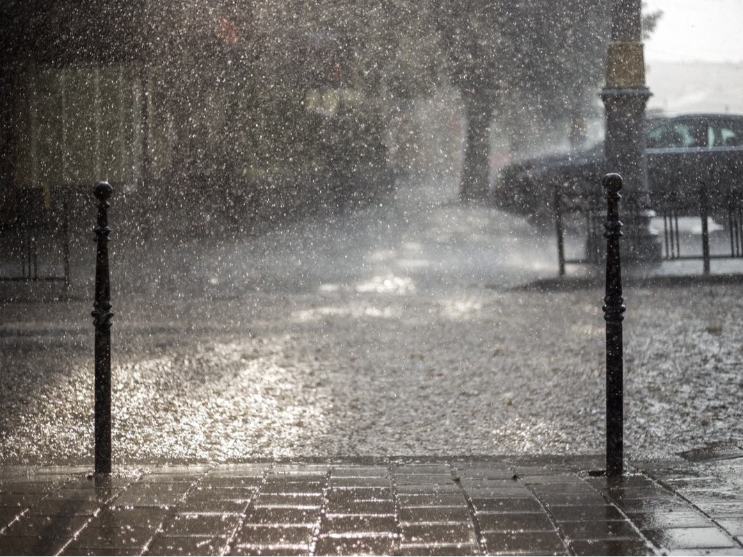
Expect bitter cold in the new year after thunder, gusty winds and possible small hail put a damper on New Year's Eve parties.

NEW JERSEY — A wet and windy New Year's Eve in the Garden State will be followed by frigid air as an Arctic blast sweeps across the region in the beginning of 2025, forecasters say.
Dec. 31 will start off dry. Then, as the afternoon goes on, things will get very wet. Moderate to heavy showers will drench New Jersey in the evening. There's even the chance we see thunder, gusty winds and small hail, according to the National Weather Service.
But the storm will move quickly and things will dry out for the first day of 2025, National Weather Service forecasters say. It will be very windy, with gusts up to 40 mph.
Find out what's happening in Across New Jerseyfor free with the latest updates from Patch.
Things will take a very cold turn into the new year. Several blasts of Arctic air will sweep through the eastern half of the country during the first half of January, AccuWeather long-range forecasters warn.
“Bitterly cold air will make a big return to the East Coast starting this weekend. This could end up being the coldest January since 2011 for the U.S. as a whole,” AccuWeather Lead Long-Range Expert Paul Pastelok said.
Find out what's happening in Across New Jerseyfor free with the latest updates from Patch.
This cold could be dangerous and will likely create a surge in demand for heating, leading to higher energy bills.
The warmest temperatures this weekend will only hit the upper-30s.
Long-range forecasters say that this level of cold supports the potential for snowstorms in the mid-Atlantic. Two are possible next week, AccuWeather forecasters say.
However, this is far out enough that models are not sure of what will happen.
“While it will certainly be cold enough for snow, several other factors that remain highly uncertain will have to come together just right for us to get a big snow storm,” the National Weather Service said. “So it's possible, but remains to be seen if a significant storm will develop or impact us.”
Here's the latest forecast.
North Jersey
Tuesday: Mostly sunny, with a high near 51. Calm wind becoming southeast around 5 mph in the afternoon.
Tuesday Night: Rain and thunderstorms before 11 p.m., then rain likely and possibly a thunderstorm between 11 p.m. and 1 a.m., then a chance of rain after 1 a.m. Patchy fog after midnight. Low around 42. East wind 5 to 10 mph becoming west after midnight. Chance of precipitation is 90 percent. New rainfall amounts between a half and three quarters of an inch possible.
New Year's Day: A slight chance of rain before 7 a.m., then a slight chance of showers after 10 a.m. Mostly cloudy, with a high near 49. West wind 10 to 15 mph, with gusts as high as 30 mph. Chance of precipitation is 20 percent.
Wednesday Night: Partly cloudy, with a low around 30. West wind around 15 mph, with gusts as high as 30 mph.
Thursday: Mostly sunny, with a high near 38. Breezy, with a west wind 15 to 20 mph, with gusts as high as 30 mph.
Thursday Night: Mostly clear, with a low around 25.
Friday: Mostly sunny, with a high near 36.
Friday Night: Partly cloudy, with a low around 23.
Saturday: Partly sunny, with a high near 33.
Central Jersey
Tuesday: Mostly sunny, with a high near 54. Light southeast wind increasing to 5 to 10 mph in the afternoon.
Tuesday Night: Rain and thunderstorms before 1 a.m., then a slight chance of rain between 1 a.m. and 4 a.m. Patchy fog after midnight. Low around 44. East wind 5 to 15 mph becoming west after midnight. Chance of precipitation is 100 percent. New rainfall amounts between a half and three quarters of an inch possible.
New Year's Day: Mostly sunny during the morning, then cloudy during the afternoon, with a high near 50. Breezy, with a west wind 10 to 20 mph, with gusts as high as 30 mph.
Wednesday Night: Partly cloudy, with a low around 30. West wind around 15 mph, with gusts as high as 30 mph.
Thursday: Sunny, with a high near 39. Breezy, with a west wind 15 to 20 mph, with gusts as high as 30 mph.
Thursday Night: Mostly clear, with a low around 25.
Friday: Partly sunny, with a high near 37.
Friday Night: Partly cloudy, with a low around 22.
Saturday: Mostly sunny, with a high near 33.
South Jersey
Tuesday: A chance of rain and thunderstorms, mainly after 5 p.m. Mostly sunny, with a high near 56. Light east wind becoming southeast 5 to 10 mph in the morning. Chance of precipitation is 30 percent. New rainfall amounts of less than a tenth of an inch, except higher amounts possible in thunderstorms.
Tuesday Night: Rain and possibly a thunderstorm before 11 p.m., then a chance of rain between 11 p.m. and 1 a.m. Patchy fog after midnight. Low around 43. East wind 5 to 10 mph becoming west after midnight. Chance of precipitation is 100 percent. New precipitation amounts between a quarter and half of an inch possible.
New Year's Day: Cloudy, then gradually becoming mostly sunny, with a high near 50. Breezy, with a west wind 10 to 20 mph, with gusts as high as 35 mph.
Wednesday Night: Mostly clear, with a low around 29. West wind around 15 mph, with gusts as high as 30 mph.
Thursday: Sunny, with a high near 39. West wind around 15 mph, with gusts as high as 30 mph.
Thursday Night: Mostly clear, with a low around 25.
Friday: Partly sunny, with a high near 38.
Friday Night: Partly cloudy, with a low around 21.
Saturday: Mostly sunny, with a high near 33.
Get more local news delivered straight to your inbox. Sign up for free Patch newsletters and alerts.