Weather
Major Weather Shift Coming To NJ: See Timeline
Temperatures could reach the upper 90s following two rounds of showers, forecasters at the National Weather Service said.

Multiple rounds of showers and thunderstorms will fan out across New Jersey, bringing locally heavy downpours and muggy heat, on and off from Thursday night through Saturday, forecasters said.
The first round of rain will arrive Friday after 3 a.m., particularly north of I-78, lingering through the early morning, according to the National Weather Service.
The first round of downpours will be followed by temperatures in the low to mid-80s and breezy south winds during the day.
Find out what's happening in Across New Jerseyfor free with the latest updates from Patch.
"A cold front will slowly move through the region late Friday into Saturday. This will bring showers and thunderstorms to the region as early as this evening, continuing at times into Saturday," the forecasters at the National Weather Service said.
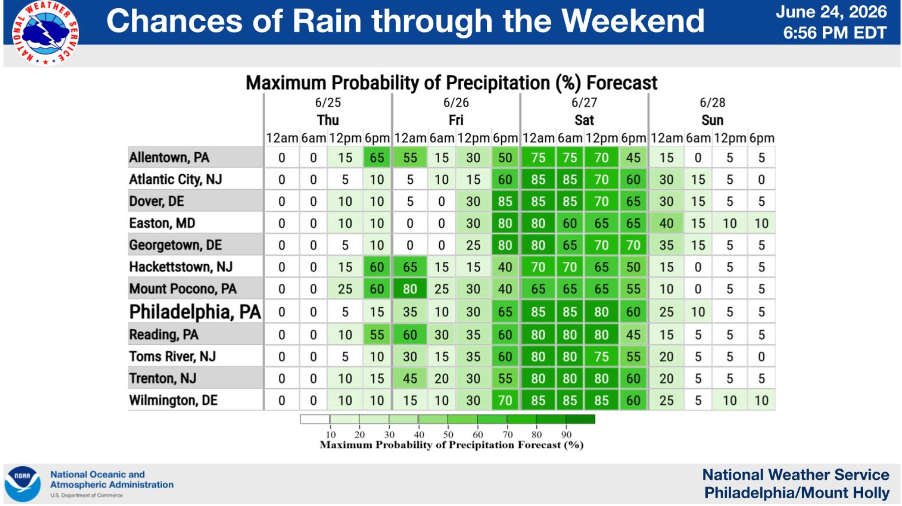
The rest of Friday will be largely dry throughout the state, before the second round starts in the early hours of Saturday after 2 a.m. Despite the breeze, expect muggy humidity on Friday, forecasters said.
Find out what's happening in Across New Jerseyfor free with the latest updates from Patch.
The second round of rain will target the area south of I-78 and continue into the late evening before drying off around midnight, according to the forecast.
Though the storms should be moving across the region fast enough as not to cause widespread flooding concerns, "downpours are certainly possible as this activity slowly weakens with eastward extent late into the night," the National Weather Service forecasters said.
After the rain on Saturday, the air will become less humid, and highs will drop to the mid- and upper-70s.
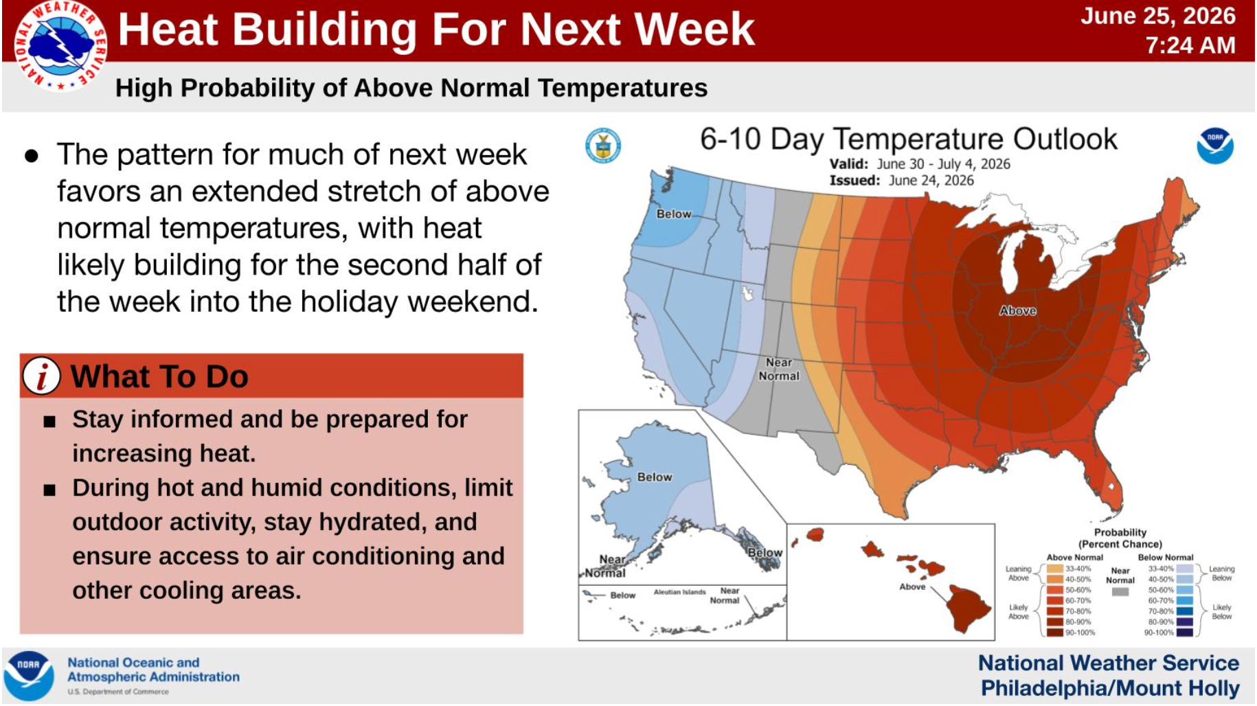
Across the state, Sunday is expected to be dry and sunny, with highs in the 80s, a trend which will continue upward during the first half of next week.
Forecasters said temperatures could soar into the upper 90s, with the "feels like" temperatures reaching nearly 100 degrees by Wednesday.
Here's the latest forecast from the National Weather Service.
South Jersey forecast
Thursday: Mostly sunny with a high near 86. A light south wind at 5 to 10 mph will make for a warm, pleasant day.
Thursday night: Partly cloudy with a slight chance of showers or thunderstorms after 3 a.m. Low around 66. Chance of rain: 20%.
Friday: Partly sunny and warm with a high near 87. Southwest winds become westerly during the afternoon.
Friday night: Showers and thunderstorms become increasingly likely, with rain expected after 2 a.m. Low around 68. Chance of rain: 80%.
Saturday: Wet weather continues with showers and possible afternoon thunderstorms. High near 79. Chance of rain: 80%.
Saturday night: A few lingering showers or thunderstorms are possible early before skies gradually dry out overnight. Low around 65. Chance of rain: 30%.
Sunday: Mostly sunny and warmer with a high near 85.
North Jersey forecast
Thursday: Mostly sunny with a high near 84. South winds of 6 to 13 mph.
Thursday night: Showers and thunderstorms become more likely overnight, especially between 2 and 5 a.m. Low around 68. Chance of rain: 70%.
Friday: A few early morning showers are possible before skies turn partly sunny. High near 85. Chance of rain: 30%.
Friday night: Mostly cloudy with a chance of showers developing after 2 a.m. Low around 69. Chance of rain: 50%.
Saturday: Showers are likely through much of the morning and early afternoon under mostly cloudy skies. High near 78. Chance of rain: 70%.
Saturday night: A slight chance of lingering showers early, then mostly cloudy. Low around 68. Chance of rain: 30%.
Sunday: Mostly sunny with a high near 79.
Sunday night: Partly cloudy with a low around 69.
Check Patch for updates.
Get more local news delivered straight to your inbox. Sign up for free Patch newsletters and alerts.