Weather
Flood Watches Remain Across NJ: See When The Sun Will Come Out
A flood watch remains in effect for parts of 14 counties. See the extended forecast.


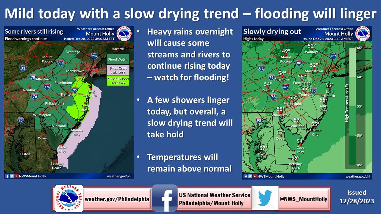
NEW JERSEY — Flood watches remain in effect across most of New Jersey and a flood warning is in place in Passaic County on Thursday as rain that fell overnight turns into runoff, swelling creeks and streams still contending with high levels from earlier in December.
The National Weather Service's Mount Holly office says between 1.5 and 3 inches of rain fell, putting low-water crossings at risk of flooding.
"Several creeks, streams, and rivers remain in flood stage," the weather service said. "Additional rises are possible across the watch area through the morning" Thursday.
Find out what's happening in Across New Jerseyfor free with the latest updates from Patch.
A flood warning was issued at 9:30 a.m. Thursday for the Wanaque River at the Wanaque Dam in Passaic County, where minor flooding is forecast.
A flood watch remains in effect until 7 p.m. Thursday for northern Burlington County along with Camden, Gloucester, Hunterdon, Mercer, Middlesex, Morris, Monmouth, Salem, Somerset, Sussex, and Warren counties.
Find out what's happening in Across New Jerseyfor free with the latest updates from Patch.
Coastal areas are under coastal flood watch until 1 p.m., as the combination of runoff and high tides may inundate low-lying areas along the bays and the ocean. Up to 1 foot of water above ground level is possible, the weather service said.
The coastal flood watch is in effect for Middlesex, Monmouth, Ocean and Southeastern Burlington counties, the weather service said.
The worst of the rain is over, the weather service said. Drizzling rain is possible for the rest of Thursday, along with cloudy skies. Temperatures will remain in the low to mid-50s, the weather service said.
When will the sun show up? The extended forecast is below, but it appears the sun will peek out for New Year's Eve.
THURSDAY: Areas of drizzle and fog with scattered showers. Cloudy, with a high near 55. North wind 5 to 10 mph. Chance of precipitation is 30 percent.
THURSDAY NIGHT: Areas of drizzle and fog with isolated showers before 11pm, then areas of drizzle after 11pm. Cloudy, with a low around 43. Calm wind becoming west around 5 mph after midnight. Chance of precipitation is 20 percent.
FRIDAY: Patchy drizzle and fog before 9am. Mostly cloudy, with a high near 53. West wind 5 to 10 mph.
FRIDAY NIGHT: Mostly cloudy, with a low around 34. West wind 5 to 10 mph.
SATURDAY: Partly sunny, with a high near 46. West wind 10 to 15 mph.
SATURDAY NIGHT: Partly cloudy, with a low around 30.
NEW YEAR'S EVE: Mostly sunny, with a high near 46, dropping into the 30s overnight.
NEW YEAR'S DAY: Partly sunny, with a high near 46.
Get more local news delivered straight to your inbox. Sign up for free Patch newsletters and alerts.


