Weather
Severe Weather Risk Across NJ Tuesday As Flooding, Power Outages Linger
As the Garden State recovers from stormy weather on Monday night, severe weather and flooding may still linger in parts of NJ on Tuesday.

Hundreds of New Jersey residents remain without power on Tuesday morning following severe thunderstorms scattered across the Garden State on Monday.
According to Jersey Central Power & Light (JCP&L), outages still linger in Hunterdon, Monmouth, Morris, Ocean, Somerset, Sussex, Union and Warren Counties on Tuesday morning.
Morris County hosts the most power outages as of Tuesday morning, with 96 customers affected.
Find out what's happening in Across New Jerseyfor free with the latest updates from Patch.
The estimated time of restoration is Tuesday afternoon.
While severe thunderstorms moved across New Jersey on Monday night, the National Weather Service (NWS) said a low-pressure system will still cause a risk for severe weather and flooding on Tuesday.
Find out what's happening in Across New Jerseyfor free with the latest updates from Patch.
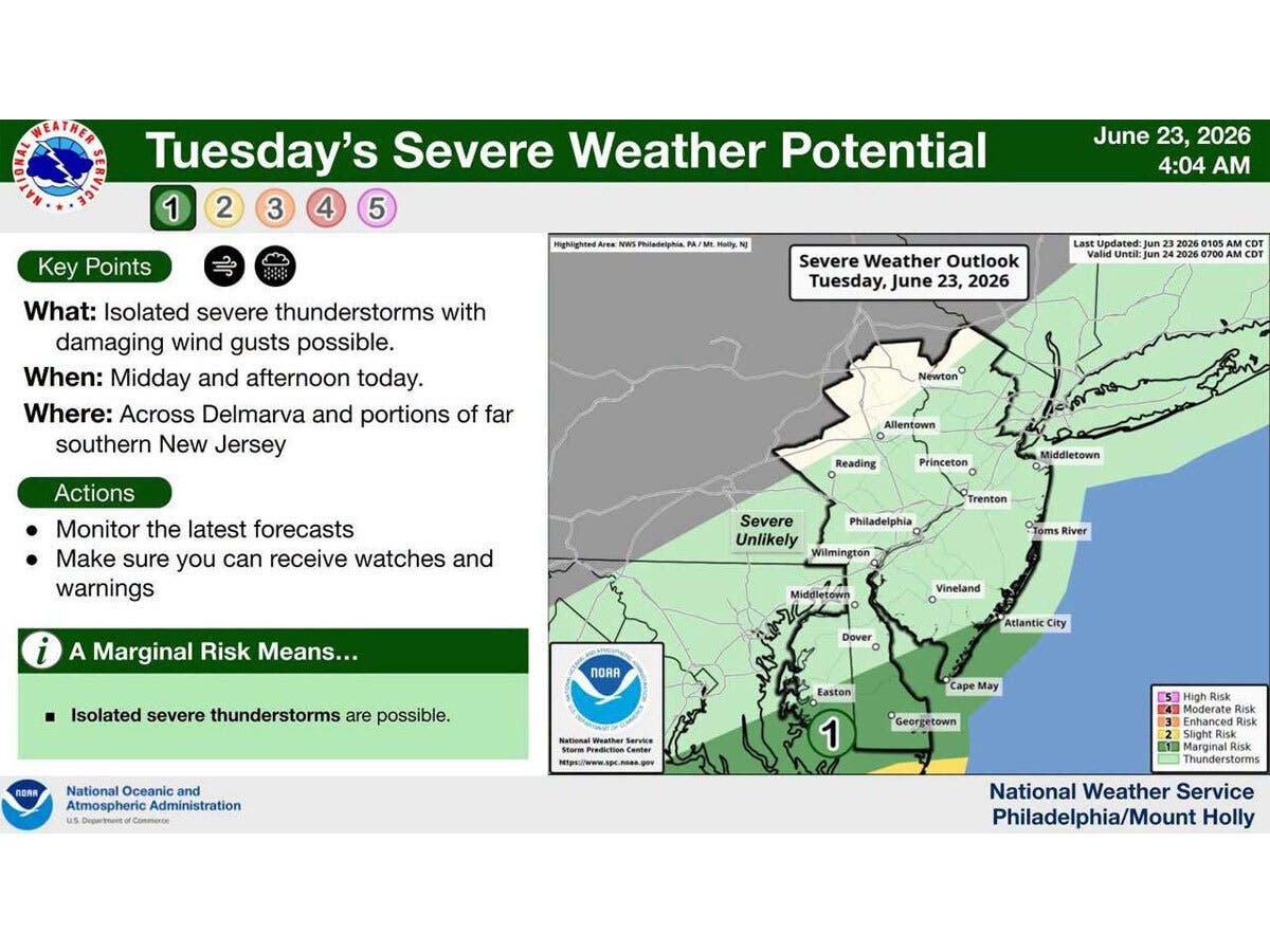
These conditions are expected to linger across the far southern parts of the region, with lighter rains and sub-severe storms further north.
Isolated severe thunderstorms with damaging wind gusts are possible mid-day/afternoon Tuesday in parts of far southern NJ, forecasters said.
The weather service is urging residents to monitor the latest forecasts and make sure they can receive watches and warnings.
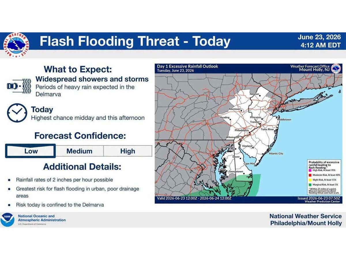
As storms continue throughout parts of the state, forecasters predict that rainfall rates of two inches per hour are possible, with the highest chance for widespread showers and storms taking place midday Tuesday.
The greatest risk for flash flooding is in urban, poor drainage areas, though the weather service said risk on Tuesday is primarily confirmed to the Delmarva.
Previous Coverage
Get more local news delivered straight to your inbox. Sign up for free Patch newsletters and alerts.