Weather
Weather Watches Issued Across NJ As Severe Weather Moves In
Monday and Tuesday are set to be stormy, with heavy rain, damaging winds and flash flooding in store.


Flood watches will be in place across New Jersey Tuesday as severe storms bring damaging winds and heavy rain, according to the latest forecast.
"Showers and thunderstorms will increase over the area Tuesday morning and afternoon," the National Weather Service said. "Rainfall rates of 1 to 2 inches per hour are possible. Total rainfall of 2 to 4 inches could occur into Tuesday night."
The flood watch will go into effect Tuesday morning in Sussex, Warren, Morris, Hunterdon, Somerset, Middlesex, Monmouth, Mercer, Salem, Gloucester, Camden, Burlington and Ocean counties.
Find out what's happening in Across New Jerseyfor free with the latest updates from Patch.
North Jersey will be at a moderate risk of heavy rainfall, with the rest of the state at a slight risk.
The severe thunderstorm risk is greatest south of Philadelphia.
Find out what's happening in Across New Jerseyfor free with the latest updates from Patch.
"Damaging winds are the primary threat with thunderstorms on Tuesday," the National Weather Service said.
.png)
The entire state is at a marginal risk of severe weather Monday, level 1 out of 5.
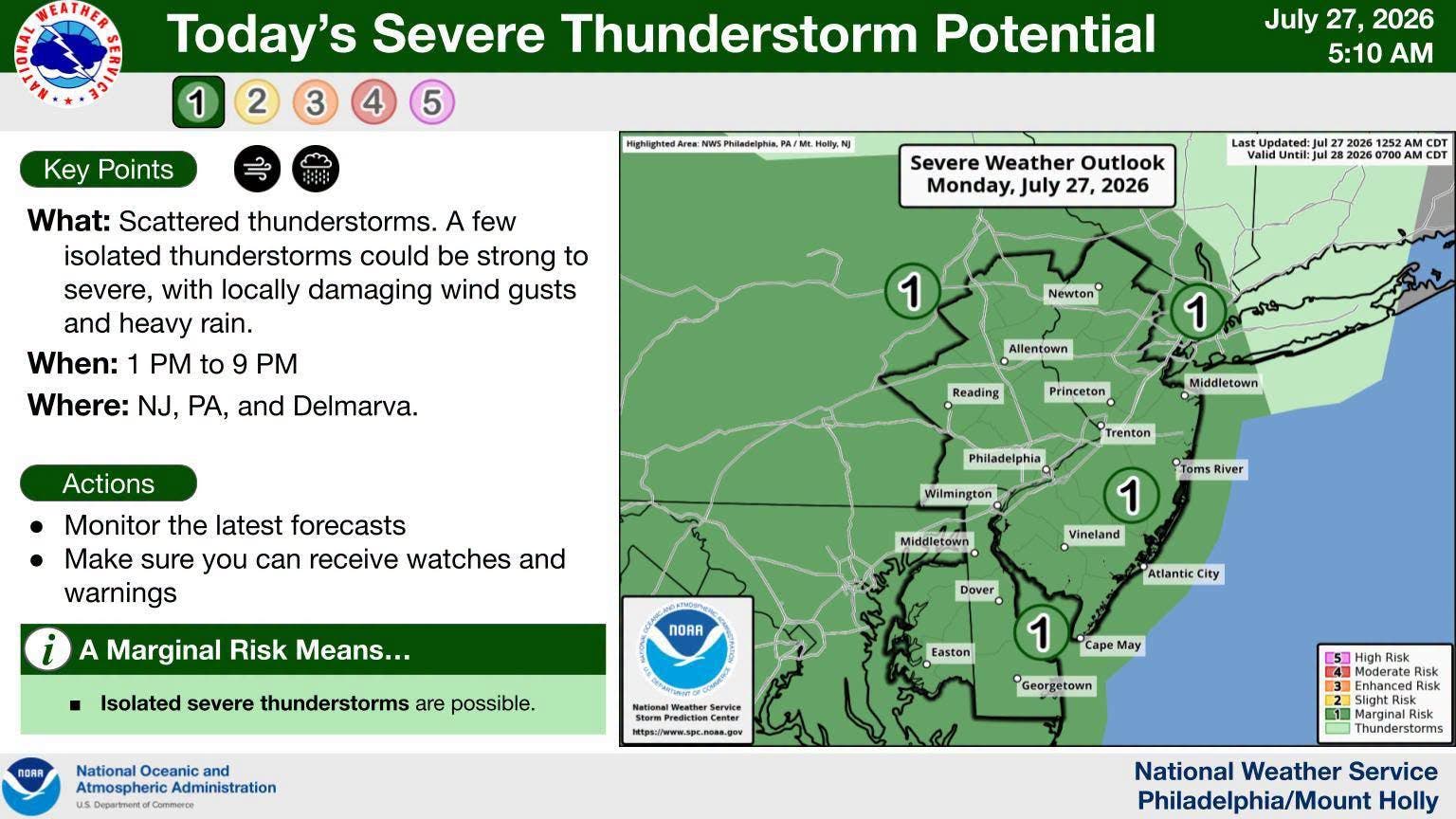
Pop-up thunderstorms are possible Monday evening.
Scattered showers and storms will develop again Wednesday, but the severe risk will be lowered, according to the National Weather Service.
However, flash flooding will remain a threat.
Beyond Wednesday, things are unclear.
"As we head through Thursday and Friday, the risk of scattered showers and storms will slowly decline as the Tuesday-Wednesday system slowly pushes east," the National Weather Service said. "Details on the late week period are
still very uncertain, however. We may briefly dry out completely Saturday before the next system approaches Sunday."
Get more local news delivered straight to your inbox. Sign up for free Patch newsletters and alerts.