Weather
Severe Storms, Dangerous Heat Targets NJ Friday
Some relief from humidity is expected during the weekend, according to the latest forecast.

Near record heat and severe thunderstorms are on tap for New Jersey Friday, but some relief is in store, according to the latest forecast.
"Dangerous heat is expected to continue across much of our region through today, with several record highs likely to be challenged again. High temperatures are forecast to peak into the low to mid 90s across most of the area," the National Weather Service said Friday.
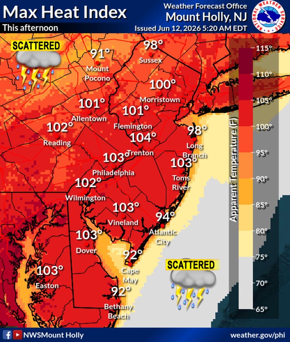
A Heat Advisory is in effect until 8 p.m. across the state except for Atlantic, Cape May, Cumberland and Salem counties.
Find out what's happening in Across New Jerseyfor free with the latest updates from Patch.
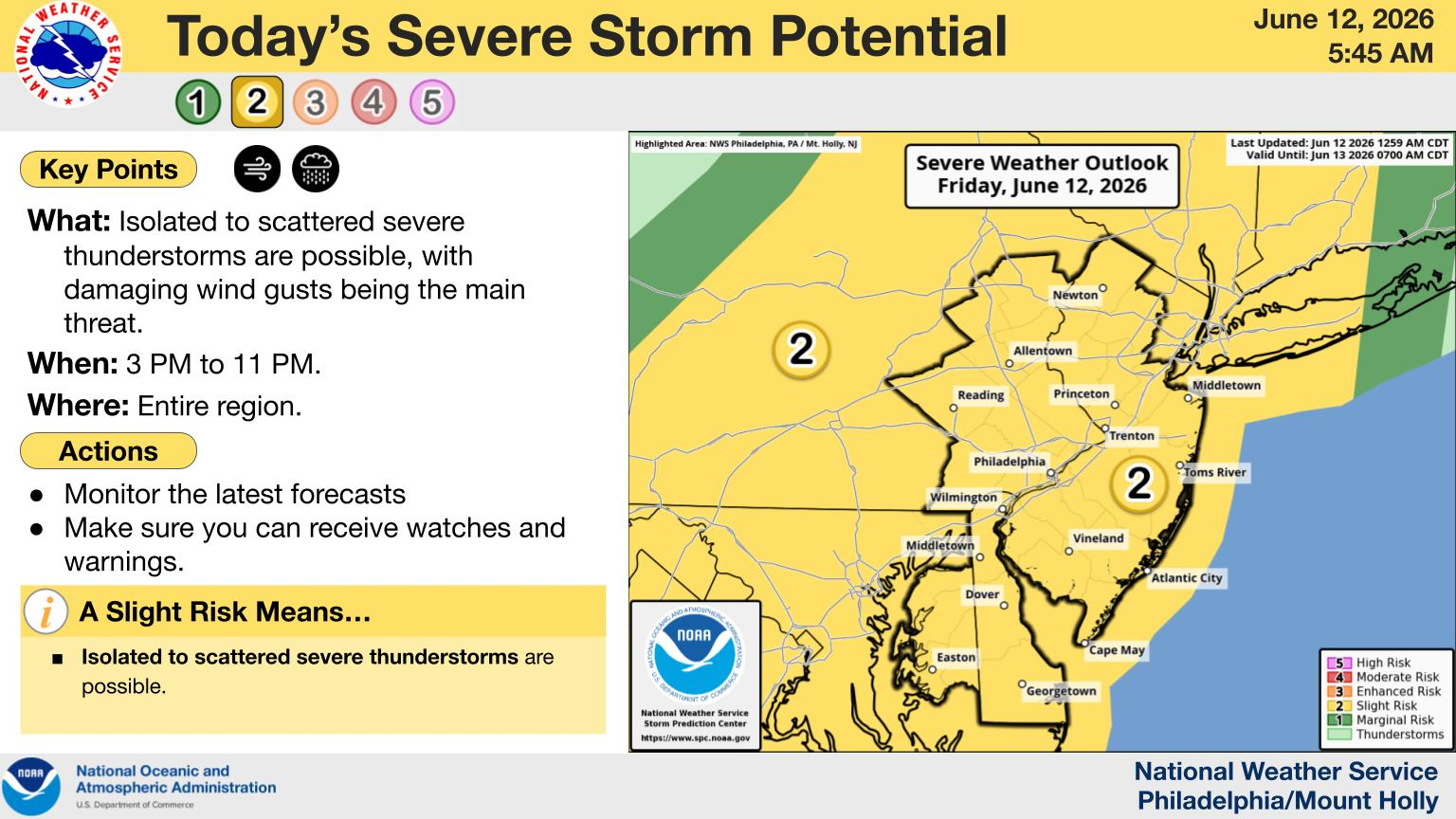
The entire state is at a slight risk (level 2 out of 5) of severe thunderstorms as well. The main risk is damaging winds.
Storms are expected later in the afternoon and evening.
Find out what's happening in Across New Jerseyfor free with the latest updates from Patch.
The storms will usher in a period of lower humidity.
"A cold front is forecast to move through the region tonight,
which will knock the temperatures and especially the dewpoints down several degrees," National Weather Service forecasters said. "Though it will still be hot with high temperatures in the upper 80s to low 90s over the weekend, dewpoints will return to much more comfortable levels (into the 50s in some areas Saturday)."
More storms and showers are expected Sunday, forecasters said.
Then, the weather will turn pleasant for early next week.
"Highs will be in the mid 70s to mid 80s Monday through Wednesday, with lows in the mid 50s to low 60s. Dewpoints in the 50s and low 60s will make for much more pleasant conditions," National Weather Service forecasters said.
Get more local news delivered straight to your inbox. Sign up for free Patch newsletters and alerts.