Weather
Severe Thunderstorm Watch Blankets These 13 Counties In NJ Through Monday Morning
Heat and humidity that have blanketed New Jersey has set the right conditions for severe storms, the National Weather Service says.

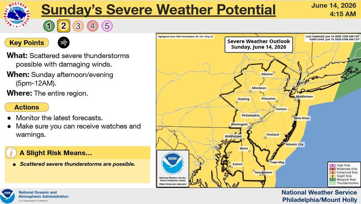
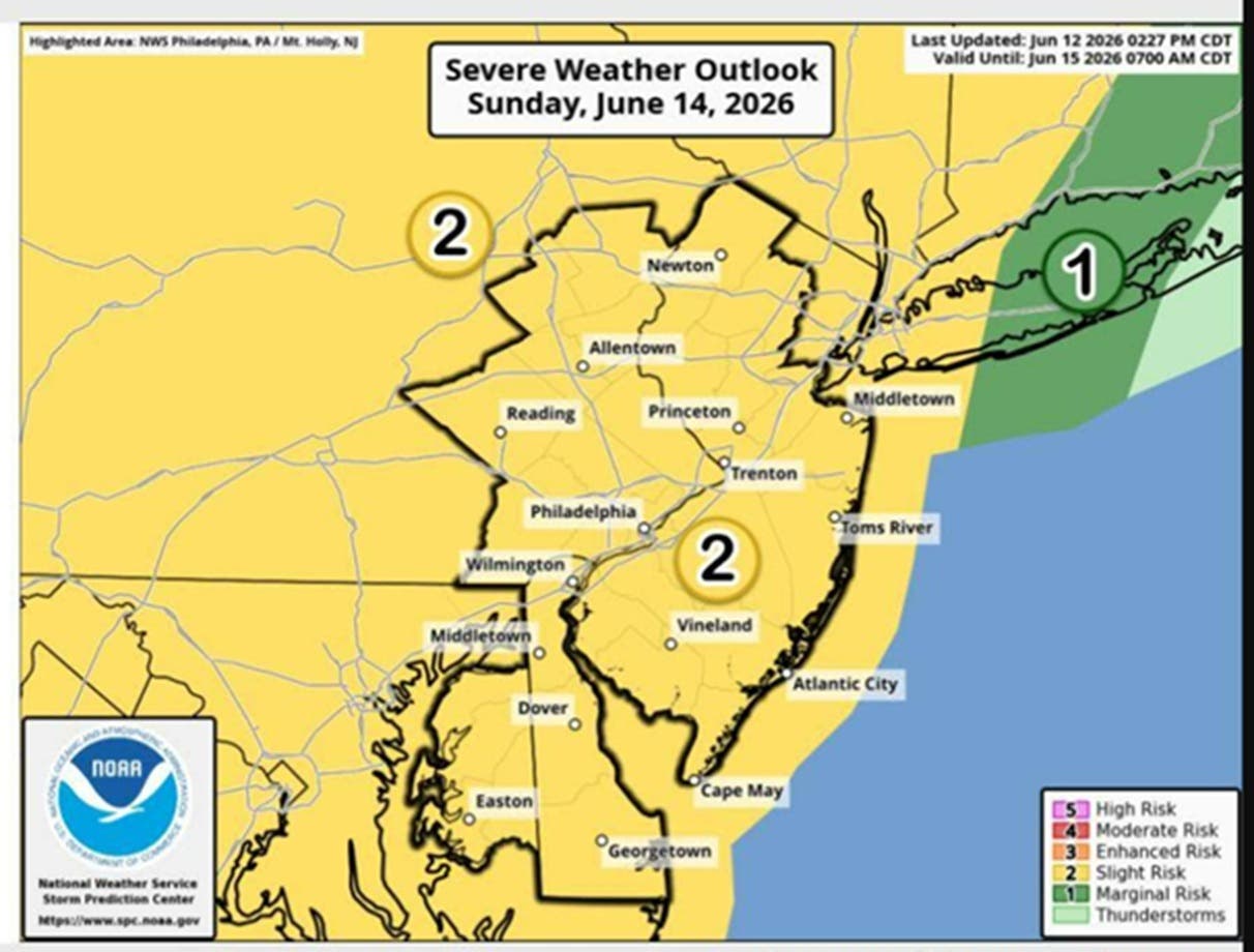
A total of 13 counties are under a severe thunderstorm watch as the heat and humidity that hit New Jersey Saturday gives way to severe weather on Sunday, forecasters say.
Atlantic, Burlington, Camden, Cape May, Cumberland, Gloucester, Hunterdon, Mercer, Morris, Salem, Somerset, Sussex and Warren are under watch until 1 a.m. Monday.
“We're still looking at a threat for severe weather later today though the timing looks to be slightly later than previous thinking as the best chance for severe storms will be during the evening period,” the National Weather Service said Sunday.
Find out what's happening in Across New Jerseyfor free with the latest updates from Patch.
Initially, the forecast from the National Weather Service's Mount Holly office was calling for the heat to remain until Sunday afternoon, with high temperatures reaching 90 degrees.
"The heat and humidity will aid the production of additional strong to severe thunderstorms from the Mid-Atlantic to the Northeast later on Sunday ahead of the cold front with the intensifying low pressure wave," the forecast said.
Find out what's happening in Across New Jerseyfor free with the latest updates from Patch.
There is a small tornado threat for the southern portion of the state, according to NorEaster Nick, a forecaster based in South Jersey.
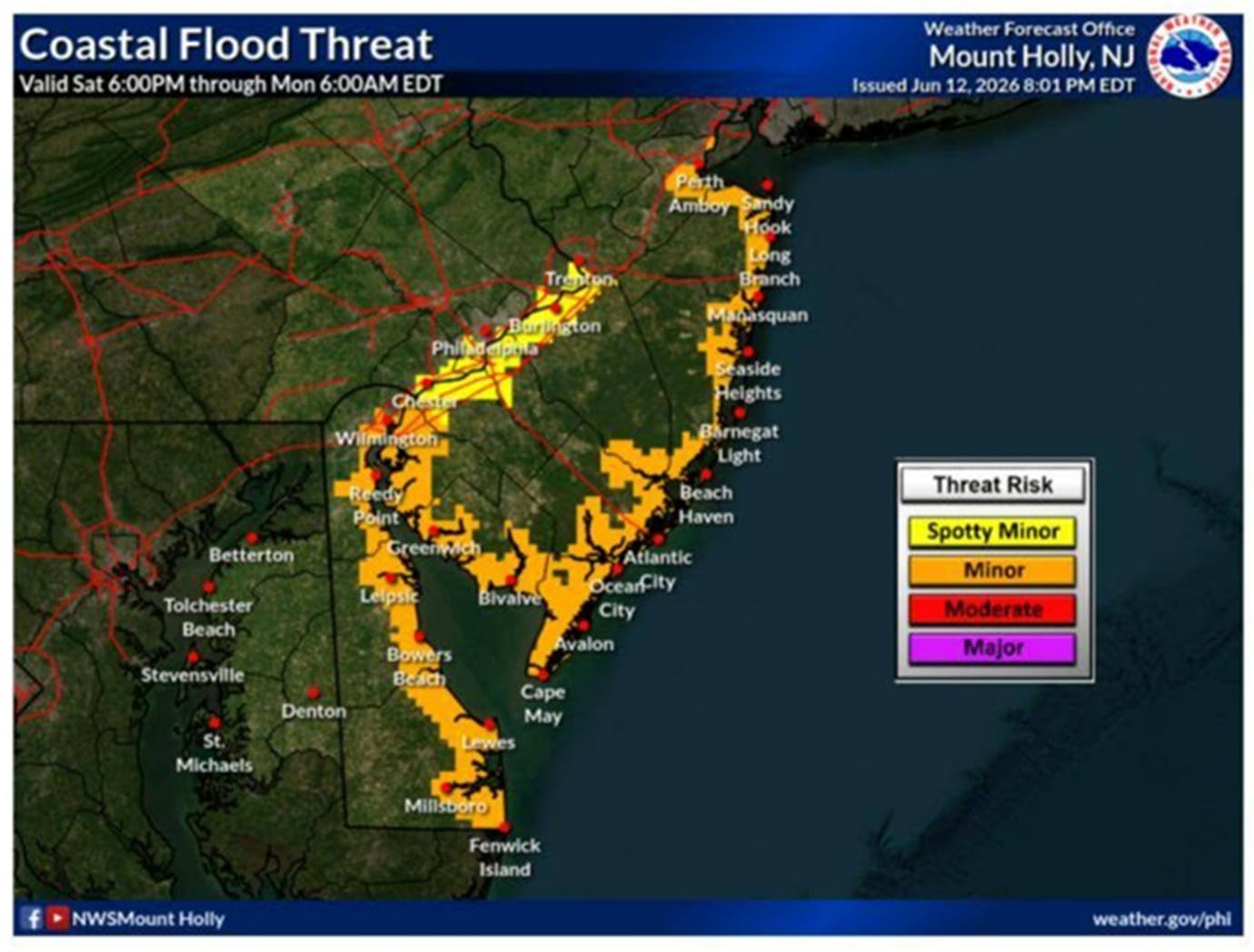
In addition, the weather service has issued coastal flood advisory for Saturday evening and said minor coastal flooding is possible on Sunday around high tide because the new moon will result in higher than normal astronomical tides. The highest of the new moon tides will be Sunday evening, the weather service said
The cold front and storms are expected to leave slightly cooler temperatures in their wake, with highs in the upper 70s on Monday and Tuesday.
Get more local news delivered straight to your inbox. Sign up for free Patch newsletters and alerts.