Weather
New Details On Timing, Snow Totals For Possible Storm Targeting NJ This Weekend
A coastal storm is expected for Saturday; forecasters say the possibility it will bring more snow is increasing.


As a deep freeze keeps snow in place across the Garden State, forecasters say a shift is increasing the potential for more snow from a coastal weekend storm.
How much and the timing of the storm continues to be elusive at this point, the forecasters say.
The National Weather Service Mount Holly office said that while there is still a lot of uncertainty in the storm track, there is a 30 to 40 percent chance of 5 inches of snow or more for New Jersey near and southeast of the Interstate 95 corridor, "diminishing to around 20 percent in the Poconos," the forecasters said.
Find out what's happening in Across New Jerseyfor free with the latest updates from Patch.
Frigid temperatures expected to stay put through the weekend and well into next week will mean the precipitation, if it comes, will be all snow, the forecast said.
Timing would be late Saturday into Sunday, the Mount Holly forecasters said.
Find out what's happening in Across New Jerseyfor free with the latest updates from Patch.
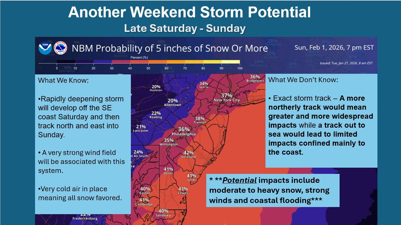
"A strong surface low-pressure system" is expected to rapidly develop off the Southeast coast on Saturday and the move into the Mid-Atlantic on Sunday, the National Weather Service Weather Prediction Center said.
"Generally speaking, the latest trends in forecast guidance are favoring a track farther east," the Mount Holly forecaster said, "meaning impacts may be confined largely to coastal areas. However that could easily still change."
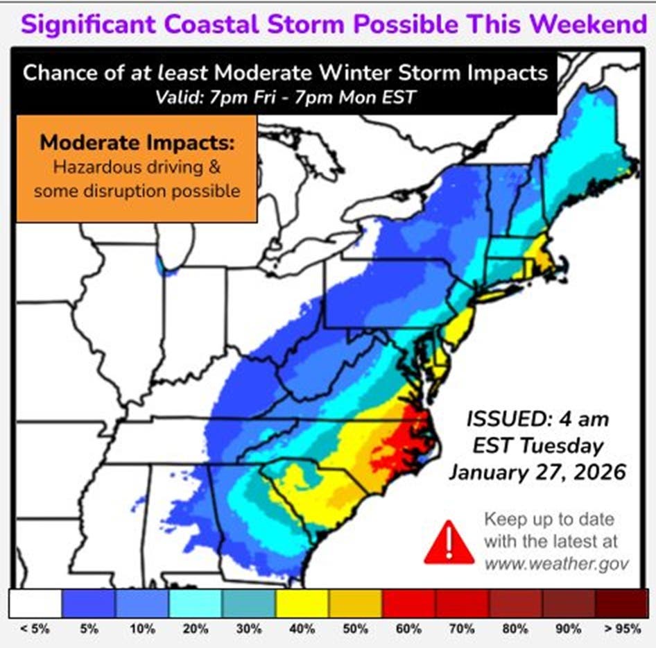
The potential storm would be from a low front that has stalled near the Gulf Coast, according to Paul Pastelok of AccuWeather.
Rain could start Friday in the Gulf, Pastelok said, and "depending on exactly when the storm strengthens, snow could mix with rain" in the southern states.
As the storm moves east, the rain and potentially snow will move with it into Florida and the Carolinas, he said.
"How fast the storm strengthens will be a determining factor in the final track of the storm this weekend and whether or not it moves up the East Coast," Pastelok said.
Meteorologist Dan Zarrow from NJ101.5 said there are three possible scenarios he is monitoring, "two of which would bring impactful snow to New Jersey."
The storm could completely miss New Jersey, Zarrow said, but he said he sees a 60 percent chance of the storm hugging the coast and bringing "impactful snow" to the southern and eastern parts of the state. He said a slim chance exists for widespread snow of 1 to 2 feet and it would take a "perfect track, perfect phasing, perfect temperatures" for that to happen.
Noreaster Nick, a New Jersey-based meteorologist also said there is a legitimate potential for snow on Sunday.
He said one thing that has his attention is the barometric pressure they are seeing with the low-pressure system. He said the average with this potential storm is lower than the storm that just moved through, "so this would be a quicker consolidated low, meaning stronger storm overall."
If this storm materializes, it would likely bring flooding, Noreaster Nick said.
"Something to watch. Not panic over, but watch," he said, adding Wednesday will give a better view of the probabilities.
In the meantime, the deep freeze across the area is the bigger issue.
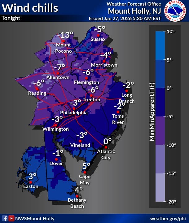
"We remain in a deepening cold spell, with overnight wind chills expected to continue dropping progressively," the Mount Holly office said, "bottoming out at the end of the week. Continue to take precautions."
Get more local news delivered straight to your inbox. Sign up for free Patch newsletters and alerts.