Weather
Thunderstorms, Flash Flooding Headed For NJ Again
Heavy rain and damaging winds could be back on Thursday and Friday, according to the latest forecast.


Severe storms and flash flooding are possible again for the end of the week in New Jersey, according to the latest forecast.
Damage from storms early this week was reported across the state, flooding a hospital, causing a lake to overflow and destroying the roof of a BJ's.
In some areas, residents were still waiting for the return of their electricity. More than 5,600 customers of Jersey Central Power & Light were awaiting restoration on Wednesday afternoon, including more than 4,000 in Morris County, hardest hit by the storms over the Fourth of July weekend.
Find out what's happening in Across New Jerseyfor free with the latest updates from Patch.
Isolated showers will begin Wednesday night, becoming more widespread through Thursday, according to the National Weather Service.
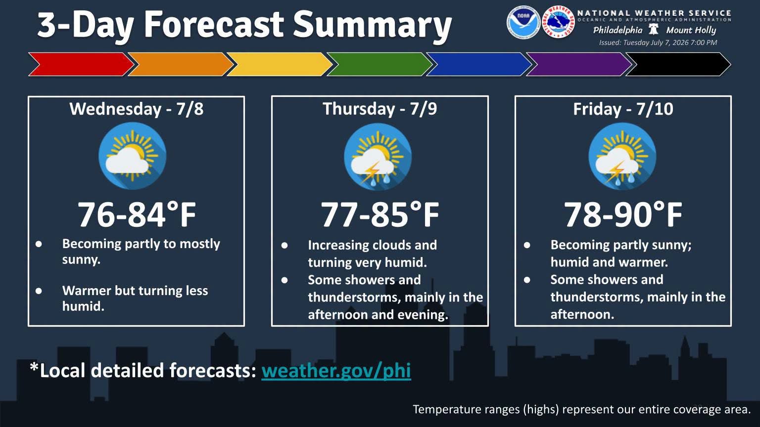
These showers and storms carry the potential for heavy rain, meaning more flash flooding is possible, forecasters said.
Find out what's happening in Across New Jerseyfor free with the latest updates from Patch.
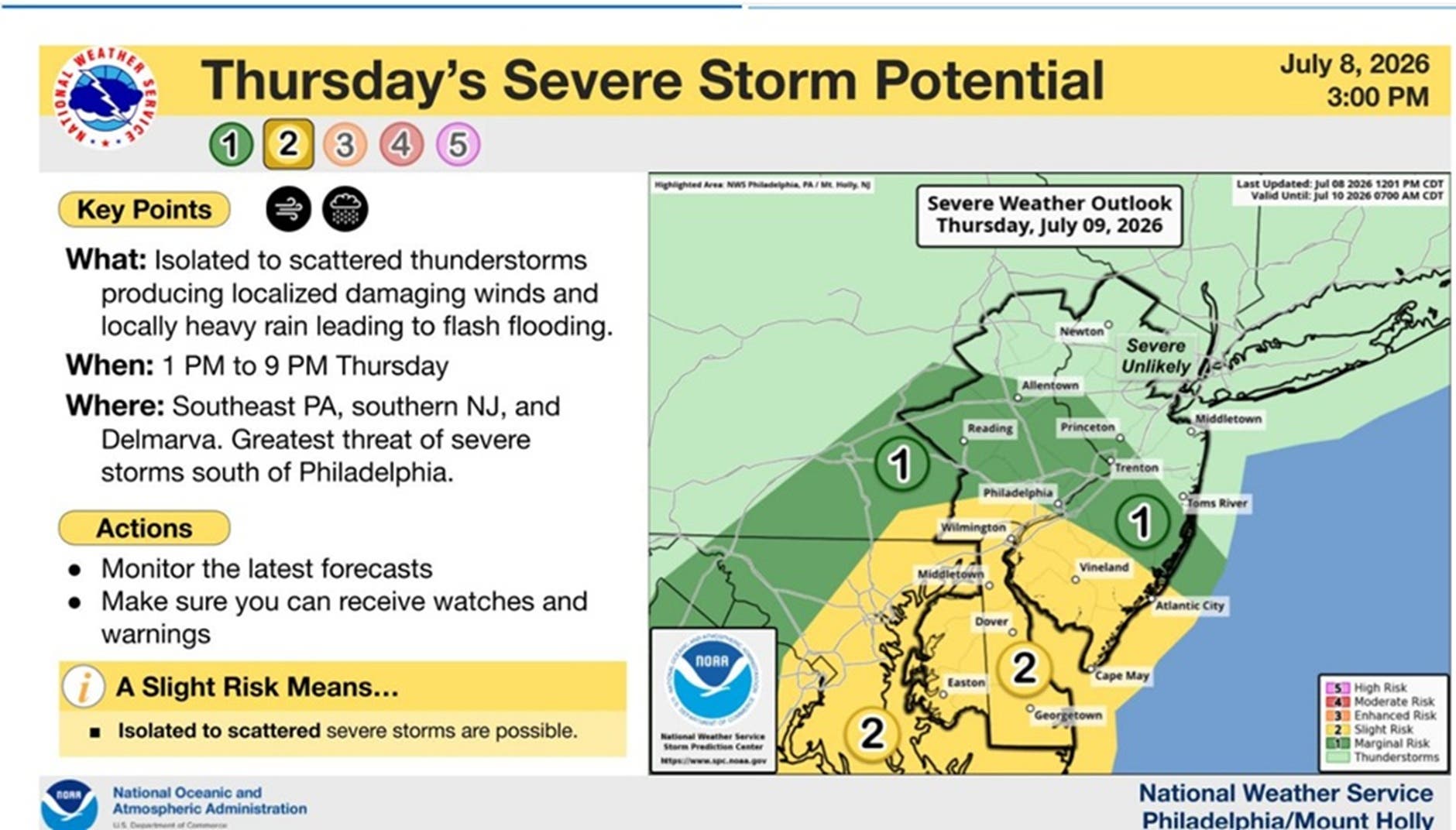
"There is also the signal for a marginal severe weather threat," National Weather Service forecasters said.
Another round of showers and thunderstorms move in Friday, again with the possibility of heavy rain and flash flooding.
"So there looks to be at least some threat for severe weather once again with the biggest threat again being damaging winds," National Weather Service forecasters said.
Scattered showers and storms may linger into Saturday, forecasters said.
Lingering rain will likely be more in Central and South Jersey, with things being dry up in North Jersey.
By Sunday, conditions will return to being dry and comfortable.
Get more local news delivered straight to your inbox. Sign up for free Patch newsletters and alerts.