Weather
Tornadoes, Flash Floods, Severe Storms Target NJ Saturday: See Latest Forecast
Damaging winds, flooding and possibly a tornado or two are forecast for Saturday's storms.


A stormy Saturday is ahead for New Jersey, with flooding, damaging winds and even a possible tornado or two in the forecast.
"A significant weather event is looking more likely Saturday," the National Weather Service said Friday morning. "Multiple rounds of showers and storms are expected, which may begin before noon and extend after sunset."
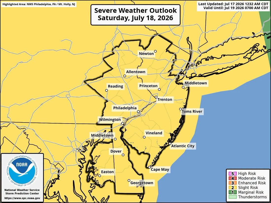
A warm front Saturday morning will trigger the first round of showers, though it could miss parts of South Jersey.
Find out what's happening in Across New Jerseyfor free with the latest updates from Patch.
After the first round, forecasters expect a several hour break between storms. Conditions are expected to be hot and muggy.
Severe weather is more likely Saturday afternoon into evening.
Find out what's happening in Across New Jerseyfor free with the latest updates from Patch.
Rainfall rates of more than 2 inches an hour are possible, making flash flooding a threat.
Damaging winds are also possible, along with large hail.
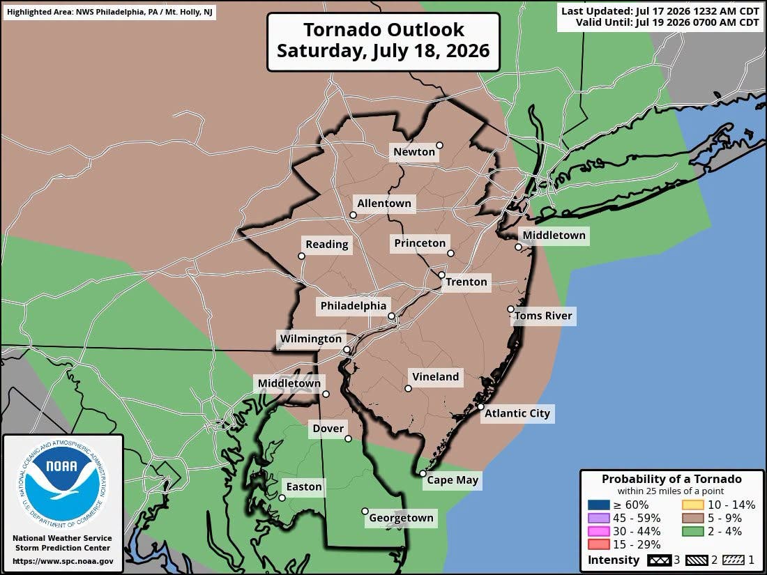
"There is a significant risk of wind damage, along with a notable risk of flash flooding and even some potential for tornadoes," the National Weather Service said.
The positive side of the severe storms is that forecasters expect Canadian wildfire smoke to clear out by Saturday night.
Sunday is set to be a pleasant day, with dry conditions, seasonable temperatures and comfortable humidity levels, according to the National Weather Service. Highs will be in the 80s.
That's good news for both soccer fans and players, with the final World Cup game set for Sunday afternoon at Metlife Stadium (which has no roof).
Get more local news delivered straight to your inbox. Sign up for free Patch newsletters and alerts.