Weather
Storms To Bring Major Weather Shift To NJ: See Latest Forecast
A rainy Wednesday into Thursday will transition into summerlike conditions by early next week, according to the latest forecast.

Rainy conditions, including thunderstorms, are in store for New Jersey this week ahead of a big warmup, according to the latest forecast.
“From mid- to late week, a late-spring, clipperlike system diving south out of central Canada into the Great Lakes and East could spark some gusty thunderstorms across the Northeast and mid-Atlantic,” said AccuWeather Senior Meteorologist Tyler Roys.
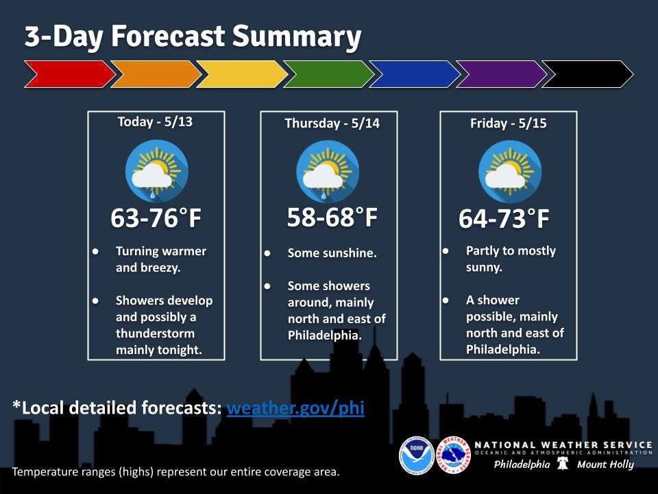
“The timing of precipitation seems to have slowed down a bit, with scattered showers moving into far northern and western zones by midday Wednesday, but the bulk of the showers will hold off until evening,” National Weather Service forecasters said.
Find out what's happening in Across New Jerseyfor free with the latest updates from Patch.
Thunderstorms are also possible, though they won't be severe, forecasters said. Those are more likely later Wednesday into Wednesday night.
As the storm departs, temperatures will begin to climb again. Forecasters expect temperatures to get to warm to potentially hot this weekend.
Find out what's happening in Across New Jerseyfor free with the latest updates from Patch.
Saturday will see temperatures in the high 70s to lower 80s, becoming widespread 80s on Sunday, according to the National Weather Service. Conditions will be cooler by the coast.
“The heat looks to build into early next week with even hot conditions possible. Highs Monday are forecast to be in the 80s with even some areas reaching 90 degrees (again cooler along the coast),” the National Weather Service said.
It could get into the low 90s Tuesday as well.
Dry conditions are also expected from this weekend into early next week.
Get more local news delivered straight to your inbox. Sign up for free Patch newsletters and alerts.