Weather
Basking Ridge Prepares For Major Winter Storm: Latest Forecast, How To Prepare
From Saturday night through Monday morning, Basking Ridge is expected to get between 12 to 18 inches of snow.

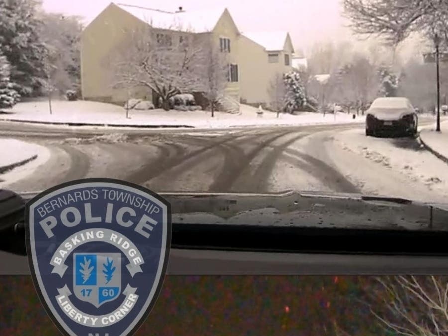
BASKING RIDGE, NJ — As a major snowstorm heads toward Basking Ridge, the Township is already making preparations.
"A major winter storm is expected to impact our area on Sunday. Significant snow accumulations are possible throughout the region," stated Bernards Township.
A Winter Storm Watch has been issued for the area from 7 p.m. Saturday through 1 p.m. Monday by the National Weather Service.
Find out what's happening in Basking Ridgefor free with the latest updates from Patch.
In addition to the major winter storm, dangerous cold is expected, beginning Friday Night. Wind chills in the single digits or below zero are expected for several nights.
Preparations
Find out what's happening in Basking Ridgefor free with the latest updates from Patch.
The Bernards Township Department of Public Works would like to remind all residents of the following Winter Weather information:
- Parking on snow covered streets is prohibited. Vehicles parked on snow covered streets are subject to a summons and being towed.
- Depositing snow onto the street is prohibited. Do not shovel, plow, snow blow or otherwise place snow onto the roadway.
- Do not place garbage or recycling cans in the street during a snow event, they could be hit by vehicles or taken away by snowplows.
"These conditions create hazards for motorists and DPW crews working to keep the roads safe and clear during a snow storm. The removal of snow and ice from Township roadways, sidewalks and facilities in a safe and efficient manner is a large undertaking and would not be possible without the assistance of all residents and property owners. We sincerely appreciate your cooperation. For more information, please see Winter Storm Tips and Information," according to the Township.
PSE&G also offered some tips to prepare for the storm:
- If you (or a member of your household) rely on electricity to operate life-sustaining equipment, visit pseg.com/Life or call 1-800-436-PSEG (7734) to let us know
- If you haven’t changed the batteries in your carbon monoxide detector lately, now is a good time to do so
- Know where your gas meter and regulator are located outside your home and be sure to keep them clear of snow and ice
- Download our PSEG mobile app, where you can report and track outages, by visiting pseg.com/App
Closures
Due to the impending storm, Raritan Valley Community College will be closed on Monday. All classes and activities are cancelled.
On Monday, the following County services will be cancelled or closed:
- All Somerset County Transportation Services (Senior, Disabled, DASH, SCOOT, CAT, Veterans Shuttle) are cancelled.
- All six senior wellness centers (Senior Wellness Center at Basking Ridge, Senior Wellness Center at Bridgewater, Senior Wellness Center at Hillsborough, Montgomery Senior Center, Quail Brook Senior Center in Franklin, and Warrenbrook Senior Center in Warren) will be closed.
- The Office on Aging and Disability Services Administration Office will be closed to walk-ins. Clients or caregivers needing information and assistance or in need of an appointment may call (908) 704-6346 or toll free (888) 747-1122.
- There will be no Home Delivered Meals (HDM) on Monday, however, extra shelf stable (snow) meals were delivered earlier in the week. Clients are encouraged to use these frozen or shelf stable meals which were previously delivered. If any clients do not have frozen meals or have lost power, they may also use Heater Meals (delivered previously). Heater Meals are shelf stable meals that come in an orange box. Be sure to follow the directions on the package on how to heat the meal without a power source. Heater Meals are NOT intended for use in the microwave oven.
- All group sessions have been cancelled at Richard Hall Community Health & Wellness Center for Monday. If you need immediate mental health support, call 988 or PESS at (908) 526-4100. If you have a scheduled appointment, please call your provider and listen to the voicemail message before coming to the Center.
Latest Forecast
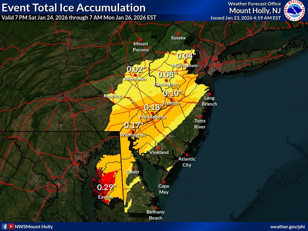
From Saturday night through Monday morning, the National Weather Service is predicting that Basking Ridge is expected to get between 12 to 18 inches of snow.

A possibility of about an inch of ice is also expected in Basking Ridge.
Here is a timeline of the upcoming snowstorm:
Saturday Night: A chance of snow after 1 a.m. Cloudy, with a low around 11. Calm wind. Chance of precipitation is 50 percent. New snow accumulation of less than a half inch possible.
Sunday: Snow. The snow could be heavy at times. High near 24. Northeast wind 5 to 15 mph, with gusts as high as 30 mph. Chance of precipitation is 100 percent. New snow accumulation of 8 to 12 inches possible.
Sunday Night: Snow before 10 p.m., then snow and sleet between 10 p.m. and 4 a.m., then snow likely after 4 a.m. Low around 17. Chance of precipitation is 100 percent. New precipitation amounts between a half and three-quarters of an inch possible.
Monday: Snow likely, mainly before 1pm. Mostly cloudy, with a high near 28. Chance of precipitation is 60 percent.
Have a news tip? Email alexis.tarrazi@patch.com.
Get more local news delivered straight to your inbox. Sign up for free Patch newsletters and alerts.