Crime & Safety
BREAKING: Nor'easter Could Intensify, Strike Berkeley Area; How Much Snow, How Long?
A long nor'easter winter storm is expected to intensify before striking N.J. and PA late Friday. How much will we get, and for how long?

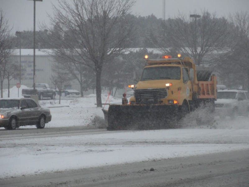
A long, heavy and significant nor’easter winter storm is set to intensify before striking New Jersey and Pennsylvania late Friday through Saturday.
This storm has the potential to dump snow for a 24-hour period, piling it as high as 10 inches across the region beginning late Friday, and cause significant wind damage and flooding, forecasters say.
The storm’s pressure will drop significantly off the Southeast coast, and then should strengthen as it heads toward New Jersey and Pennsylvania, according to the National Weather Service.
Find out what's happening in Berkeleyfor free with the latest updates from Patch.
If the storm develops to its full potential and takes a track just off the mid-Atlantic and New England coasts, then a blizzard can unfold. The storm could shut down highways and perhaps cause airport closures, according to an AccuWeather release.
“This could be a long-duration snowfall that could last more than 24 hours in some locations,” AccuWeather Chief Meteorologist Elliot Abrams said in the release.
Find out what's happening in Berkeleyfor free with the latest updates from Patch.
Related: WEATHER UPDATE: Details Released On Nor’easter, ‘Major’ Snowstorm Possible For N.J.
The National Weather Service has issued a Hazardous Weather Outlook, outlining the potential impacts, including potential snow inch counts:
- The threat of coastal flooding has increased. Major coastal flooding is now expected on the Atlantic Coast, with moderate to major impacts especially along the Delaware coast of Delaware Bay.
- Hazards and Impacts: From Philadelphia south and east, there is the potential for snow to change to rain on Saturday which would lower any accumulations.
- Wind: Strong and gusty wind is possible through the same period which could lead to blowing and drifting snow, as well as beach erosion. The strongest gusts will be along the coast.
- Depending on the track and intensity of the storm, wind speeds of 25 to 40 MPH with higher gusts of 60 mph are possible.
- Tidal/Coastal Flooding: With the strong onshore flow, and a full moon on Saturday, major flooding is anticipated along the coasts of New Jersey and Delaware and moderate to Major Flooding along Delaware Bay.
- Back bay flooding is also likely in these areas. At this time, no tidal flooding is expected along the Delaware River or Chesapeake Bay.
Here are the expected snow accumulations (but just through Saturday morning at 7 a.m.):
- South Jersey: Up to 10 inches
- Central Jersey: Up to 4 inches
- Jersey Shore: Up to 6 inches
- North Jersey: Up to 2 inches
Here is the forecast:
Wednesday: Increasing clouds, with a high near 34. Southwest wind 5 to 9 mph becoming northwest in the morning.
Wednesday night: A slight chance of snow showers between 8 p.m.. and 4 a.m. Mostly cloudy, with a low around 23. Northwest wind around 7 mph. Chance of precipitation is 20 percent.
Thursday: Mostly sunny, with a high near 35. Northwest wind 8 to 13 mph.
Thursday night: Mostly clear, with a low around 21. Northwest wind 6 to 9 mph.
Friday: Partly sunny, with a high near 34. Northwest wind around 6 mph.
Friday night: Snow, mainly after 2 a.m. Low around 26. Blustery. Chance of precipitation is 80 percent.
Saturday: Snow. High near 31. Blustery. Chance of precipitation is 80 percent.
Saturday night: Snow. Low around 24. Blustery. Chance of precipitation is 80 percent.
Sunday: Mostly sunny, with a high near 36.
Get more local news delivered straight to your inbox. Sign up for free Patch newsletters and alerts.