Weather
NJ Weather: Severe Thunderstorms, Hail, Strong Winds Possible
Forecasters have provided more details on a "major storm" that's supposed to hit New Jersey this week.


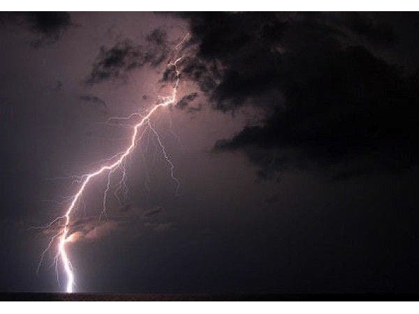
Forecasters provided more details Wednesday on a "major storm" that's supposed to hit New Jersey this week.
The National Weather Service has issued a hazardous weather outlook and a flood watch for most of the state, saying rain, hail and severe thunderstorms are possible, as well as strong, 30-mph-plus winds, on Thursday and possibly Friday.
The weather system could behave like a nor'easter but won't actually be one since it's moving from the Southwest, NWS officials said. The storm is expected to dump as many as 3 inches of rain on New Jersey.
Find out what's happening in Brickfor free with the latest updates from Patch.

Travel and outdoor plans will take a hit as the "major storm" takes aim during the second half of this week, according to AccuWeather.
Read more: N.J. Weather: Major Storm Could Hit With High Winds, Possible Flooding
Find out what's happening in Brickfor free with the latest updates from Patch.
"The storm has the potential to be the strongest in a series to hit the Northeast since late March and through the first week of April," AccuWeather Senior Meteorologist Brett Anderson said in a release.
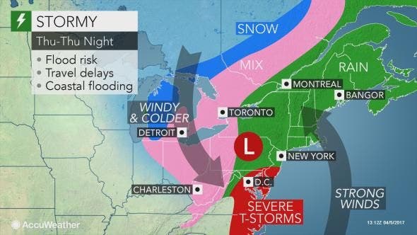
Here are more details on the storm:
- Rain is forecast to overspread central and northern New Jersey on Thursday. The rain is expected to be moderate to heavy during the late morning and afternoon.
- Rain with embedded thunderstorms is forecast to overspread South Jersey and the Jersey Shore on Thursday. Rain will likely be heavy at times, especially Thursday morning into early afternoon.
- The moderate to heavy rain will likely result in some roadway flooding along with flooding in areas of poor drainage on Thursday. Isolated instances of flash flooding may occur, especially in urban areas. Some small streams and creeks may leave their banks Thursday afternoon into Thursday night.
![]()
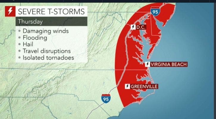
Here is the forecast:
- Wednesday afternoon: Sunny, with a high near 67. North wind around 5 mph becoming calm.
- Wednesday night: A chance of rain and/or thunderstorms, then rain and possibly a thunderstorm after 2am. Low around 49. Southeast wind 7 to 13 mph. Chance of precipitation is 80%. New rainfall amounts between a tenth and quarter of an inch, except higher amounts possible in thunderstorms.
- Thursday: Rain and.or possibly a thunderstorm. Some of the storms could produce heavy rainfall. High near 63. East wind around 15 mph. Some wind gusts could exceed 30 mph. Chance of precipitation is 100 percent. New rainfall amounts between 1 and 2 inches possible.
- Thursday night: Showers and possibly a thunderstorm before 8 p.m., then a chance of showers. Low around 46. Southwest wind around 14 mph. Chance of precipitation is 80 percent. New precipitation amounts between a tenth and quarter of an inch, except higher amounts possible in thunderstorms.
- Friday: A chance of showers, mainly after 8 a.m. Mostly cloudy, with a high near 53. West wind 14 to 16 mph. Chance of precipitation is 30 percent percent. New precipitation amounts of less than a tenth of an inch possible.
Patch file photo
Get more local news delivered straight to your inbox. Sign up for free Patch newsletters and alerts.