Weather
Snow Totals: How Much Did Bridgewater Get?
While we didn't receive as much snow as in North Jersey, Somerset County did get enough for schools to close on Monday. See how much:

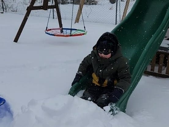
BRIDGEWATER, NJ — Plenty of snow and ice fell across Bridgewater on Sunday, but how much did we get?
North Jersey got the most snow, with 17 inches falling in Branchville in Sussex County. Morris County wasn't far behind with 16.4 inches in Green Pond.
While we didn't receive as much snow, Somerset County definitely saw a good amount with totals near 12 inches, according to the National Weather Service(NWS).
Find out what's happening in Bridgewaterfor free with the latest updates from Patch.
Belle Mead logged the highest in the County with 12.1 inches, and Bridgewater saw 9.2 inches.
Here is a look at the snowfall totals for Somerset County for Sunday's storm:
Find out what's happening in Bridgewaterfor free with the latest updates from Patch.
- Belle Mead - 12.1 inches
- Bernards Township - 11.8 inches
- Bedminster Twp - 11.6 inches
- Hillsborough Twp - 11.5 inches
- Manville - 11.3 inches
- Franklin Township - 10.4 inches
- Warren - 10.2 inches
- Watchung - 10.2 inches
- Montgomery Twp - 10.0 inches
- Green Brook - 9.7 inches
- North Plainfield - 9.5 inches
- Middlebush - 9.5 inches
- Bridgewater 9.2 inches
- Somerville - 8.7 inches
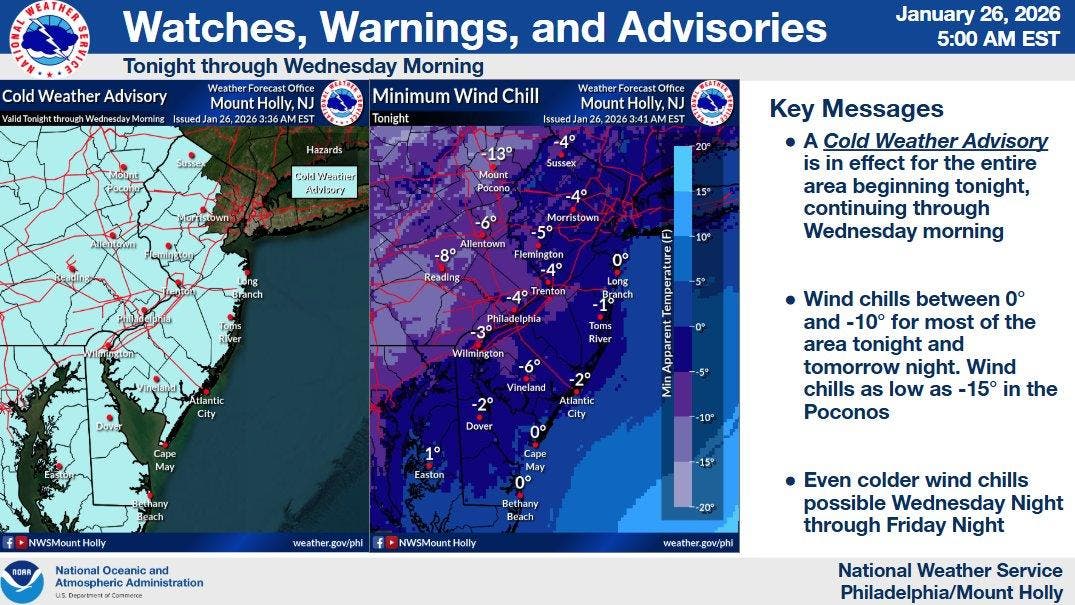
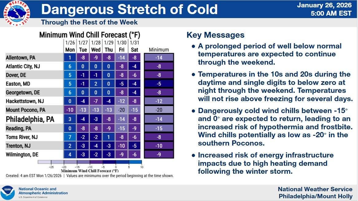
Looking ahead, the NWS is warning about dangerously cold temperatures arriving this week with several nights featuring single-digit temperatures and wind chills below zero.
"Some record lows and record low highs may be in jeopardy later this week. The stretch begins tonight, with a Cold Weather Advisory in place for the entire area," according to the NWS on Monday.
"Its quite rare to get a stretch of temperatures this cold for so long," said the NWS.
A Cold Weather Advisory was issued by the NWS and will be in effect from 7 p.m. on Monday until 10 p.m. on Wednesday.
Very cold wind chills are expected between 5 and 10 degrees below zero. The cold wind chills as low as 10 below zero could result in hypothermia if precautions are not taken, according to the NWS.
The Advisory could be upgraded to an Extreme Cold Warning for Wednesday night and/or Thursday Night.
Wind chills below zero and even 10 below zero at night are likely to continue into the weekend, according to the NWS.
Here is a look at the upcoming forecast:
Monday: A slight chance of snow before 10 a.m. Mostly cloudy, with a high near 29. Light northwest wind becoming west 5 to 10 mph in the morning. Winds could gust as high as 20 mph. Chance of precipitation is 20 percent.
Monday Night: Mostly clear, with a low around 5. Wind chill values as low as -5. West wind around 10 mph, with gusts as high as 25 mph.
Tuesday: Increasing clouds, with a high near 19. Wind chill values as low as -6. West wind 5 to 10 mph, with gusts as high as 20 mph.
Tuesday Night: Mostly clear, with a low around 1. West wind around 5 mph.
Wednesday: Mostly sunny, with a high near 22. West wind around 5 mph.
Wednesday Night: Partly cloudy, with a low around -2.
Thursday: Mostly sunny, with a high near 20.
Thursday Night: Mostly clear, with a low around -4.
Friday: Sunny, with a high near 17.
Have a news tip? Email alexis.tarrazi@patch.com.
Get more local news delivered straight to your inbox. Sign up for free Patch newsletters and alerts.