Politics & Government
Somerset County Revamps Its Tax Parcel Viewer Application
This redesigned tool enhances user experience and accessibility, allowing anyone to effortlessly access property data across the county.

SOMERSET COUNTY, NJ — The Somerset County Board of Commissioners and its Geographic Information Systems (GIS) services are pleased to announce the revamp of its Tax Parcel Viewer application.
This redesigned tool enhances user experience and accessibility, allowing residents, businesses, and decision-makers to effortlessly access property data across the county.
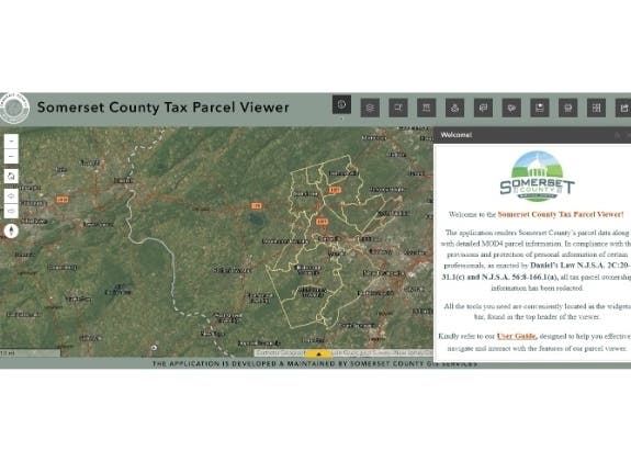
The updated Tax Parcel Viewer application offers a user-friendly interface with several key enhancements. Users can now filter and search for properties by criteria such as address, parcel block/lot, and property class code for quick and precise parcel search.
Find out what's happening in Bridgewaterfor free with the latest updates from Patch.
New 200-Ft notification and search widgets allow users to generate reports and maps for parcels within specified distances or search parameters directly within the browser. Additional functionalities include the ability to create bookmarks and switch basemaps. To protect personal information, the names of property owners have been redacted from tax parcel data.
The revamped application remains available on the Somerset County GIS website and is fully compatible with both desktop and mobile devices. A comprehensive user guide has also been created to reflect the new functionalities, providing clear instructions on how to utilize the enhanced features.
Find out what's happening in Bridgewaterfor free with the latest updates from Patch.
Click here to see the Tax Parcel Viewer.
GIS technology captures, manages, analyzes, and visualizes location data, supporting a broad range of applications from urban planning and environmental management to public services and emergency response. Somerset County's GIS Services within the Department of Engineering and Planning designs and develops web applications and websites for use by residents and county agencies. In addition, the team maintains the Somerset County Open Data Portal, which provides public access to a range of geospatial datasets, enhancing transparency and enabling community engagement in data-driven decision-making.
This press release was produced by the Somerset County Government. The views expressed here are the author’s own.
Get more local news delivered straight to your inbox. Sign up for free Patch newsletters and alerts.