Schools
County, Rowan College to Celebrate Advances in Geospatial Technology
The celebration is Nov. 5.

Burlington County, Rowan College at Burlington County, and the Mid-Atlantic Geospatial Transportation Users Group (MAGTUG) presents Geographic Information Systems (GIS) Day on Thursday, Nov. 5 at the college’s Mt. Laurel campus.
The day celebrates the value of geospatial technology through hands-on activities and presentations, college officials said on Thursday.
“GIS technology impacts everyday life whether you realize it or not,” Burlington County Freeholder Director Mary Ann O’Brien said. “GIS Day is a chance for experts in the field to come together in Burlington County, share their knowledge and demonstrate the ways this technology affects everything from emergency management to mapping projects.”
Find out what's happening in Cinnaminsonfor free with the latest updates from Patch.
Speaker presentations highlighting GIS applications across various industries highlight the morning session. The afternoon will include the MATUG fall meeting, a hands-on GPS exercise using professional equipment, and GIS exercises using professional software. A Map Gallery will be on display throughout the day on the third floor of Laurel Hall.
“Rowan College at Burlington County has been proud to host this annual event since 2005. It gives the community insight into the science behind geospatial technology,” Rowan College at Burlington County President Paul Drayton said. “We invite the community to learn more about real-world applications of GIS, GPS, and remote sensing and RCBC’s high-quality degree and certificate programs in geospatial technology. RCBC is preparing students for careers where they can address real-world problems using this technology.”
Find out what's happening in Cinnaminsonfor free with the latest updates from Patch.
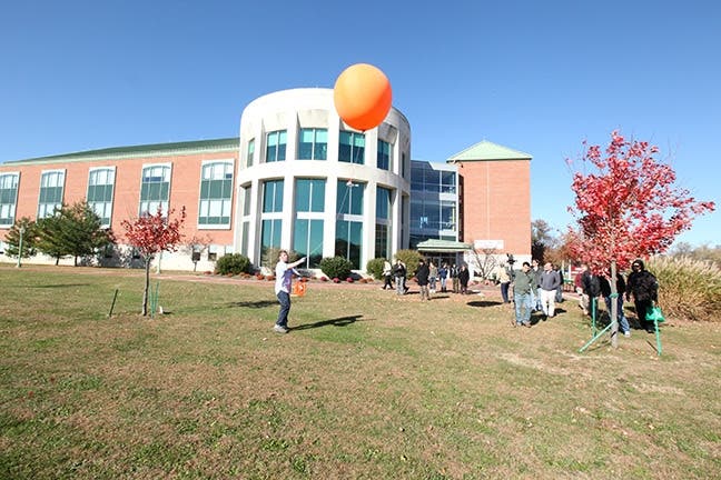
Geospatial technology is used to map wildfires and stormwater, identify trends, find directions, inventory historic preservation sites and trees and take balloon imagery of wetlands, among other uses.
“GIS is influencing the world’s decision-makers,” RCBC Science, Math & Technology Assistant Professor Marc Zamkotowicz said. “Both GIS and GPS allow us to include a geographic perspective as we find solutions to real-world problems and issues.”
Palmyra Nature Cove’s Mobile Geoscience and Remote Sensing Lab will be in attendance during the event.There will also be a chance to participate in contests and win prizes.
The schedule is as follows:
- 9 a.m. to noon: Speaker Presentations.
- Noon to 1 p.m.: Lunch.
- 1 p.m. to 4:30 p.m.: Mobile Geoscience and Remote Sensing Lab.
- 1 p.m. to 2:15 p.m.: GPS Outdoor Field Activity.
- 1:30 p.m. to 4:30 p.m.: Fall MAGTUG Meeting & Seminar on Stormwater.
- 2:30 p.m. to 4:30 p.m.: Hands-on, Self-paced GIS Lab Exercises.
- All Day: Map Gallery.
The day’s activities are free and open to the public. Events will be held in Laurel Hall, room 320, and in the TEC building, room 208. Lunch and refreshments will be provided. For more information and to register, visit co.burlington.nj.us/gisdayatbcc.
Organizations that use GIS are invited to display maps in the Map Gallery. Map submission deadline is Wednesday, Nov. 4. For more information or to display a map in the Gallery, contact Merrilee Torres at 609-702-7067 or mtorres@co.burlington.nj.us.
The attached image was provided by Rowan College at Burlington County
Get more local news delivered straight to your inbox. Sign up for free Patch newsletters and alerts.