Neighbor News
Brief Summer Weather before Fall pattern takes hold
A cold front will drive through the region this afternoon with widely scattered thunderstorms. A cool, unsettled pattern will follow
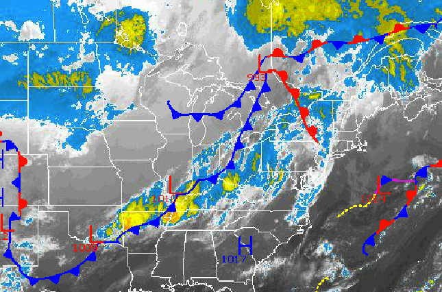
Summer weather will visit the New York City and Philadelphia metropolitan areas today, but Fall weather conditions won’t be far behind as a strong cold front drives through the region this afternoon and evening. A cool and unsettled weather pattern will take hold for this weekend on through next week.
Today, a strong cold front will approach the region this afternoon and evening. A few showers will pass through the New York City metropolitan area this morning until 9 AM, otherwise scattered clouds can be expected through 2 PM this afternoon. Widely scattered showers and thunderstorms will develop from 3 PM through 8 PM this evening as the cold front moves from west to east, exiting off the coast after 8 PM this evening. The strongest thunderstorms will be capable of heavy downpours, frequent lightning, and wind gusts over 30 mph. Winds will be from the southwest at 5 to 15 mph, veering to the northwest by this evening. Temperatures will rise into the upper 70’s to lower 80’s over the northern interior and lower to mid 80’s in the Philadelphia and New York City metropolitan areas.
Tonight, the cold front will exit with clearing skies towards morning. Winds will be from the northwest at 5 to 15 mph. Temperatures will fall into the upper 40’s to lower 50’s over the interior and mid to upper 50’s along the coast.
Find out what's happening in Freeholdfor free with the latest updates from Patch.
Tomorrow, high pressure will be in full control with clear skies to scattered cloud cover expected. Winds will be from the northwest at 5 to 10 mph. Temperatures will rise into the upper 60’s to lower 70’s over the northern interior and lower to mid 70’s in the Philadelphia and New York City metropolitan areas and along the coast.
An area of low pressure will drive through the northern Mid Atlantic on Saturday with periods of showers and scattered to overcast cloud cover. The showers will be capable of heavy downpours at times. Low temperatures will range from the mid to upper 40’s over the interior and lower to mid 50’s along the coast. High temperatures will range from the mid to upper 60’s over the northern interior, upper 60’s to lower 70’s in the New York City metropolitan area, and lower to mid 70’s in the Philadelphia metropolitan area.
Find out what's happening in Freeholdfor free with the latest updates from Patch.
Polar high pressure will be in place on Sunday and Monday with clear skies to scattered clouds. Cool conditions will be in place for the period. Low temperatures will range from the upper 40’s to lower 50’s over the interior and lower to mid 50’s along the coast. High temperatures will range from the upper 60’s to lower 70’s over the interior and lower to mid 70’s along the coast.
An area of low pressure will move through the northern Mid Atlantic on Tuesday with periods of rain expected. The rain will be heavy at times. Low temperatures will range from the lower to mid 50’s over the interior and upper 50’s to lower 60’s along the coast. High temperatures will range from the lower to mid 70’s throughout the region.
High pressure will take hold on Wednesday with clear skies and very comfortable weather conditions. Low temperatures will range from the mid to upper 40’s over the interior and lower to mid 50’s along the coast. High temperatures will range from the upper 60’s to lower 70’s over the interior and lower to mid 70’s along the coast.


