Community Corner
Developing Storm Has Some Tricks And Is No Treat
A developing coastal storm will bring heavy rain to the immediate New Jersey coast
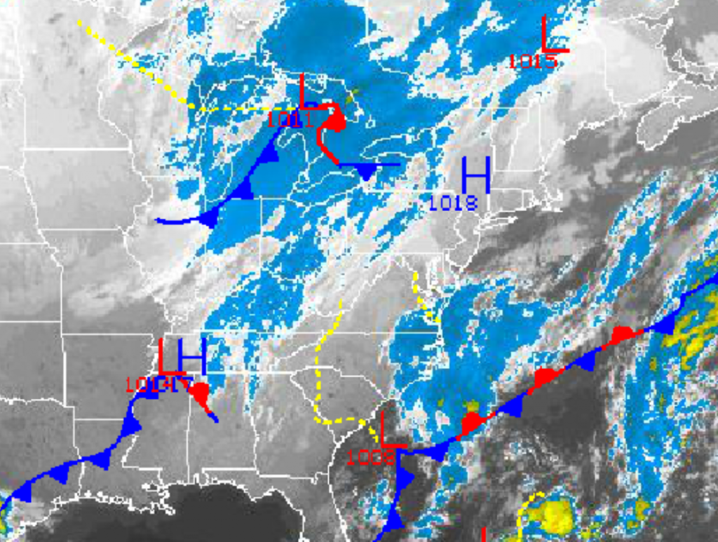
An area of low pressure developing off the South Carolina coast this morning will interact with a disturbance diving south from the Upper Mid West to produce a wet, windy, and raw start to the weekend. The good news is after this storm exits, tranquil conditions will be in place for much of next week.
Clouds will slowly increase through this afternoon as an area of low pressure develops off the Mid Atlantic coast. Winds will veer to the northeast and increase to 10 to 20 mph by this evening. Dry conditions are expected through at least late this evening. Temperatures will rise into the mid to upper 50’s for highs throughout the Philadelphia and New York City metropolitan areas.
Tonight, rain will develop after midnight and will become widespread along the coast towards morning. Periods of rain will rotate in from the Atlantic into the coast through tomorrow with the heaviest rainfall along the immediate coast and more scattered showers over the interior. Rainfall amounts will range from 0.10″ to 0.25″ over the interior locations; 0.25″ to 0.50″ over southeastern Pennsylvania including Philadelphia, northwestern New Jersey, the Hudson River Valley, and much of central and southern Connecticut; and 0.50″ to 1.00″ with locally higher amounts up to 2.50″ over southwestern and central New Jersey, the New York City metropolitan area, and Long Island. Localized urban flash flooding will be a threat along the immediate coast. Winds will be from the northeast at 15 to 25 mph with gusts over 30 mph throughout the northern Mid Atlantic. There will be a threat for some snow to mix in for all locations, however no accumulation is expected at all. Low temperatures will range from the upper 30’s to lower 40’s over the interior and lower to mid 40’s along the coast. High temperatures will range from the lower to mid 50’s throughout the region.
Find out what's happening in Freeholdfor free with the latest updates from Patch.
The storm will exit tomorrow night with clearing skies and windy conditions. Scattered clouds to clear skies are expected on Sunday, however winds will back to the northwest at 15 to 25 mph with gusts over 30 mph at times. Low temperatures will range from the upper 20’s to lower 30’s over the interior and mid to upper 30’s along the coast. Hight temperatures will range from the mid to upper 40’s over the interior and upper 40’s to lower 50’s along the coast. The strong winds will make temperatures fell like the upper 30’s to lower 40’s.
High pressure will be in control Monday on through Wednesday with clear skies, light winds, and moderating temperatures. Temperatures on Monday will range from the upper 20’s to lower 30’s for lows and upper 50’s to lower 60’s for highs. Temperatures on Tuesday and Wednesday will range from the upper 30’s to mid 40’s for lows and lower to mid 60’s for highs.
Find out what's happening in Freeholdfor free with the latest updates from Patch.
A cold front will move through the region on Thursday with scattered showers. Temperatures will range from the mid to upper 40’s for lows and mid to upper 50’s for highs.
Follow NY NJ PA Weather for the latest weather information.


