Community Corner
Excellent weather to start the week
Excellent weather conditions will start the week, but stormy weather will return by Thursday.
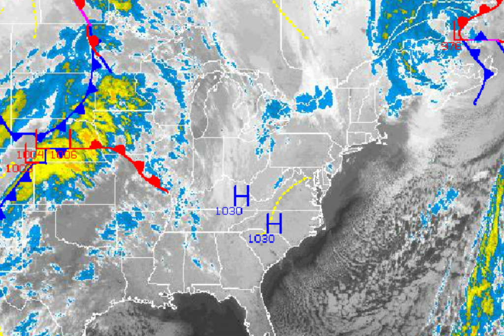
High pressure will produce another excellent start to the work week with tranquil conditions expected through Wednesday. However, stormy and colder weather is going to return by the end of the week with the threat for moderate to heavy rainfall and chilly weather conditions by the end of the week.
High pressure will produce comfortable weather conditions today on through Wednesday with clear skies to scattered cloud cover. Winds will back from the northwest to southwest at 5 to 15 mph through the forecast period. Temperatures this afternoon will rise into the mid to upper 50’s for highs. Low temperatures tomorrow will range from the lower to mid 30’s over the interior and upper 30’s to lower 40’s along the coast. High temperatures tomorrow will range from the upper 50’s to lower 60’s throughout the Philadelphia and New York City metropolitan areas. Temperatures on Wednesday will range from the lower to mid 40’s for lows and lower to mid 60’s for highs. Temperatures will be above normal by Wednesday with likely the best weather of the week!
An area of low pressure will approach on Thursday morning and redevelop along the New Jersey coast on Thursday afternoon with periods of moderate to heavy rainfall expected along with windy conditions. Showers will linger into Friday afternoon with a strong northwesterly wind driving much colder air into the northern Mid Atlantic. Temperatures on Thursday will range from the mid to upper 40’s for lows and lower to mid 60’s for highs. Temperatures on Friday will range from the mid to upper 40’s for lows and mid to upper 50’s for highs. Temperatures will crash into the 40’s by the late afternoon on Friday.
Find out what's happening in Freeholdfor free with the latest updates from Patch.
High pressure will be in control for Saturday and Sunday with scattered cloud cover expected. Temperatures will return to below normal levels for next weekend. Low temperatures will range from the lower to mid 30’s throughout the region. High temperatures will range from the upper 40’s to lower 50’s over the interior and lower to mid 50’s along the coast.


