Neighbor News
Hazy, hot, and humid today
Hazy, hot, humid weather conditions will be in place this afternoon for the first time for much of this August
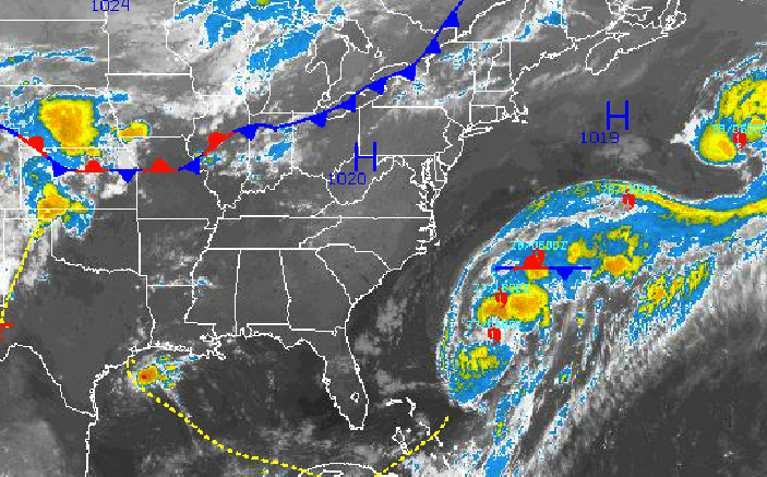
Hazy, hot, humid weather conditions will be in place this afternoon for the first time for much of this August with a heat index pushing into the mid 90’s for some locations, especially urban locations. The hot weather won’t last long though as a cold front will move through the Philadelphia and New York City metropolitan areas by tomorrow morning with drastically lower humidity by tomorrow afternoon.
Scattered cloud cover can be expected through this afternoon with some haze as very humid conditions set in for this afternoon. Winds will be from the southwest at 5 to 10 mph. Temperatures will rise into the lower to mid 80’s over Long Island and upper 80’s to lower 90’s throughout the rest of the northern Mid Atlantic. The heat index will push into the mid 90’s for some locations due to the high levels of humidity.
A cold front will move through the Philadelphia and New York City metropolitan areas late tonight through tomorrow morning. Isolated to widely scattered showers and thunderstorms will be a threat starting late this evening over eastern Pennsylvania and spread east through the rest of the northern Mid Atlantic for tomorrow morning. Most locations will remain dry. However, an isolated severe thunderstorm is possible with wind gusts over 40 mph, small hail, frequent lightning, and very heavy downpours. Skies will clear in the afternoon with dew points rapidly falling into the upper 40’s to lower 50’s by the evening leading to very pleasant weather conditions. Low temperatures will range from the upper 50’s to lower 60’s over the northern interior and lower to mid 60’s throughout the rest of the region. High temperatures will range from the upper 70’s to lower 80’s throughout the New York City metropolitan area and interior and lower to mid 80’s in the Philadelphia metropolitan areas.
Find out what's happening in Freeholdfor free with the latest updates from Patch.
High pressure will be in control tomorrow evening on through Saturday with clear skies to scattered cloud cover expected. Winds will be from the northwest and west at 5 to 15 mph. Temperatures on Friday will range from the mid to upper 50’s for lows and upper 70’s to lower 80’s for highs. Temperatures on Saturday will range from the upper 50’s to lower 60’s for lows and lower to mid 80’s for highs.
By Sunday, high pressure will shift to the east of the Philadelphia and New York City metropolitan areas leading to a return of southwesterly winds and thus more humidity. Scattered clouds can be expected with areas of fog a threat in the morning hours. Temperatures will range from the mid to upper 60’s for lows and mid to upper 80’s for highs.
Find out what's happening in Freeholdfor free with the latest updates from Patch.
A cold front will approach on Monday, Labor Day, in the evening hours. Clouds will increase through the day with the threat for showers and thunderstorms by the evening hours. The thunderstorms will be capable of frequent lightning, wind gusts over 40 mph, hail, and very heavy downpours. Temperatures will range from the mid to upper 60’s for lows and mid to upper 80’s for highs.
High pressure will take hold for Tuesday with clearing skies expected. Temperatures will range from the lower to mid 60’s for lows and lower to mid 80’s for highs.


