Neighbor News
Hazy, hot and humid today, thunderstorms tonight
Hazy, hot, and humid weather will give way to thunderstorms tonight.
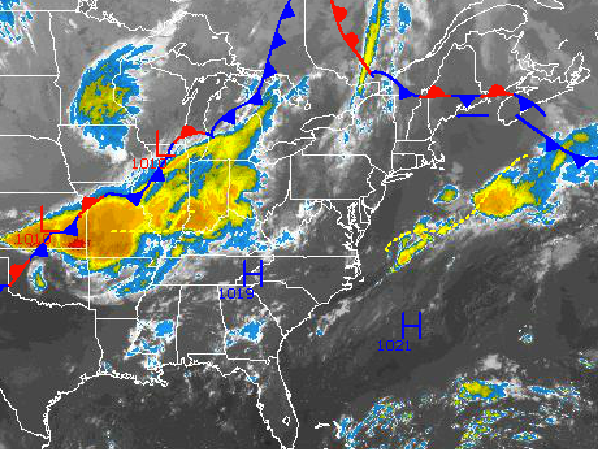
Hazy, hot, and humid conditions will be in place to start the short work week as we kick off the first meteorological week of Fall with Summer like conditions. Of course, we have seen hot conditions before this time of year, in fact in 1950 temperatures were over 100 degrees. Thunderstorms will move through tonight as a cold front drives through and puts a quick end to the hot and humid weather.
Today, as the fog lifts by 10 AM; hazy, hot, and humid weather conditions can be expected throughout the Philadelphia and New York City metropolitan areas. Winds will be from the southwest at 5 to 15 mph. Temperatures will rise into the mid to upper 80’s along the immediate coast and upper 80’s to lower 90’s throughout the rest of the region. Temperatures will feel like the lower to mid 90’s due to the humidity.
A cold front will drive through the northern Mid Atlantic tonight with scattered showers and strong to isolated severe thunderstorms this evening into the early morning hours tomorrow. The strongest thunderstorms will be capable of very heavy downpours, frequent lightning, hail, and wind gusts over 40 mph. The thunderstorms are expected to develop after 5 PM and will linger through 3 AM tomorrow morning. Winds will veer from the southwest to northwest at 5 to 15 mph. Temperatures will fall into the upper 50’s to lower 60’s over the northern interior, lower to mid 60’s over the western suburbs of the Philadelphia and New York City metropolitan areas, and upper 60’s to lower 70’s in urban areas and along the immediate coast.
Find out what's happening in Freeholdfor free with the latest updates from Patch.
High pressure will build into the region tomorrow with clearing skies from west to east. Winds will be from the northwest at 5 to 15 mph as a much drier air mass with low humidity builds into the region by the afternoon. Temperatures will rise into the lower to mid 80’s along the coast and mid 80’s throughout the rest of the northern Mid Atlantic.
High pressure will be in control Thursday and Friday with clear skies to scattered cloud cover. Winds will be from the west to northwest at 5 to 15 mph. Temperatures on Thursday will range from the upper 50’s to lower 60’s for lows and mid to upper 80’s for highs. Temperatures on Friday will range from the lower to mid 60’s for lows and lower to mid 80’s for highs.
Find out what's happening in Freeholdfor free with the latest updates from Patch.
On Saturday, a strong cold front will move through the region in the afternoon and evening with showers and strong to severe thunderstorms. The thunderstorms will be capable of frequent lightning, wind gusts over 50 mph, heavy downpours, and hail. Temperatures will range from the upper 60’s to lower 70’s for lows and mid 80’s for highs.
Canadian high pressure will take hold for Sunday and Monday with with much cooler weather conditions expected. Low temperatures will range from the lower to mid 50’s over the interior and upper 50’s to lower 60’s along the coast. High temperatures will range from the mid to upper 70’s over the interior and upper 70’s to lower 80’s in urban areas and along the coast.


