Neighbor News
Hot and humid pattern coming to an end
Hot and humid conditions through tomorrow will come to a very stormy end by tomorrow evening
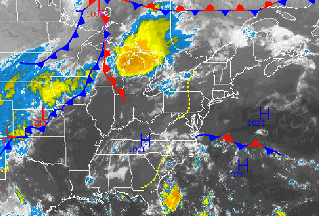
Hazy, hot, and humid conditions will be in place today and tomorrow, but these tropical conditions will be coming to a very stormy end by tomorrow afternoon and evening followed by cooler but unsettled weather conditions.
Hazy, hot, and humid weather conditions can be expected today with an isolated shower or thunderstorm possible in the afternoon. While isolated, these thunderstorms will be capable of very heavy downpours, frequent lightning, and wind gusts over 30 mph. Winds will be from the southwest at 5 to 15 mph. Temperatures will rise into the mid to upper 80’s throughout the Philadelphia and New York City metropolitan areas however the heat index will be in the mid 90’s.
Tonight, clouds will increase with areas of fog possible towards morning. The fog will be locally dense in some locations with visibility below 2 miles at times. Winds will be from the southwest at 5 to 10 mph. Temperatures will fall into the upper 60’s to lower 70’s for lows.
Find out what's happening in Freeholdfor free with the latest updates from Patch.
Tomorrow, a strong cold font will approach and then move through the northern Mid Atlantic. Showers and thunderstorms are expected from 4 PM to 10 PM over the Philadelphia metropolitan areas and northeastern Pennsylvania, 5 PM to 11 PM over the New York City metropolitan areas and coastal New Jersey, and 7 PM through 2 AM Sunday over eastern Connecticut and eastern Long Island. These thunderstorms will be capable of very heavy downpours, frequent lightning, hail, and wind gusts over 60 mph. There is a threat for wind damage and localized flash flooding due to the tropical nature of the downpours. Winds will be from the southwest at 5 to 15 mph. Temperatures will rise into the mid to upper 80’s along the immediate coast and upper 80’s to lower 90’s throughout the rest of the Philadelphia and New York City metropolitan areas. The heat index will remain around the mid 90’s ahead of the cold front.
Canadian high pressure will take hold on Sunday with clearing skies and much lower humidity. Winds will veer to the northwest at 5 to 15 mph with gusts up to 20 mph at times. Temperatures will range from the lower to mid 60’s for lows and upper 70’s to lower 80’s for highs.
Find out what's happening in Freeholdfor free with the latest updates from Patch.
An area of low pressure will develop along the Mid Atlantic coast on Monday leading to broken to overcast cloud cover and scattered showers on Monday. The area of low pressure will lift northeast over the New Jersey coastal waters producing a north to northeasterly wind. Low temperatures will range from the mid 50’s over the interior to the upper 50’s to lower 60’s along the coast. High temperatures will range from the mid to upper 70’s over the interior, New York City metropolitan area, and immediate coast and upper 70’s to lower 80’s over the Philadelphia metropolitan areas.
A series of low pressure systems will move through the northern Mid Atlantic on Tuesday through Thursday with variable cloud cover and the threat for scattered showers. Temperatures will remain seasonable through the period. Low temperatures will range from the mid to upper 50’s over the interior and upper 50’s to lower 60’s along the coast. High temperatures will range from the mid to upper 70’s along the immediate coast and upper 70’s to lower 80’s throughout the rest of the northern Mid Atlantic.


