Community Corner
Nor'easter Slowly Exits
A departing Nor'easter will bring periods of rain to the region
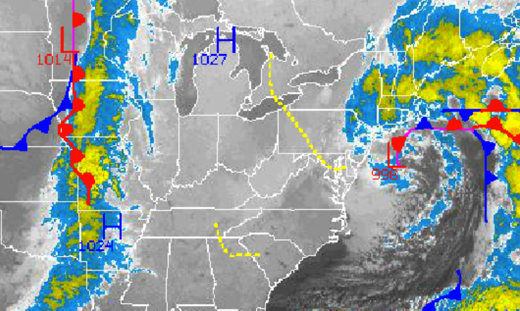
As a Nor’easter slowly exits, a round of moderate to heavy rain will continue to rotate through the Philadelphia and New York City metropolitan areas. The storm will exit by tonight with improving weather conditions expected by Friday morning. High pressure will be in complete control for this weekend.
The Nor’easter will slowly exit with periods of moderate to heavy rainfall expected. The rain will be heavy at times, especially along the coast. The rain will become more scattered in the afternoon and evening hours. Winds will back to the northwest at 15 to 25 mph with gusts over 30 mph. Temperatures will rise into the mid to upper 50’s for highs throughout the region.
The low pressure system will exit with a few lingering showers into the morning hours Friday. Winds will be from the northwest at 10 to 20 mph. Temperatures will fall into the upper 30’s to lower 40’s over the interior and mid to upper 40’s along the coast.
Find out what's happening in Freeholdfor free with the latest updates from Patch.
High pressure will take control tomorrow afternoon on through Tuesday with clear skies to scattered cloud cover. Winds will be from the northwest and west-northwest at 5 to 15 mph. Low temperatures will range from the upper 30’s to lower 40’s over the interior and mid to upper 40’s along the coast. High temperatures will range from the upper 50’s to lower 60’s over the interior and mid 60’s along the coast.
A cold front will approach the region on Wednesday with scattered showers. Temperatures will be above normal ahead of the cold front. Low temperatures will range from the lower to mid 50’s. High temperatures will range from the mid to upper 60’s.


