Neighbor News
Perfect weather to start the week
Canadian high pressure over the St. Lawrence River Valley will continue to slowly drop south today before shifting east
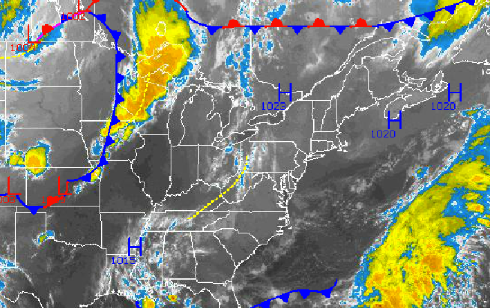
Canadian high pressure over the St. Lawrence River Valley will continue to slowly drop south today before shifting east towards the New England coastal waters on Wednesday. Tranquil weather conditions will be in place through much of the week with only a few isolated showers a threat on Thursday.
Today through tomorrow, high pressure will move over the Philadelphia and New York City metropolitan areas with clear skies to scattered clouds. Winds will veer from the north to the southeast at 5 to 10 mph through the period. Temperatures this afternoon will rise into the upper 70’s to lower 80’s along the immediate coast and lower to mid 80’s throughout the rest of the region. Temperatures tonight will fall into the lower to mid 50’s over the northern interior, upper 50’s to lower 60’s over the western suburbs, and lower to mid 60’s in urban areas and long the coast. Temperatures tomorrow will rise into the upper 70’s to lower 80’s along the immediate coast and mid 80’s throughout the rest of the Philadelphia and New York City metropolitan areas.
On Wednesday, high pressure will shift to the east of the Philadelphia and New York City metropolitan areas. Winds will veer to the southwest at 5 to 15 mph, which will transport a warm and more humid air mass into the region. Low temperatures will range from the mid to upper 60’s throughout the region. High temperatures will range from the lower to mid 80’s over Long Island, mid to upper 80’s throughout much of the rest of the region, and upper 80’s to lower 90’s in urban locations.
Find out what's happening in Freeholdfor free with the latest updates from Patch.
A cold front will move through the Philadelphia and New York City metropolitan areas on Thursday with scattered clouds with isolated showers. Winds will veer from the southwest to northwest at 5 to 15 mph. Temperatures will range from the mid to upper 60’s for lows and lower to mid 80’s for highs.
High pressure from southeastern Canada and northeastern New England will build into the region for Friday on through Sunday with scattered to broken cloud cover expected. Temperatures on Friday will range from the lower to mid 60’s for lows and mid to upper 70’s for highs. Temperatures on Saturday and Sunday will range from the lower to mid 60’s for lows and lower to mid 80’s for highs.


