Community Corner
Periods of rain develop Friday evening; Rain On The Way
Clouds were to increase Friday
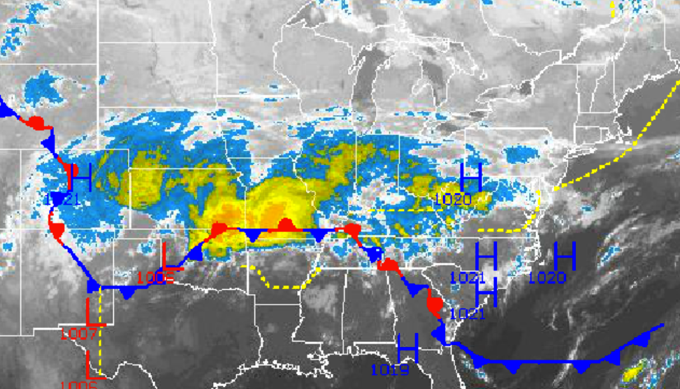
High pressure drifting over the Philadelphia and New York City metropolitan areas is producing tranquil weather conditions this morning, however an area of low pressure developing over the Southern Plains will bring periods of rain tonight into tomorrow. Unsettled conditions can be expected through next week as well as a series of cold fronts and low pressure systems pass through the region.
Clouds will increase through the day with rain developing late in the afternoon and in the evening hours. Winds will veer from the northwest to the northeast at 5 to 15 mph. Temperatures will rise into the upper 50’s to lower 60’s throughout the Philadelphia and New York City metropolitan areas this afternoon.
Periods of rain can be expected this evening on through tomorrow afternoon. The rain will be heavy at times with localized flash flooding a possibility. Rainfall amounts will range from 0.50” to 1.50” in the Philadelphia and New York City metropolitan areas and along the coast, 0.25” to 0.75” over the western suburbs of Philadelphia and New York City and northwestern New Jersey, and 0.10” to 0.25” over northeastern Pennsylvania, the Hudson River Valley, and northern Connecticut. Winds will be from the northeast at 5 to 15 mph with gusts over 20 mph at times. Temperatures will range from the mid to upper 40’s for lows and upper 50’s to lower 60’s for highs.
Find out what's happening in Freeholdfor free with the latest updates from Patch.
The low pressure system will exit on Saturday night with clearing skies, however the frontal boundary associated with the low pressure system will linger just south and southeast of the northern Mid Atlantic. As a result, isolated showers will remain a threat for Sunday and Monday, although most locations will remain dry with variable cloud cover. Winds will back to the north at 5 to 15 mph through the period. Low temperatures will range from the mid to upper 30’s over the interior and lower to mid 40’s along the coast. High temperatures will range from the upper 50’s to lower 60’s over the interior and lower to mid 60’s along the coast.
A warm front will lift north on Tuesday morning with scattered showers in the morning and isolated showers in the afternoon on through Wednesday. Much warmer conditions will be in place for the region. Temperatures on Tuesday will range from the lower to mid 50’s for lows and lower to mid 70’s for highs. Temperatures on Wednesday will range from the mid to upper 50’s for lows and upper 60’s to lower 70’s for highs.
Find out what's happening in Freeholdfor free with the latest updates from Patch.
A very slow moving cold front will approach the region on Thursday and Friday with periods of moderate to heavy rainfall expected. Rainfall amounts will have the potential to exceed an inch as rain lifts to the northwest off the Atlantic Ocean. Low temperatures will range from the lower to mid 50’s for lows. High temperature will range from the mid to upper 60’s for highs.


