Community Corner
Quiet end to October
Tranquil conditions will end October, but a storm is brewing to start November
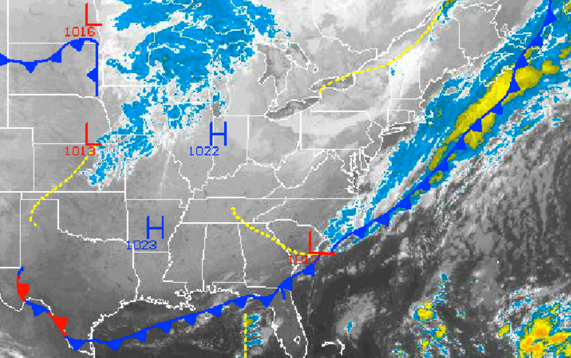
High pressure will produce tranquil conditions to end October with clear skies to scattered cloud cover and seasonable temperatures. However, the tranquil conditions won’t last long as November will start off cold, stormy, and windy for the Philadelphia and New York City metropolitan areas.
Today on through tomorrow, high pressure will produce clear skies to scattered cloud cover for the entire Philadelphia and New York City metropolitan areas. Winds will be from the northwest at 5 to 15 mph this afternoon, increasing to 10 to 20 mph by tomorrow. Winds will veer to the north at 1o to 20 mph by tomorrow evening. Temperatures will rise into the mid to upper 50’s for highs throughout the region this afternoon. Temperatures tomorrow morning will fall into the upper 20’s to lower 30’s over the interior and mid to upper 30’s along the coast for lows. Temperatures tomorrow afternoon will rise into the mid to upper 50’s for highs throughout the region.
I should note that dry conditions can be expected for Halloween evening with winds veering to the north-northeast at 10 to 20 mph and clouds increasing. Temperatures will fall into the upper 40’s to lower 50’s tomorrow evening, so be sure to have those super heroes, ghouls, and ghosts properly layered.
Find out what's happening in Freeholdfor free with the latest updates from Patch.
An area of low pressure will develop along the North Carolina coast on Friday night and slowly lift northeast towards the New England coastal waters by Sunday morning. Periods of rain can be expected along the immediate coast on Saturday with winds from the northeast at 15 to 25 mph with higher gusts. The rain will be more scattered away from the coast. Rainfall amounts will range from up to 0.25″ over the interior, 0.25″ to 0.50″ in the Philadelphia metropolitan area and the western suburbs of New York City, and 0.50″ to 1.00″ along the New Jersey coast, New York City metro, Long Island, and coastal Connecticut. Temperatures will range from the lower to mid 40’s for lows and mid 50’s for highs.
High pressure will build into the Philadelphia and New York City metropolitan areas on Sunday with clearing skies and windy conditions. Winds will back to the northwest at 15 to 25 mph with gusts over 30 mph. Low temperatures will range from the upper 20’s to lower 30’s over the interior and mid to upper 30’s along the coast. High temperatures will range from the mid to upper 40’s over the interior and upper 40’s to lower 50’s along the coast. Due to the wind, temperatures will feel like the upper 30’s to mid 40’s in the afternoon.
Find out what's happening in Freeholdfor free with the latest updates from Patch.
High pressure will remain in control Monday on through Wednesday with clear skies to scattered cloud cover. Temperatures will average near normal through the period. Temperatures on Monday will range from the upper 20’s to lower 30’s for lows and upper 50’s to lower 60’s for highs. Temperatures on Tuesday and Wednesday will range from the lower to mid 40’s for lows and lower to mid 60’s for highs.
For more information visit NY NJ PA Weather!


