Community Corner
Rain and snow return tonight through tomorrow morning
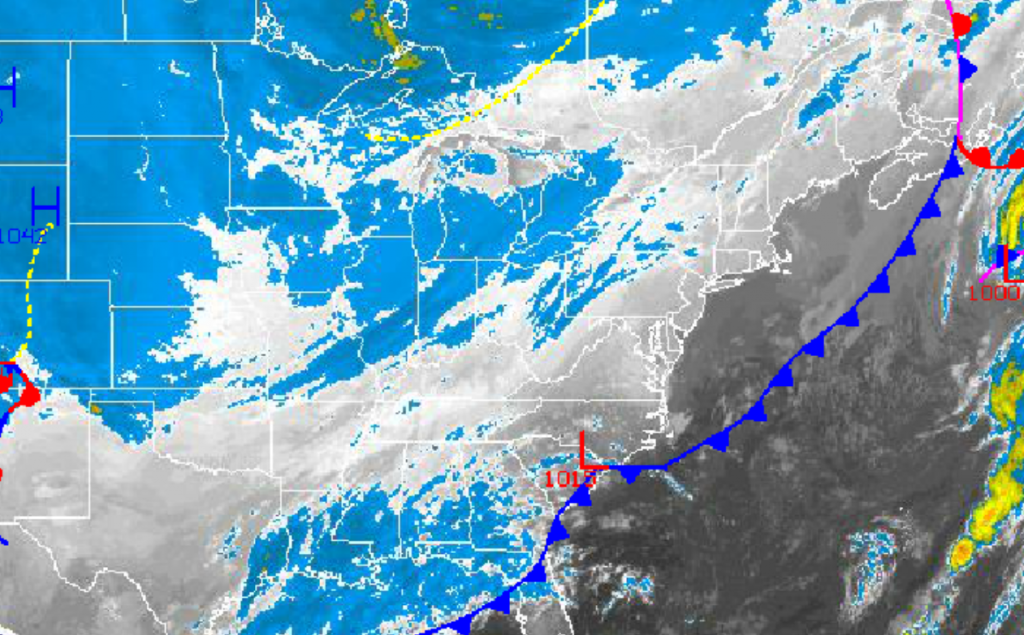
An area of low pressure will bring rain and snow back to the region tonight
A fresh Polar air mass has invaded the Philadelphia and New York City metropolitan areas this morning with temperatures back in the 20’s and 30’s this morning. More wintery weather is on the way for tonight into tomorrow as an area of low pressure produces rain and snow for the region. A chilly weekend will follow with temperatures averaging well below normal for this time of year.
Clear skies to scattered cloud cover can be expected through this afternoon as high pressure builds into the Philadelphia and New York City metropolitan areas from the Great Lakes. Winds will be from the northwest and north at 5 to 15 mph, increasing to 10 to 20 mph by tonight. Temperatures will rise into the mid to upper 40’s over the interior and upper 40’s to lower 50’s along the immediate coast.
An area of low pressure developing along the North Carolina coast will lift northeast through the New Jersey coastal waters tonight into tomorrow morning and towards New England by tomorrow afternoon. Periods of rain and snow can be expected with some minor accumulations on cold surfaces of a trace to a half an inch possible, especially over the interior. Winds will back to the northwest at 10 to 20 mph. Temperatures will fall into the mid to upper 20’s over the interior and upper 20’s to lower 30’s along the coast.
Find out what's happening in Freeholdfor free with the latest updates from Patch.
High pressure will be in control tomorrow night on through Sunday with clear skies to scattered cloud cover. Winds will be from the northwest through the period at 5 to 15 mph. Temperatures will remain well below normal through the period. Low temperatures will range from the lower to mid 20’s over the interior and upper 20’s to lower 30’s along the coast. High temperatures will range from the upper 30’s to lower 40’s over the interior and lower to mid 40’s along the coast.
An area of low pressure will track through the Philadelphia and New York City metropolitan areas on Monday. The storm track is still uncertain however enough warm air is expected to invade the region ahead of the low pressure system to lead to periods of rain for most locations on Monday. Low temperatures will range from the upper 20’s to lower 30’s over the interior and lower to mid 30’s along the coast. High temperatures will range from the mid to upper 40’s throughout the northern Mid Atlantic.
Find out what's happening in Freeholdfor free with the latest updates from Patch.
Arctic high pressure will be in place for Tuesday and Wednesday with clear skies and very cold weather conditions expected. Temperatures will average nearly 15 degrees below normal in some locations. Low temperatures on Tuesday will range from the upper 20’s to lower 30’s over the interior and lower to mid 30’s along the coast. High temperatures on Tuesday will range from the lower to mid 40’s throughout the northern Mid Atlantic. Low temperatures on Wednesday will range from the upper 10’s to lower 20’s over the interior and lower to mid 20’s along the coast. High temperatures on Wednesday will range from the mid to upper 30’s over the interior and upper 30’s to lower 40’s along the coast.


