Community Corner
Rain Exits by Saturday Evening; Chilly Air To Come
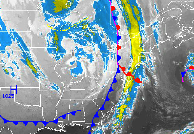
A strong cold front brought rain Saturday, but chilly air took its place
Periods of rain this morning gave way to clearing skies Saturday as a cold front drives through the Philadelphia and New York City metropolitan areas today. Canadian high pressure will bring cool weather conditions with the threat for frost for some locations.
The strong cold front drove through the Philadelphia and New York City metropolitan areas with the threat for moderate to heavy rain through 2 PM Saturday for all over Pennsylvania, New Jersey, and the Hudson Valley and until 5 PM for eastern Connecticut and eastern Long Island. Winds veered from the southeast to west at 10 to 20 mph with gusts over 30 mph at times. Temperatures rose into the lower to mid 60’s over the interior and upper 60’s to lower 70’s along the coast. Rainfall amounts ranged from 0.25” to 0.75” over the Philadelphia metropolitan areas and 0.50” to 1.50” for the New York City metropolitan area and northern interior.
Canadian high pressure took control with clearing skies and winds from the west and northwest at 5 to 15 mph, decreasing to around 5 mph by Sunday. Temperatures will fall into the mid to upper 30’s over the northern interior and lower to mid 40’s along the coast.
Find out what's happening in Freeholdfor free with the latest updates from Patch.
High pressure will remain in control through Monday with clear skies to scattered clouds. Winds will be from the west at 5 to 10 mph. High temperatures on Sunday will range from the mid to upper 50’s over the northern interior and upper 50’s to lower 60’s along the coast. Low temperatures on Monday will range from the mid to upper 30’s over the interior and lower to mid 40’s along the coast. High temperatures will range from the mid to upper 60’s throughout the northern Mid Atlantic.
A series of low pressure systems will move through the Philadelphia and New York City metropolitan areas on Tuesday and Wednesday with periods of showers expected. Temperatures will be near to above normal through the period. Low temperatures will range from the mid to upper 40’s over the interior and lower to mid 50’s along the coast. High temperatures will range from the upper 60’s to lower 70’s over the interior and lower to mid 70’s along the coast.
Find out what's happening in Freeholdfor free with the latest updates from Patch.
High pressure will take hold for Thursday and Friday with scattered to broken clouds. Low temperatures will range from the lower to mid 40’s over the interior and upper 40’s to lower 50’s along the coast. High temperatures will range from the mid 60’s over the interior and upper 60’s to lower 70’s along the coast.


