Community Corner
Spring like conditions linger but not for long
Mild conditions continue throughout the region, but an Arctic cold front is on the way for tomorrow
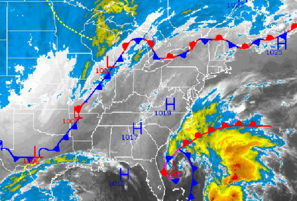
Another warm day is expected throughout the Philadelphia and New York City metropolitan areas however, an Arctic cold front is on the way for tomorrow that will put an end to the above normal temperatures for some time as Arctic air invades from the Great Lakes and Northern Plains.
High pressure will slowly exit into the Atlantic Ocean today with increasing clouds through the day. Winds will be from the southeast at 5 to 15 mph. Temperatures will rise into the lower to mid 60’s for highs throughout the Philadelphia and New York City metropolitan areas.
An area of low pressure off the Southeast coast will lift northeast towards the New England coastal waters tonight through tomorrow morning while an Arctic cold front will drive towards the coast from the Great Lakes and Ohio River Valley. The coastal low pressure system will slow the Arctic cold front slightly leading to a cold front passage in the afternoon hours. Broken to overcast cloud cover can be expected with scattered showers. Winds will veer from the south to the northwest at 10 to 20 mph. Temperatures in the morning will range from the mid to upper 40’s over the interior and lower to mid 50’s along the coast for lows. High temperatures ahead of the cold front will range from the upper 50’s to lower 60’s over the interior and lower to mid 60’s along the coast. Temperatures will fall through the 50’s, 40’s, and into the 30’s behind the cold front in the evening.
Find out what's happening in Freeholdfor free with the latest updates from Patch.
High pressure will be in control by Thursday morning with clear skies and winds from the northwest at around 5 mph. Tranquil conditions will remain through Thursday evening. Low temperatures will range from the mid to upper 20’s over the interior and lower to mid 30’s along the coast. High temperatures will struggle in the mid to upper 40’s throughout the Philadelphia and New York City metropolitan areas.
A wave of low pressure will pass to the southeast of the New Jersey coast on Friday morning with a mix of rain and snow showers along the coast and snow showers over the interior. Accumulations of a half an inch to an inch on cold surfaces is possible for elevations over 500 feet, however the threat is rather small. Skies will clear in the afternoon and evening. Low temperatures will range from the mid to upper 20’s over the interior and upper 20’s to lower 30’s along the coast. High temperatures will range from the lower to mid 40’s throughout the Philadelphia and New York City metropolitan areas.
Find out what's happening in Freeholdfor free with the latest updates from Patch.
High pressure will be in control for Saturday and Sunday with clear skies to scattered cloud cover. Temperatures will average well below normal through the weekend. Low temperatures will range from the lower to mid 20’s over the interior and upper 20’s to lower 30’s along the coast. High temperatures will range from the upper 30’s to lower 40’s over the interior and mid to upper 40’s along the coast.
An area of low pressure will bring the threat for rain along the coast and a wintry mix of rain, sleet, and snow over the interior on Monday. The precipitation may be heavy at times. Low temperatures will range from the mid to upper 20’s over the interior and lower to mid 30’s along the coast. High temperatures will range from the upper 30’s to lower 40’s over the interior and mid to upper 40’s along the coast.


