Community Corner
Wet, cool, and raw through this evening
Periods of rain today will give way to cold and windy conditions for this weekend
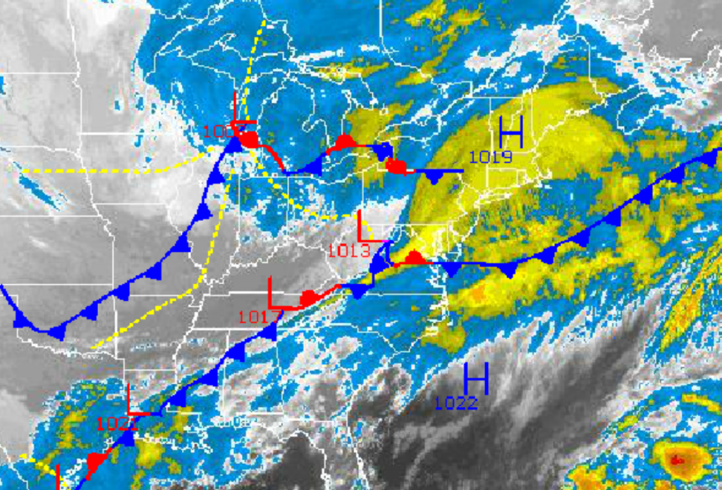
As two low pressure systems begin to interact over the Philadelphia and New York City metropolitan areas today, periods of rain will linger through this evening leading to wet, cool, and raw weather conditions. Cold and wind weather will return to the region tomorrow on through Saturday, however a far more impressive cold snap is on the way for next week.
As the low pressure systems over the Ohio River Valley and central Great Lakes merge into a low pressure system off the New Jersey coast by this evening, periods of rain will move through the region. The rain will be light to moderate through this afternoon, however a few heavier downpours can not be ruled out. The steady rainfall will come to an end this evening, however showers will linger over the region through tomorrow afternoon as the low pressure system intensifies over the New England coastal waters. Total rainfall amounts will range from 0.25″ to 0.75″ with locally higher amounts possible. Winds will back from the southwest to the southeast at 10 to 20 mph through this afternoon and then back to the northeast at 10 to 20 mph tonight. Winds will back to the northwest at 15 to 25 mph with higher gusts as the low pressure system exits and intensifies. Temperatures this afternoon will rise into the lower to mid 50’s over the interior and upper 50’s to lower 60’s along the coast. Temperatures tomorrow morning will range from the lower to mid 40’s throughout the Philadelphia and New York City metropolitan areas. Temperatures will rebound into the lower to mid 50’s for highs tomorrow afternoon.
High pressure will briefly take control tomorrow evening on through Saturday with cool weather conditions expected. Scattered clouds to clear skies can be expected through the period with winds from the northwest at 5 to 15 mph. Temperatures will fall into the mid to upper 20’s over the interior and upper 20’s to lower 30’s along the coast for lows. Temperatures will rebound into the mid to upper 40’s over the interior and upper 40’s to lower 50’s along the coast for highs.
Find out what's happening in Freeholdfor free with the latest updates from Patch.
A weak area of low pressure will produce scattered showers on Sunday. The showers are expected to be light with no significant impacts expected on the region. Most locations will have scattered to broken cloud cover through the day. Low temperatures will range from the mid to upper 30’s throughout the region. High temperatures will range from the upper 40’s to lower 50’s throughout the region.
High pressure will be in place for Monday and Tuesday with clear skies to scattered cloud cover. Temperatures will moderate ahead of an advancing Arctic cold front leading to mild conditions to start the week. Temperatures on Monday will range from the lower to mid 30’s for lows and mid to upper 50’s for highs. Temperatures on Tuesday will range from the lower to mid 40’s for lows and lower to mid 60’s for highs.
Find out what's happening in Freeholdfor free with the latest updates from Patch.
An Arctic cold front will drive through the region on Wednesday with periods of rain expected. Temperatures will peak early into the upper 40’s to lower 50’s for highs ahead of the cold front but then fall through the 40’s and 30’s in the afternoon and evening. Skies will clear by Thursday with temperatures in the mid to upper 20’s for lows and lower to mid 40’s for highs.


