Community Corner
Wintery Mix Returns
After Spring like weather yesterday; snow, sleet, and rain returns today
A day after temperatures rose into the 60’s and even a few lower 70’s for afternoon highs, the threat for snow, sleet, and rain return to the Philadelphia and New York City metropolitan areas. Granted, much of the frozen precipitation will be north and west of the I-95 corridor, the 20 to 30 degree flip in temperatures is rather impressive. The roller coaster ride of above to below normal temperatures will be a continued theme rise through this weekend.
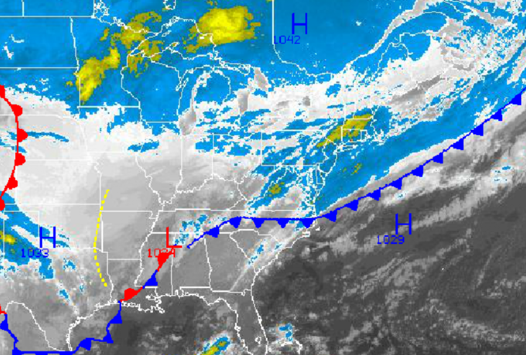
An area of low pressure over the Tennessee River Valley this morning will lift to the northeast towards New England today through tomorrow morning. As the low pressure system approaches, the cold front that moved through the region last night will rebound to the north as a warm front. Periods of showers can be expected along the coast and over much of the Philadelphia and New York City metropolitan areas. Meanwhile a wintery mix of snow, sleet, and freezing rain can be expected for interior southeastern Pennsylvania, northeastern Pennsylvania, northwestern New Jersey, the Hudson River Valley, and northwestern Connecticut leading to up to 2″ of snow and up to 0.10″ of ice on mostly cold surfaces. Caution should be taken on untreated roadways and walk ways through this evening. Winds will veer from the northeast to southwest at 10 to 20 mph through the period. Temperatures will slowly rise into the mid to upper 30’s over the interior and upper 30’s to lower 40’s by late this evening.
The low pressure system will continue to move into New England by tomorrow morning which will force a cold front through the region by the late morning hours leading to periods of showers. Skies will slowly clear in the afternoon and evening hours as high pressure builds in from the Great Lakes. Winds will veer from the southwest to northwest at 10 to 20 mph. Before the cold front passage, early morning lows will be in the upper 30’s over the interior and lower 40’s along the coast. Temperatures will continue to rise through the early afternoon into the lower to mid 50’s before the cold front exits followed by temperatures rapidly falling through the 40’s in the evening.
Find out what's happening in Freeholdfor free with the latest updates from Patch.
High pressure will be in control tomorrow evening on through Thursday with tranquil weather conditions expected. Winds will be from the northwest and north at 10 to 20 mph. Temperatures will fall into the upper 20’s over the interior and lower to mid 30’s along the coast for lows. High temperatures will rebound to near normal levels in the upper 30’s to lower 40’s over the interior and lower to mid 40’s along the coast.
A series of weak low pressure systems will move through thePhiladelphia and New York City metropolitan areas Friday on through Monday with periods of showers expected along with overcast cloud cover. Temperatures will be slightly above normal through the period with only rainfall expected, no frozen precipitation. Low temperatures will range from the lower to mid 30’s over the interior and upper 30’s to lower 40’s along the coast. High temperatures will range from the mid 40’s over the interior and upper 40’s to lower 50’s along the coast.


