Weather
Snowfall Totals: How Much Did Haddonfield, Haddon Twp. Get?
How much snow fell locally during South Jersey's biggest snowstorm in years? A few different measurements tell the story.

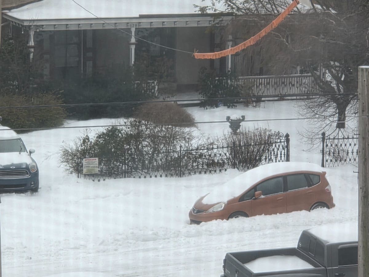
HADDON TOWNSHIP, NJ — Plenty of snow and ice fell across Haddonfield and Haddon Township on Sunday, but how much did we get?
North Jersey got the most snow in the state, with 17 inches recorded in Stockholm and Branchville — both in Sussex County.
But South Jersey endured its greatest snowstorm in years, with a wintry mix thrown in there.
Find out what's happening in Haddonfield-Haddon Townshipfor free with the latest updates from Patch.
So how much snow did Haddon Township and Haddonfield get? A few different measurements tell the story.
The National Weather Service has not posted an official measurement for Haddonfield. But Haddon Township recorded at least 7 inches, according to the NWS.
Find out what's happening in Haddonfield-Haddon Townshipfor free with the latest updates from Patch.
However, that total was measured late Sunday afternoon, while the snowstorm was still underway. Several nearby towns had higher measurements Monday morning, including Cherry Hill (9.3 inches) and Somerdale (9.3 inches).
Those are the highest official measurements. But it appears that Camden County received 10 to 10.5 inches of snow, according to NWS estimates.
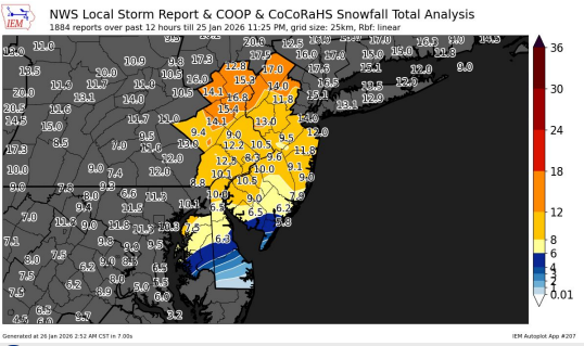
Here are the latest snowfall totals in Camden County, according to the National Weather Service:
- Cherry Hill: 9.3 inches (as of 7 a.m. Monday)
- Somerdale: 8.5 inches (as of 7 p.m. Sunday)
- Barrington: 7.8 inches (as of 7 a.m. Monday)
- Erial: 7.5 inches (as of 7 p.m. Sunday)
- Blackwood: 7.5 inches (as of 8:17 p.m. Sunday)
- Lindenwold: 7.2 inches (as of 7 p.m. Sunday)
- Mount Ephraim: 7 inches (as of 11:40 a.m. Sunday)
- Haddon Township: 7 inches (as of 5:10 p.m. Sunday)
- Winslow: 6.8 inches (as of 7 p.m. Sunday)
- Stratford: 6.5 inches (as of 1:30 p.m. Sunday)
- Berlin: 6 inches (as of 2 p.m. Sunday)
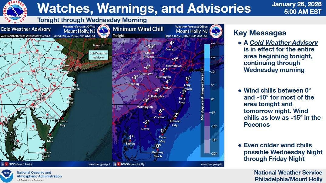
Looking ahead, the NWS is warning about dangerously cold temperatures arriving this week with several nights featuring single-digit temperatures and wind chills below zero.
"Some record lows and record low highs may be in jeopardy later this week," the NWS said Monday. "The stretch begins tonight, with a Cold Weather Advisory in place for the entire area. It's quite rare to get a stretch of temperatures this cold for so long."
The cold weather advisory is in effect from 7 p.m. Monday to 10 a.m. Wednesday, when wind chills could dip to 7 below zero — cold enough to cause hypothermia if precautions aren't taken.
"Use caution while traveling outside," the advisory says. "Wear appropriate clothing, a hat, and gloves."
Even-colder wind chills are possible Wednesday night through Friday night, the NWS said.
Get more local news delivered straight to your inbox. Sign up for free Patch newsletters and alerts.