Weather
3 Inches Of Rain May Fall In Short Time In Hoboken: See Map, Timing
"Heavy rainfall with rates of 2 to 4 inches per hour anticipated in the heaviest downpours," the NWS says.


HOBOKEN, NJ — A flood watch has been issued for Hudson County for Thursday, with heavy rain possible in the evening, the National Weather Service said.
The NWS said showers and a thunderstorm are possible any time after 12 p.m.
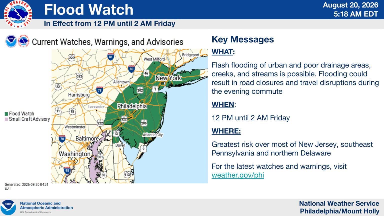
The flood watch runs from 2 p.m. to 2 a.m. While the evening high tide isn't expected until 3:52 a.m. Friday, forecasters are concerned that heavy rain will fall in a short time.
Find out what's happening in Hobokenfor free with the latest updates from Patch.
"An active day is expected for today," the NWS said. "Storms begin to develop by the early afternoon, continuing into the evening. Scattered strong to severe thunderstorms that develop are capable of damaging winds, hail, and a few tornadoes.
"These storms will be capable of producing very heavy rainfall with rates of 2 to 4 inches per hour anticipated in the heaviest downpours. Heavy rain and flash flooding could result in road closures and disruptions to the evening commute. Stay weather aware and have multiple ways to receive warnings!"
Find out what's happening in Hobokenfor free with the latest updates from Patch.
The NWS predicts as much as 3 inches in total for Hoboken.
To follow changes in the forecast, use the links below.
Local Links To Track Storms
- Keep an eye on the radar here.
- Check out the Accuweather Minutecast here.
- See a current map of all watches and warnings in New Jersey here.
- The NOAA (National Oceanic and Atmospheric Administration) keeps us informed about larger weather events. Follow them here.
- Check the air quality by inputting your zip code here.
Updated NWS forecasts, watches, and warnings in each county:
Get more local news delivered straight to your inbox. Sign up for free Patch newsletters and alerts.