Weather
Flash Floods, Thunderstorms In Hoboken Forecast: See Risk Map
Thunderstorms and flash flooding is again possible in Hudson County this weekend.


HUDSON COUNTY, NJ — Hoboken may be soaked by thunderstorms and flooding again this weekend, the National Weather Service says.
The NWS issued a Hazardous Weather Outlook for Sunday.
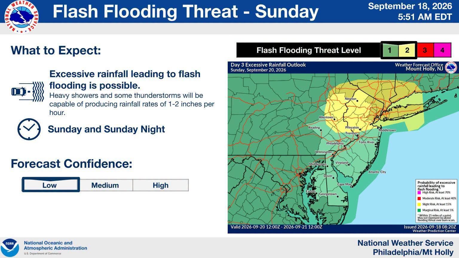
Rain is in the forecast for much of the workweek, with precipitation expected all day Sunday.
Find out what's happening in Hobokenfor free with the latest updates from Patch.
The Outlook says, "An approaching low pressure system will bring an increasing likelihood for showers Sunday morning into afternoon, with a period of heavy downpours and embedded thunderstorms possible Sunday afternoon into Sunday night.
"Areas of minor urban and poor drainage flooding are likely, as well as minor flooding along a few quick responding small river and streams. There is a threat for isolated instances of flash flooding."
Find out what's happening in Hobokenfor free with the latest updates from Patch.
High tide on Sunday occurs around 4:42 p.m.
Hoboken officials have said in the past that the city's low-lying areas can flood if more than .8 inch of rain falls in an hour.
Residents can report a clogged sewer to the NHSA hotline at (866) 689-3970.
Watch Patch for updates, and use the links below for the most up-to-date information.
- Keep an eye on the radar here.
- Check out the Accuweather Minutecast here.
- See a current map of all watches and warnings in New Jersey here.
- The NOAA (National Oceanic and Atmospheric Administration) keeps us informed about larger weather events. Follow them here.
Updated NWS forecasts, watches, and warnings in each county:
What about the rivers? This NWS map of the United States will show the potential for river flooding.
RELATED STORY: Jersey City Responders Rescue 69 People From Floodwaters
Get more local news delivered straight to your inbox. Sign up for free Patch newsletters and alerts.