Weather
Hazardous Weather Outlook Issued; Winter Weather For Weekend In N.J. Expected
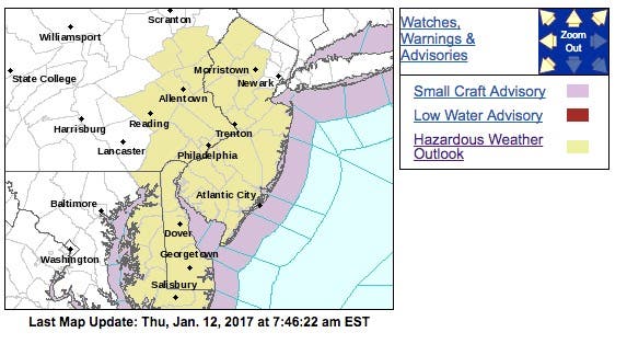
A hazardous weather outlook has been issued for New Jersey as more bad weather is expected.


Enjoy the nice weather on Thursday, because it's not going to last. And it's not going to be fun, especially for drivers.
A hazardous weather outlook was issued for almost all of New Jersey this weekend as more snow, freezing rain and ice is expected to make roads pretty slick.
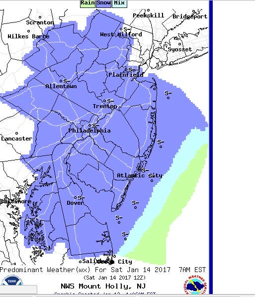
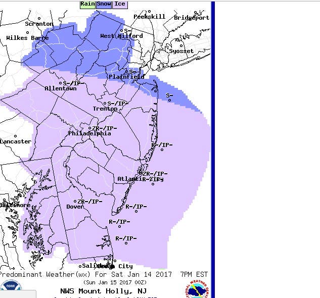
A light mixture of snow and sleet is possible Saturday afternoon and evening, which could affect travel conditions. But some of it may come earlier than that.
Find out what's happening in Morristownfor free with the latest updates from Patch.
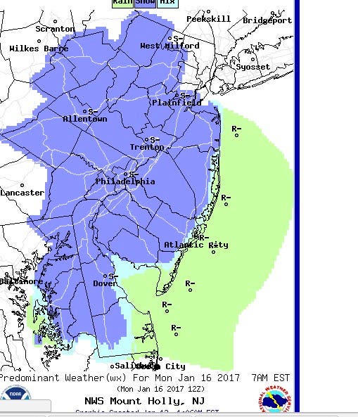
The snow will first impact South Jersey on Saturday morning, and then more will come during the afternoon. Saturday evening and Sunday morning should bring the worst:
Some snow could also come Monday morning:
Find out what's happening in Morristownfor free with the latest updates from Patch.
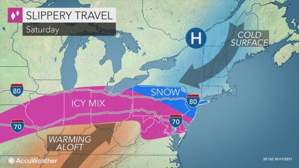
While still causing ice to accrue over much of the central Plains and Midwest, part of the same storm will spread snow, ice and slippery travel into the northeastern United States this weekend, according to an AccuWeather release.
"Similar to the Central states, a wedge of cold air will knife into part of the eastern U.S., just as a new surge of moisture arrives Friday night and Saturday," according to AccuWeather Senior Meteorologist Alex Sosnowski.
"How thick the layer of cold air gets in the atmosphere will determine which areas get freezing rain, versus sleet, versus snow," Sosnowski said.
Here is the weather forecast:
- Thursday afternoon: A chance of rain. Patchy fog before 11am. Otherwise, cloudy, with a high near 54. Southwest wind 11 to 13 mph. Chance of precipitation is 30 percent. New precipitation amounts of less than a tenth of an inch possible.
- Thursday night: A chance of showers, mainly before 10pm. Mostly cloudy, with a low around 37. Southwest wind 7 to 11 mph becoming west after midnight. Chance of precipitation is 30 percent. New precipitation amounts of less than a tenth of an inch possible.
- Friday: Mostly sunny, with a high near 41. Northwest wind 10 to 15 mph, with gusts as high as 25 mph.
- Friday night: Mostly cloudy, with a low around 16. North wind 5 to 10 mph.
- Saturday: A chance of snow. Mostly cloudy, with a high near 28. Light and variable wind becoming south around 6 mph in the afternoon. Chance of precipitation is 50 percent. New snow accumulation of less than a half inch possible.
- Saturday night: A chance of snow before 1am. Mostly cloudy, with a low around 23. Chance of precipitation is 30 percent.
Patch file photo
Get more local news delivered straight to your inbox. Sign up for free Patch newsletters and alerts.