Weather
NJ Weather: Hazardous Outlook As Storms Soak Region This Week
The days leading up to Memorial Day weekend will be stormy ones. How could this impact the holiday weekend?


If you think the weather's bad now, just wait for the rest of the week. Storms are going to make for rough conditions throughout New Jersey. Storms are expected to drench the state throughout the week — and, though the forecast is preliminary, it looks like the nastiness could impact Memorial Day weekend.
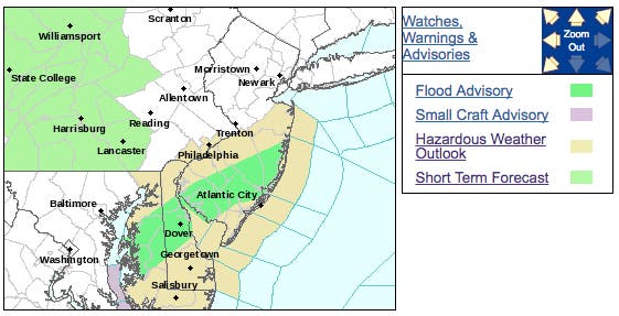
A hazardous weather outlook has been issued for the week, as heavy rain may result in localized flooding in poor drainage areas, including urban areas, through Monday evening.
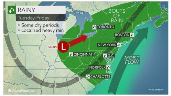
After a week dominated by summer-like and record heat, New Jersey will face rounds of rain, which could slow travel and disrupt outdoor plans, Accuweather warns.
Find out what's happening in Morristownfor free with the latest updates from Patch.
Some of the rain will be heavy in New Jersey and eastern Pennsylvania on Monday evening. The downpours will raise the risk of isolated flash flooding in urban and poor drainage areas. There is also a risk of reduced visibility, hydroplaning and flight delays, Accuweather predicts.
"Along with this rain, expect the air to feel a little chilly as temperatures will be slightly below normal for this time of year," AccuWeather Meteorologist Brett Rossio said in the release.
Find out what's happening in Morristownfor free with the latest updates from Patch.
Tuesday's rain is expected to reach Washington, D.C., Philadelphia and Trenton late Tuesday before grazing the rest of the I-95 corridor into Wednesday.
At the same time, another band of rain and thunderstorms will rotate into the Ohio Valley and Great Lakes at midweek before swinging through New Jersey and eastern Pennsylvania on Thursday into Friday, Accuweather forecasters predict.
Then, additional rounds of showers and thunderstorms may swing through the Northeast during part of the upcoming Memorial Day holiday weekend, according to forecasters.
Here is the forecast:
- Monday afternoon: Showers and possibly a thunderstorm. Some of the storms could produce heavy rainfall. High near 63. South wind around 8 mph. Chance of precipitation is 80%. New rainfall amounts between a tenth and quarter of an inch, except higher amounts possible in thunderstorms.
- Monday night: Showers likely, mainly before 7pm. Patchy fog after midnight. Otherwise, mostly cloudy, with a low around 59. Southeast wind around 6 mph becoming calm in the evening. Chance of precipitation is 60%. New precipitation amounts between a tenth and quarter of an inch possible.
- Tuesday: Scattered showers, mainly after 11am. Mostly cloudy, with a high near 71. Northeast wind 7 to 9 mph. Chance of precipitation is 40%. New precipitation amounts between a tenth and quarter of an inch possible.
- Tuesday Night: Showers likely, mainly after 2am. Cloudy, with a low around 57. Northeast wind around 7 mph. Chance of precipitation is 60%. New precipitation amounts between a quarter and half of an inch possible.
- Wednesday: Showers likely, mainly before 8am. Cloudy, with a high near 74. East wind 3 to 5 mph. Chance of precipitation is 60%. New precipitation amounts between a tenth and quarter of an inch possible.
- Wednesday night: A chance of showers and thunderstorms. Mostly cloudy, with a low around 58. Chance of precipitation is 40%. New precipitation amounts of less than a tenth of an inch, except higher amounts possible in thunderstorms.
- Thursday: Showers likely, with thunderstorms also possible after noon. Mostly cloudy, with a high near 74. Chance of precipitation is 60%.
- Thursday night:A chance of showers. Mostly cloudy, with a low around 58. Chance of precipitation is 30%.
- Friday: Mostly sunny, with a high near 75.
- Friday night: Partly cloudy, with a low around 58.
- Saturday: Mostly sunny, with a high near 78.
- Saturday night: Partly cloudy, with a low around 59.
- Sunday: A chance of showers. Partly sunny, with a high near 77. Chance of precipitation is 30%.
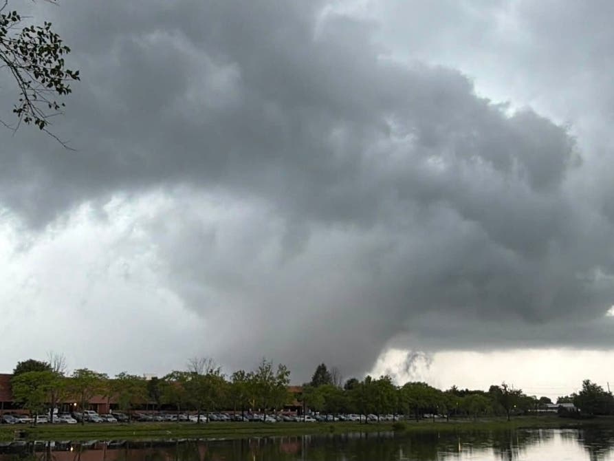
Patch file photo
Get more local news delivered straight to your inbox. Sign up for free Patch newsletters and alerts.