Weather
Winter Weather Advisory In NJ As More Snow Expected
More snow could impact your commute. Some areas could get as many as 6 inches. Some schools could close early.


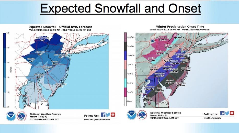
More snow is expected to impact New Jersey on Tuesday and Wednesday, and some areas could get as many as 6 inches.
The snow could cause schools to close early, or close on Wednesday. Read more: New Jersey School Closings/Delays List - 1/16/18
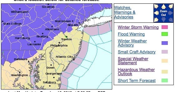
A winter weather advisory has been issued for 10 North Jersey counties, while the National Weather Service has issued a hazardous weather outlook for the rest of New Jersey.
Find out what's happening in Morristownfor free with the latest updates from Patch.
Total snow accumulations of 2 to 6 inches are expected in Morris, Hunterdon, Somerset, Warren, Bergen, Passaic, Essex, Hudson, Sussex and Union counties. The heaviest snow will be from 4 p.m. this afternoon until 9 a.m. Wednesday.
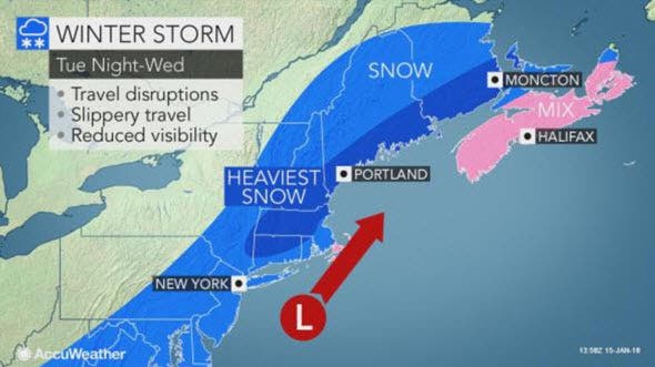
The Alberta clipper storm will spread snow to the central Appalachians and Northeast on Tuesday, while it will blanket much of New England from Tuesday night to Wednesday, according to an AccuWeather release.
Find out what's happening in Morristownfor free with the latest updates from Patch.
Snowfall over much of the central Appalachians to much of the mid-Atlantic coast will be more of a nuisance as this area will be caught up in an atmospheric hand-off, AccuWeather Senior Meteorologist Kristina Pydynowski said in the release.
"The storm from the Midwest will weaken, while there will be a delay in the formation of a new storm over the Atlantic Ocean," Pydynowski said.
Since temperatures will climb above freezing in Philadelphia, New York City, Washington, D.C., and other major metro areas in the Interstate 95 corridor on Tuesday, the roads may be wet at first. However, as colder air invades the storm, untreated roads and sidewalks are likely to become slushy and snow-covered, according to the release.
"Motorists should be prepared for changing conditions during the Tuesday evening rush hour and Tuesday night," Pydynowski said.
Delays due to deicing activities are likely in Philadelphia and New York City.
As the new storm strengthens and travels northeastward, a swath of 2-4 inches of snow is forecast to develop in northern New Jersey and the lower Hudson Valley of New York late Tuesday. "Bombogenesis is not expected with the storm," Pydynowski said in the release.
Here is the forecast:
- Tuesday: A chance of snow, mainly after 2pm. Cloudy, with a high near 32. Light southeast wind. Chance of precipitation is 40%. Little or no snow accumulation expected.
- Tuesday night: Snow, mainly after 8pm. Low around 26. Light and variable wind. Chance of precipitation is 90%. New snow accumulation of 1 to 3 inches possible.
- Wednesday: Snow likely, mainly before 1pm. Cloudy, then gradually becoming mostly sunny, with a high near 30. Northwest wind 6 to 11 mph. Chance of precipitation is 70%. New snow accumulation of 1 to 3 inches possible.
Shutterstock photo
Get more local news delivered straight to your inbox. Sign up for free Patch newsletters and alerts.