Crime & Safety
Rain Or Snow? Forecasters Release Details On Wednesday N.J. Storm
Forecasters have released details on a storm that could hit New Jersey beginning Wednesday and lasting through Thursday.

Forecasters have released details on a storm that could hit New Jersey beginning Wednesday and lasting through Thursday.
The National Weather Service has issued a Hazardous Weather Outlook, saying there is the potential for a strong storm that could lead to poor drainage and roadway flooding on Wednesday and Thursday.
It looks like precipitation will end up being rain, with a chance of snow Northern New Jersey, according to the latest information released by the National Weather Service.
While the likelihood of “major impacts” from the storm have decreased since earlier predictions, residents should continue to monitor the forecast, the NWS said.
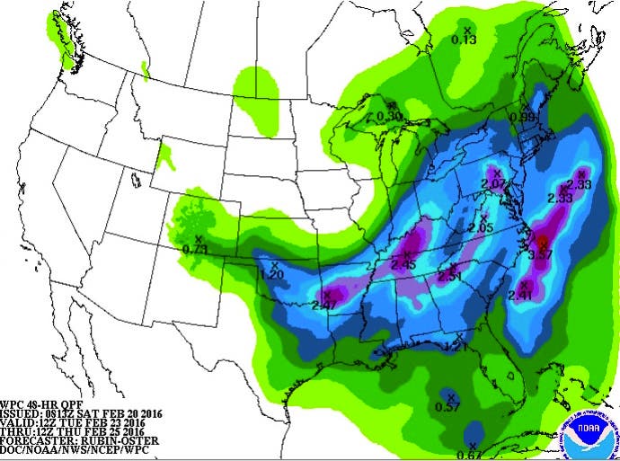
Here are the details from the NWS’s latest briefing package on the storm:
- An area of low pressure is expected to track north toward New Jersey from the Gulf Coast states Tuesday night, and then head into the Eastern Great Lakes by Thursday morning. This is a more westward track compared to what the forecast was yesterday.
- This system will bring the potential for excessive rainfall, some wintry precipitation, and coastal flooding.
- The tidal cycles with the highest chances for coastal flooding are the Wednesday and Thursday morning high tide cycles.
- Precipitation is expected to range from 1 to locally 2 inches across the region with most of that falling as rain. This may result in urban and poor drainage flooding along with minor river flooding in the mid-week period.
- The highest chances for wintry precipitation are in the Lehigh Valley, southern Poconos and northern New Jersey at the front end of the storm early Wednesday. Chances for wintry precipitation have decreased for locations further to the south.
- While the odds of a low pressure system impacting the region are increasing, the details are still uncertain with the exact impacts from this system. However, the likelihood of major impacts from this system have decreased since yesterday’s forecast.
- If these expected impacts continue to look minor, the NWS may discontinue briefing packages early next week.
- Before this system impacts the region, another system may impact the region tomorrow night into early Monday morning. There is a slight chance of snow in the higher terrain of the Southern Poconos and northwest New Jersey.
Get more local news delivered straight to your inbox. Sign up for free Patch newsletters and alerts.