Weather
Update On Severe NJ Weather On Halloween, 50-MPH Winds
UPDATE: Severe weather, 50-mph winds could cause power outages. Some NJ towns have moved Halloween. Here's where, when it's all expected.


NEW JERSEY – Severe weather is expected to hit New Jersey on Halloween, packing heavy rains and bringing thunderstorms and 50-mph winds to the region once kids are emptying their bags and counting their candy bars from trick-or treating. The storm could lead to road closings and power outages.
The creepy forecast was enough to even compel some towns to move Halloween to another date – or offer parents and trick-or-treaters options.
Ocean City moved its Halloween to Friday. Read more: Ocean City Postpones Halloween Trick-Or-Treating To Nov. 1
Find out what's happening in Point Pleasantfor free with the latest updates from Patch.
North Plainfield moved its trick-or-treating to Friday, from 3 p.m. to 8 p.m., while South Plainfield is offering Saturday as an alternative. Mantua Township and the Joint Base McGuire-Dix-Lakehurst moved trick-or-treating to Friday, while Hammonton moved it to Wednesday.
Roxbury Township considered moving the day, but then chose to keep Halloween on Halloween.
Find out what's happening in Point Pleasantfor free with the latest updates from Patch.
The National Weather Service has issued a hazardous weather outlook nearly statewide, saying a period of heavy rain and gusty winds is possible Thursday night. Winds may gust up to 40 to 50 mph, which could be enough to cause localized power outages because heavy, fully leafed trees could fall.

The weather is not expected to have a severe impact during prime trick-or-treating hours in New Jersey. Much of the rain is expected to fall in the morning, and then heavy rain, thunderstorms and winds are mostly expected after 8 p.m.
The rough weather is expected to last through the morning, and could impact the Friday morning commute.
While the storms are not expected to be as severe, they could remind many people of what happened earlier this decade.
The after-effects of Superstorm Sandy forced former Gov. Chris Christie to cancel Halloween in 2012 – the seventh anniversary of which was on Monday. Then there was the 2011 Halloween nor'easter that caused trees and branches to fall and nearly compelled local officials to cancel the holiday then, too.

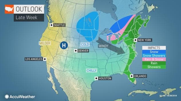
During the afternoon on Halloween, an area of high pressure off the Atlantic coast will tend to suppress rain from the Florida Peninsula to New Jersey, southeastern New York state and southeastern New England during much of Halloween, according to AccuWeather.
It is possible that heavy rain that advances across the corridor from Atlanta to Charlotte, North Carolina; Richmond, Virginia; Washington, D.C.; Baltimore, Philadelphia and New York City only lasts a few hours, according to AccuWeather.
While a shower can occur during the day Thursday to Thursday evening from Washington, D.C., to Baltimore, Philadelphia, New York City and Boston, the burst of heavy rain may hold off until late Thursday night or early Friday morning, or well after trick-or-treat time, according to AccuWeather.
"This could end up being a widespread damaging wind and power-outage event with gusts in the neighborhood of 60 mph from Delaware to Maine spanning late Thursday night to Friday morning," AccuWeather Chief Broadcast Meteorologist Bernie Rayno said in a release.
Delays and cancellations are likely on Friday morning in the Northeast from the ripple-effect of the recent rain and ongoing strong winds, according to AccuWeather.
Here is the forecast:
- Wednesday: Areas of drizzle with a chance of rain before 11am, then a chance of rain after 11 a.m. Areas of fog before 11 a.m. Otherwise, cloudy, with a high near 68. North wind 3 to 6 mph. Chance of precipitation is 30 percent. New precipitation amounts of less than a tenth of an inch possible.
- Wednesday night: Rain, mainly after midnight. Patchy fog after 9pm. Low around 60. Light south wind. Chance of precipitation is 80 percent. New precipitation amounts of less than a tenth of an inch possible.
- Thursday: Rain, mainly before 2 p.m., then a chance of showers after 2 p.m. Patchy fog before 2pm. High near 73. South wind 7 to 14 mph, with gusts as high as 24 mph. Chance of precipitation is 80 percent. New precipitation amounts between a tenth and quarter of an inch possible.
- Thursday night: Showers and thunderstorms likely, then showers and possibly a thunderstorm after 11 p.m. Some of the storms could produce gusty winds and heavy rain. Low around 53. Breezy, with a south wind 15 to 20 mph, with gusts as high as 50 mph. Chance of precipitation is 90 percent. New rainfall amounts between a quarter and half of an inch possible.
- Friday: Showers likely before 8am. Mostly sunny, with a high near 57. West wind around 16 mph, with gusts as high as 33 mph. Chance of precipitation is 60 percent. New precipitation amounts of less than a tenth of an inch possible.
Get more local news delivered straight to your inbox. Sign up for free Patch newsletters and alerts.