Weather
NJ Weather: Here's How Much Ice, Rain We'll See And When It Ends
Schools closed or delayed: Here is the updated timeline on when the ice, rain and flooding are expected to end Tuesday in New Jersey.

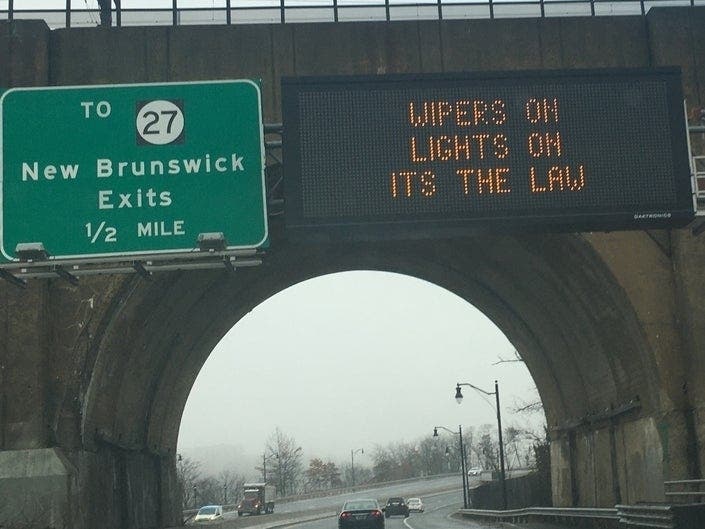
NEW JERSEY — The New Jersey storm was a dud when it came to snow accumulation. But, unfortunately, the icing and flooding concerns were real, and and they're expected continue through most of Tuesday. Hundreds of schools are closed in New Jersey, and a number of flooding incidents and crashes were reported across the state (see list below).
The weather was significant enough to close schools, delay their openings or cause early dismissals. Read more: New Jersey School Closings/Delays List/Early Dismissals For Tuesday
A winter weather advisory is in effect for nine New Jersey counties, while a winter storm warning remains in effect for two others.
Find out what's happening in Point Pleasantfor free with the latest updates from Patch.
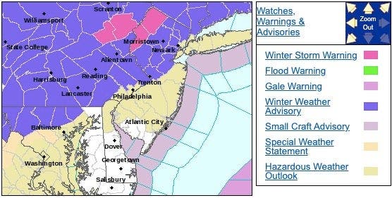
The winter storm warning is in effect until 6 p.m. in Warren and Sussex counties. The winter weather advisory ended at 10 a.m.
Here is what you should expect in those impacted areas:
Find out what's happening in Point Pleasantfor free with the latest updates from Patch.
- Freezing rain, mixed at times with sleet, are forecast in Sussex and Warren counties. Additional ice accumulations of two-tenths to four-tenths of an inch are possible.
- There is a chance for dangerous snow squalls to develop and move across the area, especially along and north of the I-80 corridor, on Wednesday afternoon and into Wednesday evening. Gusty winds of 35 to 45 mph could also occur Wednesday afternoon and Wednesday night.
- Power outages and tree damage are likely due to the ice. Travel could be nearly impossible.
- Freezing rain, mixed at times with rain, was to continue early Tuesday morning before gradually changing to all rain south of I-78 through the mid-to-late morning.
Here is the ice potential:
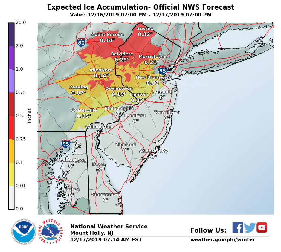
.png)
Here were the road conditions at 8 a.m.:
- Flooding on NJ 71 in both directions in the vicinity of Brighton Avenue in Deal. All lanes closed and detoured; use caution.
- Disabled vehicle on US 1 northbound North of Henderson Road in South Brunswick Twp. Right lane blocked; 5-10 minute delay.
- Crash on I-295 southbound North of Exit 43 - CR 838/Creek Road in Mount Laurel Twp. Right lane closed; 5-10 minute delay; use caution.
- Crash on US 9 northbound at West Farm Road in Howell Twp. One lane closed; 10-15 minute delay; use caution.
- Crash on the New Jersey Turnpike express lanes southbound Exit 69 - I-80 in Teaneck Twp.; Left lane blocked.
- Crash on I-80 westbound East of Exit 28 - CR 631/US 46 in Roxbury Twp. Left lane closed; use caution.
- Crash on NJ 3 westbound area of NJ 17 in Rutherford. Left lane closed.
- Crash investigation and a crash with injuries on the Garden State Parkway, local lanes southbound North of Exit 105 - NJ 36 in Tinton Falls. Left lane closed.
- Truck restrictions on the George Washington Bridge westbound entering at New York Side/Upper Level in Manhattan The 179th Street ramp to New Jersey has a width restriction of 8 feet 6 inches. Please use alternate route. Westbound Trans Manhattan Epressway restrictions are width 10 feet and height 13 feet 6 inches.
Here is the forecast:
- Tuesday: Rain, mainly before 5 p.m. High near 39. Northeast wind 6 to 10 mph. Chance of precipitation is 90 percent. New precipitation amounts between a quarter and half inch are possible.
- Tuesday night: A chance of rain before 7 p.m. Cloudy during the early evening, then gradual clearing, with a low around 28. Northwest wind 8 to 13 mph. Chance of precipitation is 30 percent. New precipitation amounts of less than a tenth of an inch are possible.
- Wednesday: A slight chance of snow showers after 4 p.m. Mostly sunny, with a high near 38. West wind 6 to 11 mph increasing to 12 to 17 mph in the afternoon. Winds could gust as high as 37 mph. Chance of precipitation is 20 percent.
Get more local news delivered straight to your inbox. Sign up for free Patch newsletters and alerts.


