

You'd better plan that outdoor party for Sunday. Or maybe some other weekend. Severe, stormy weather is expected to hit New Jersey beginning Thursday night and bring gusty thunderstorms and drenching downpours on Friday and Saturday, according to forecasters.
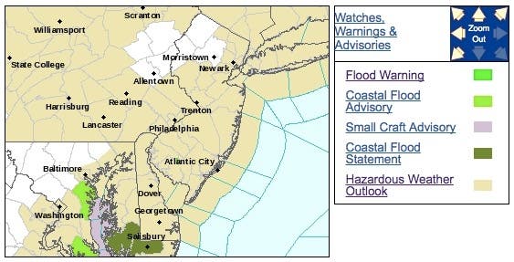
The National Weather Service has issued a hazardous weather outlook, saying showers and thunderstorms may produce locally heavy rainfall Thursday night.
There is the potential for heavy rainfall Friday afternoon through Saturday morning. Areas that were impacted by heavy rainfall earlier this week will be particularly vulnerable to another round of flash flooding.
Find out what's happening in Point Pleasantfor free with the latest updates from Patch.
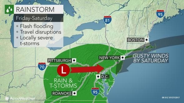
The rare storm for late July will deliver drenching rain and miserable conditions to a large part of the mid-Atlantic and southern coast of New England to end the week and start the weekend, according to AccuWeather.
The rainstorm will be unusual since it will unleash steady rain for 12 hours or more in many locations as it moves slowly across the region. Typically in the summer, rainfall is limited to a few hours in the absence of a tropical rainstorm, according to AccuWeather.
Find out what's happening in Point Pleasantfor free with the latest updates from Patch.
Motorists from Ohio, Pennsylvania, New Jersey, southeastern New York state, West Virginia, Maryland, Virginia and Delaware are likely to face difficult travel due to persistent downpours, excess water on the road and poor visibility, according to AccuWeather.
Beachgoers already have run into problems in New Jersey.
Read more: 15 N.J. Beaches Shut Down Because Of Bacterial Contamination
Enough rain can fall to cause flash and urban flooding. Small stream flooding is also possible as several inches of rain may fall on some locations.
Significant airline delays are possible at the major hubs from Pittsburgh to Philadelphia, New York City, Baltimore and Washington, D.C., due to a low cloud ceiling and fog. The leading edge of the rain will progress from west to east, according to AccuWeather.
"This type of setup has the potential to deliver very heavy rainfall and raise the risk of flooding," AccuWeather Chief Meteorologist Elliot Abrams said in a release.
Here is the forecast:
- Thursday: Mostly cloudy, with a high near 81. Southwest wind around 7 mph.
- Thursday night: A chance of showers and thunderstorms between 10pm and 5am, then a slight chance of showers. Some of the storms could produce heavy rain. Mostly cloudy, with a low around 70. South wind 5 to 7 mph becoming calm after midnight. Chance of precipitation is 30%. New rainfall amounts between a tenth and quarter of an inch, except higher amounts possible in thunderstorms.
- Friday: A chance of showers and thunderstorms, then showers likely and possibly a thunderstorm after 1pm. Some of the storms could produce heavy rain. Mostly cloudy, with a high near 82. Light and variable wind becoming southeast around 5 mph in the afternoon. Chance of precipitation is 70%. New rainfall amounts between a quarter and half of an inch possible.
- Friday night: Showers and possibly a thunderstorm. Some of the storms could produce heavy rain. Low around 67. Northeast wind 8 to 10 mph. Chance of precipitation is 90%. New rainfall amounts between 1 and 2 inches possible.
- Saturday: Showers likely and possibly a thunderstorm. Cloudy, with a high near 76. Northeast wind around 15 mph. Chance of precipitation is 70%. New rainfall amounts between a quarter and half of an inch possible.
- Saturday night: A chance of showers, mainly before 2am. Mostly cloudy, with a low around 63. Chance of precipitation is 30%. New precipitation amounts of less than a tenth of an inch possible.
Tom Davis photo
Get more local news delivered straight to your inbox. Sign up for free Patch newsletters and alerts.


