Weather
Tornado Watch Issued In NJ As Severe Weather Moves In
NWS warns of possible tornadoes and damaging wind gusts up to 75 mph through Thursday night.


(Updated 4:17 p.m.)
The National Weather Service upgraded a portion of the region, including Trenton and the surrounding area, from a severe thunderstorm watch to a tornado watch, valid until 10 p.m. Thursday.
The tornado watch, issued by the Storm Prediction Center, covers a broad swath stretching from the Philadelphia and Trenton areas south through Atlantic City, Dover and Salisbury, Maryland.
Find out what's happening in Princetonfor free with the latest updates from Patch.
A couple of tornadoes are possible within the watch area, along with isolated hail up to ping pong ball size and scattered wind gusts up to 75 mph, forecasters said.
The watch area has a population of more than 15.7 million people and includes 3,712 schools and 224 hospitals, according to the Weather Service.
Find out what's happening in Princetonfor free with the latest updates from Patch.
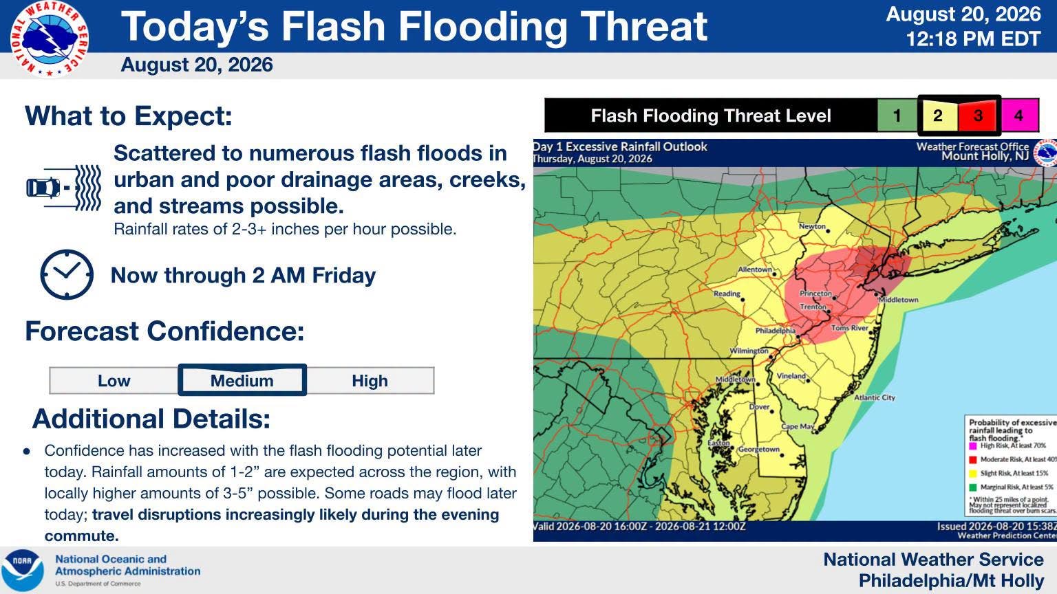
The threat of flash flooding and severe thunderstorms across New Jersey continued to increase Thursday, with the National Weather Service's Weather Prediction Center upgrading portions of the state, including Trenton and central and northern New Jersey, to a moderate risk of excessive rainfall.
The moderate risk area extends from Philadelphia northeastward into central and northern New Jersey, forecasters said. A moderate risk means instances of flash flooding could be fairly widespread and potentially significant within the affected area.
"Thunderstorms are likely to develop and intensify through 4-6 PM EDT, accompanied by the risk for a couple of tornadoes initially and increasing potential for strong to severe gusts spreading toward coastal areas into early evening," the NSW said.
"Travel disruptions increasingly likely during the evening commute," the Weather Service said, warning that some roads may flood later Thursday.
The Weather Service also raised its flash flooding threat level for the region, with the highest-threat area — a level 3 out of 4 — now covering Trenton, Princeton and the surrounding area.
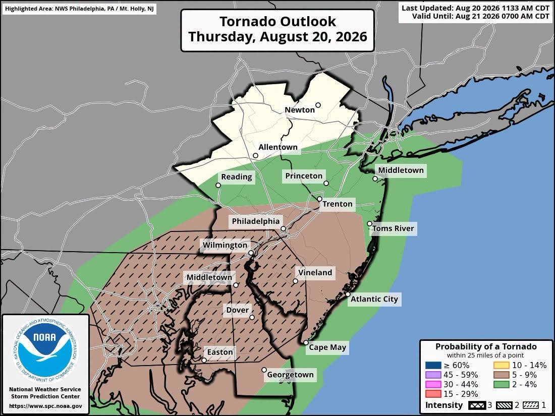
The severe weather threat also remains in play, forecasters said, including the potential for a few tornadoes. The Storm Prediction Center's tornado outlook shows Trenton and Princeton under a 5 percent to 9 percent probability of a tornado within 25 miles, an elevated risk category that also stretches south through Philadelphia, Wilmington and Vineland.
In addition to flooding, forecasters warned of the potential for wind damage, including downed trees and wires, from any severe thunderstorms that develop.
In the original forecast, NJ had been placed under a slight risk for severe thunderstorms and a flood watch. The Storm Prediction Center had placed most of the state under a level 2 "slight risk" for severe weather, with far northern parts of the state under a level 1 "marginal risk." Storms were expected to develop by early afternoon and continue into the evening, mainly south of Interstate 78.
Thursday's high is expected to reach near 83 degrees, with an 80% chance of precipitation. Showers and thunderstorms are expected to continue into Thursday night before tapering off before 11 p.m., with a low around 63 degrees.
Friday will bring a break from the wet weather, with patchy fog before 8 a.m. giving way to partly sunny skies and a high near 79 degrees. Rain chances return Friday night into the weekend, with showers and possible thunderstorms expected Saturday, when the high is forecast to reach 79 degrees.
Have a correction or news tip? Email sarah.salvadore@patch.com
Get more local news delivered straight to your inbox. Sign up for free Patch newsletters and alerts.