Weather
Weather Shift Brings Triple-Digit Temperatures To NJ Thursday
After a Wednesday peppered with heavy rainfall, the heat index will surge as high as 103 degrees Thursday.


Increasing humidity, heavy rainfall and localized flash flooding moved through New Jersey on Wednesday, as another shift in the tumultuous weather pattern takes hold, according to the National Weather Service.
The heat and humidity are forecast to build further on Thursday, when a mostly sunny day with a high near 91 will carry a heat index of up to 103 degrees, the National Weather Service said. A chance of showers and thunderstorms is possible mainly after 5 p.m., with a 30 percent chance of precipitation. Showers and a chance of thunderstorms are expected to continue before 2 a.m. Thursday night, with lows around 72.
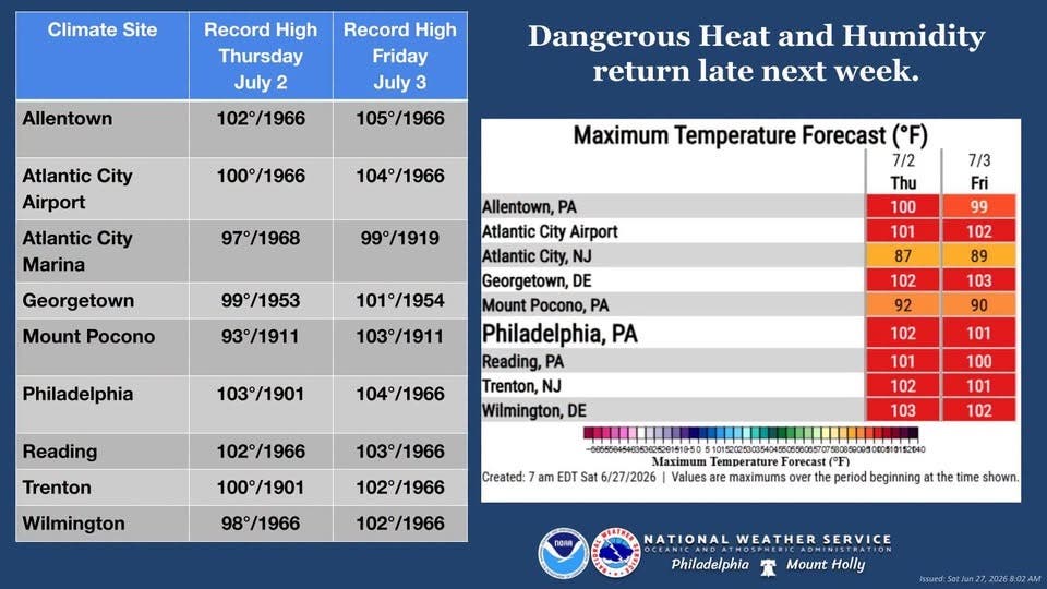
On Friday, showers are likely and a thunderstorm is possible after 2 p.m., with a high near 90 and a 60 percent chance of precipitation, according to the National Weather Service.
Find out what's happening in Princetonfor free with the latest updates from Patch.
Beyond this week, forecasters say the warm-to-hot pattern will carry into next week. The National Weather Service's 6-to-10-day outlook, issued Monday, shows higher probabilities of above-normal temperatures from Sunday, through Thursday.
The National Weather Service is urging residents to stay informed and prepare for extreme heat, particularly those with outdoor plans. During hot and humid conditions, the agency recommends limiting outdoor activity, staying hydrated, and ensuring access to air conditioning or other cooling areas.
Find out what's happening in Princetonfor free with the latest updates from Patch.
Have a correction or news tip? Email sarah.salvadore@patch.com
Get more local news delivered straight to your inbox. Sign up for free Patch newsletters and alerts.