Weather
More Snow In Forecast For NJ As State Recovers From Blizzard
More snow is in the forecast this week, making for slippery commutes, experts say. See the timing.

As the Garden State recovers from the historic blizzard that dumped 30 inches of snow in parts of the region, a pair of winter weather threats have taken shape to add to the misery.
Up to three inches of snow could fall overnight Tuesday into Wednesday morning, likely making for a slippery commute, says the National Weather Service.
The NWS said a "quick moving system" will bring snow to the area early Wednesday morning, primarily for areas near and north of the I-78 corridor. Forecasters warn there may be slick conditions during the morning commute.
Find out what's happening in Ridgewood-Glen Rockfor free with the latest updates from Patch.
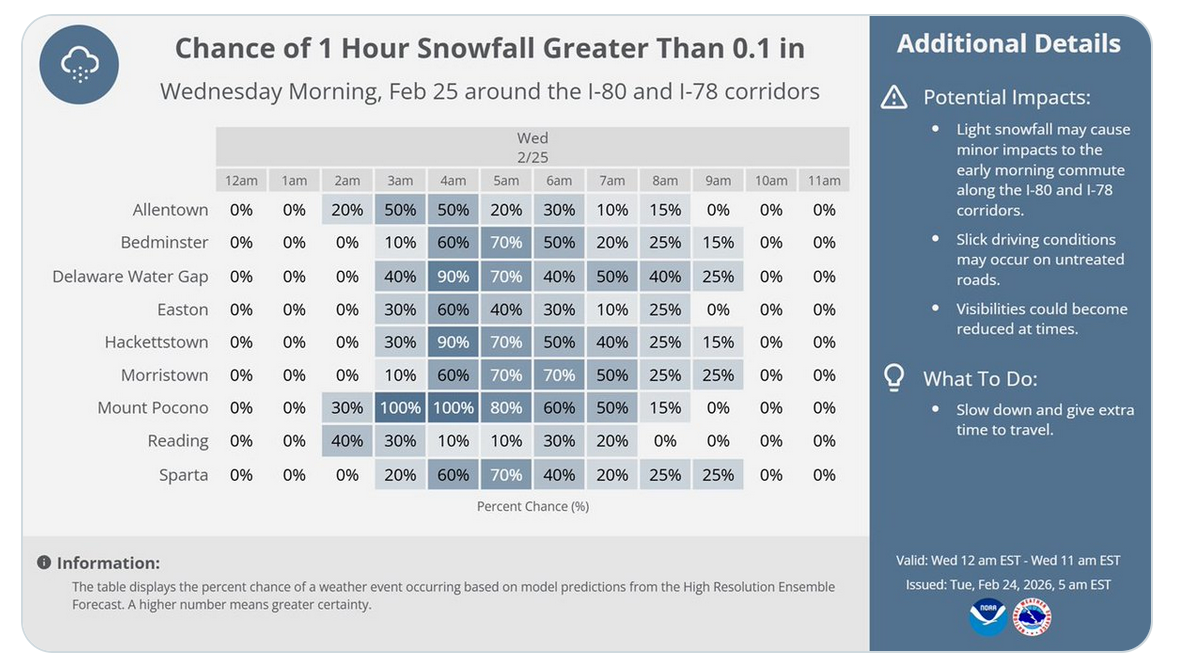
"A clipper storm will track across the Great Lakes Tuesday and Wednesday, spreading a swath of snow from northern Minnesota into New England," Accuweather said. "Farther south, including Washington, D.C., Philadelphia and New York City, snow can mix with rain as the storm moves through the region."
Accuweather noted, "While snow totals will not be as significant as the nor'easter, any streets and sidewalks that have already been cleared of any snow can become snow covered again, especially from Pennsylvania to Maine."
Find out what's happening in Ridgewood-Glen Rockfor free with the latest updates from Patch.
Thursday Forecast
Here is the NWS forecast for Thursday:
Thursday: A slight chance of rain and snow before 10 a.m., then a slight chance of snow between 10 a.m. and 1 p.m., then a chance of rain and snow after 1 p.m. Mostly cloudy, with a high near 41. Little or no snow accumulation expected.
Thursday Night: Rain and snow likely before 10 p.m., then rain likely between 10 p.m. and 4 a.m.,
then a chance of freezing rain after 4 a.m. Mostly cloudy, with a low around 25. Chance of precipitation is 60 percent. New precipitation amounts between a tenth and quarter of an inch possible.
Forecasters say rain and snow may fall on the Garden State on Thursday.
"On the heels of the clipper storm, another fast-moving storm will make its way into the Midwest Wednesday night, reaching the eastern United States later Thursday into Thursday night," Accuweather said. "Cold air in place can support a stripe of snow north of the storm track. On the southern fringe of the cold, it's possible precipitation could be a mix of rain, snow and ice."
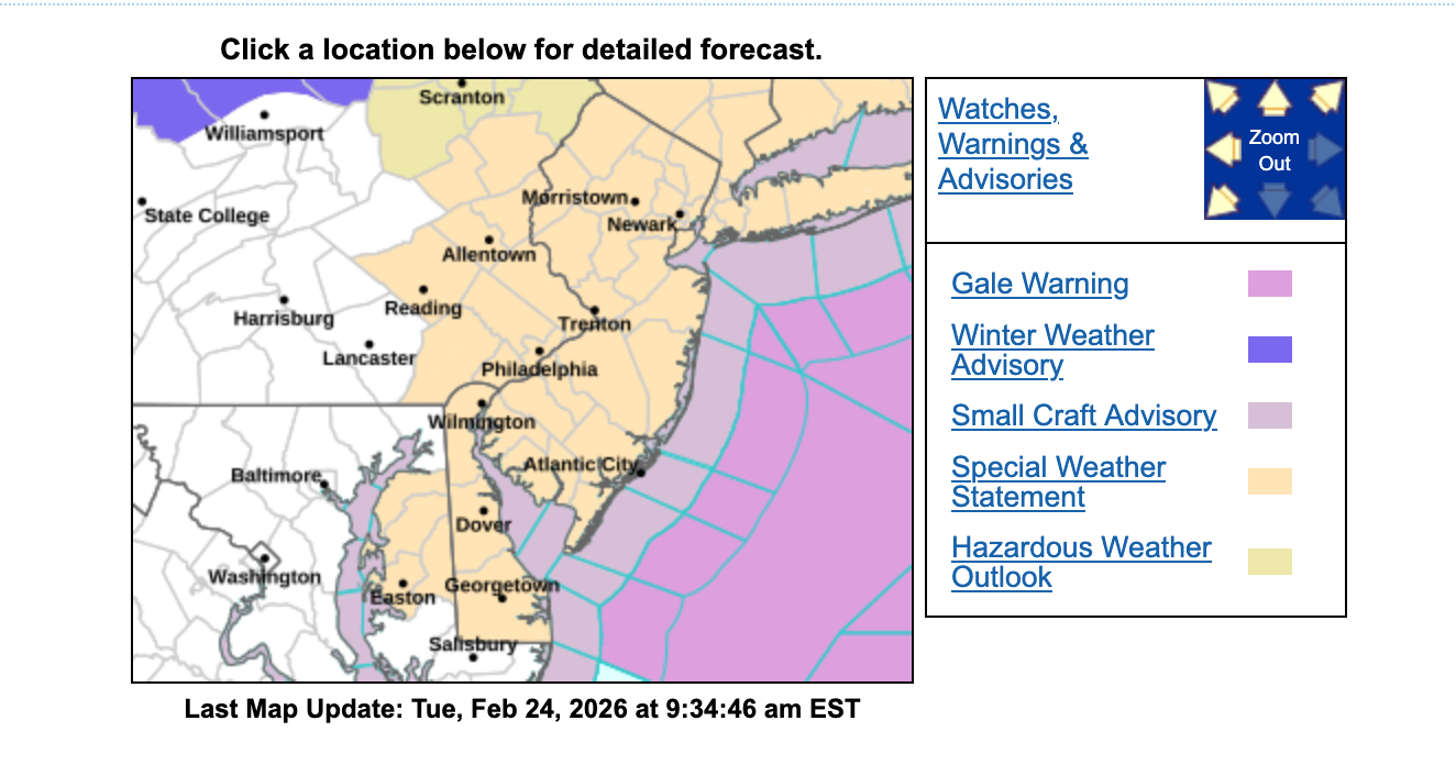
The National Weather Service issued a special weather statement about black ice on Tuesday morning, showing the potential for slippery mornings when the temperature drops.
See more storm guidance here.
Get more local news delivered straight to your inbox. Sign up for free Patch newsletters and alerts.