Weather
Thunderstorm Brings Hail, High Winds To North Jersey
A special weather statement and flood advisory were issued for North Jersey on Friday.

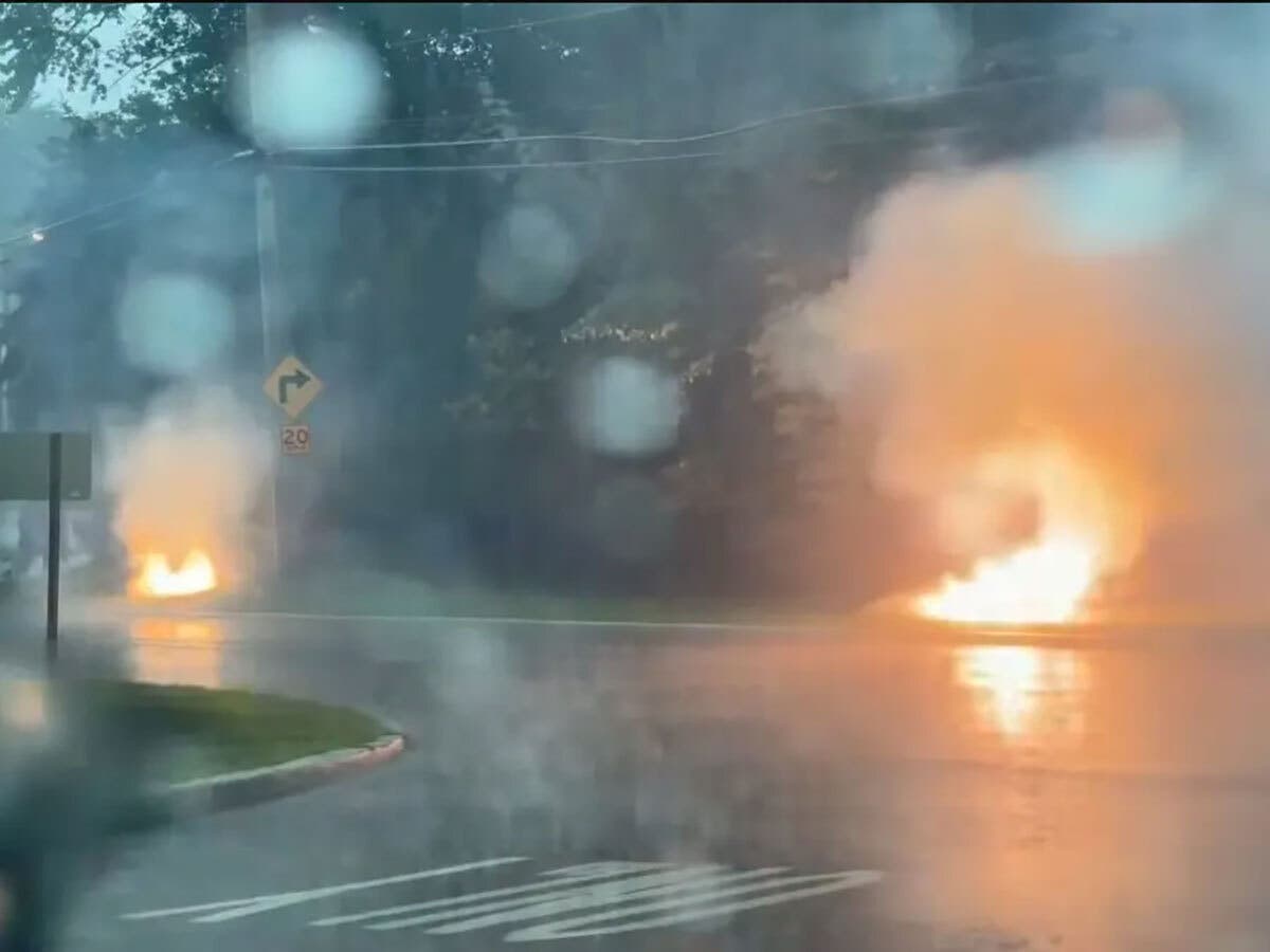
NORTH JERSEY — A severe thunderstorm brought high winds and hail to North Jersey on Friday.
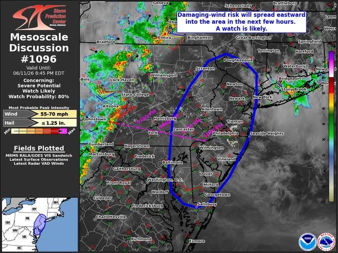
A thunderstorm watch was issued from 3:o5 p.m. until 9 p.m. Friday in North Jersey. In addition, a special weather statement was issued until 7 p.m., saying a storm with high winds was moving east toward Bergen and Hudson counties.
At 6:16 p.m., the NWS said, radar was tracking a strong thunderstorm moving east with 30 MPH winds. Gusty winds could knock down tree limbs and blow unsecured objects, the NWS said.
Find out what's happening in Ridgewood-Glen Rockfor free with the latest updates from Patch.
Forecasters told people in places like Overpeck Park and stadiums in Manhattan to seek shelter until the storm passes.
In the end, a storm did blow through the area before 7 p.m., bringing hail and heavy rain. A flood advisory was issued for those areas until 8:15 p.m.
Find out what's happening in Ridgewood-Glen Rockfor free with the latest updates from Patch.
Damage Last Weekend
Last Saturday, during severe thunderstorms, the National Weather Service got reports of wind gusts as high as 58 MPH at Newark Airport and 60 MPH at Teterboro Airport.
National Weather Service meteorologist Dave Radell told Patch that straight-line winds caused much of the damage in northeastern New Jersey, particularly in Bergen County, but there were no indications of a microburst.
The skies and forecast can change rapidly, so use the links below to see the radar and more.
Local Links To Track Storms
- Keep an eye on the radar here.
- Check out the Accuweather Minutecast here.
- See a current map of all watches and warnings in New Jersey here.
- The NOAA (National Oceanic and Atmospheric Administration) keeps us informed about larger weather events. Follow them here.
Updated NWS forecasts, watches, and warnings in each county:
What about the rivers? This NWS map of the United States will show the potential for river flooding.
Get more local news delivered straight to your inbox. Sign up for free Patch newsletters and alerts.