Crime & Safety
3 Days Of Storms Predicted; Forecasters Warn Of Flooding Risk
The National Weather Service says thunderstorms Wednesday, Thursday and into Friday could come with heavy rainfall and flash flooding.

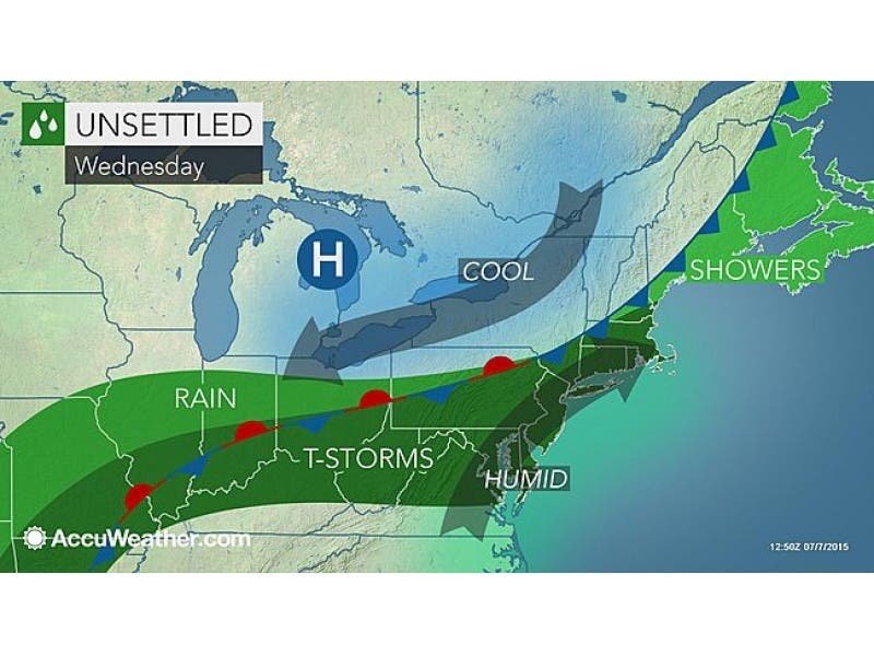
Three days of potential thunderstorms later this week could pose flooding concerns for the region, the National Weather Service says.
The National Weather Service has issued a Hazardous Weather Outlook, saying thunderstorms Wednesday, Thursday and into Friday could come with heavy rainfall in the Philadelphia region.
“Localized flooding of roadways and areas of poor drainage is possible,” according to the National Weather Service.
Find out what's happening in South Brunswickfor free with the latest updates from Patch.
The Hazardous Weather Outlook has been issued for Eastern Pennsylvania and Central New Jersey. In New Jersey, the counties that should watch out for localized flooding include Ocean, Monmouth, Camden, Burlington, Gloucester, Bergen, Essex, Union, Sussex, Warren, Morris, Hunterdon, Somerset, Middlesex and Mercer.
According to the long-term forecast, the stormy weather should clear in time for the weekend.
Find out what's happening in South Brunswickfor free with the latest updates from Patch.
Here is the forecast for the next few days:
Tuesday night: Scattered showers and thunderstorms before 8pm, then a slight chance of showers after 5am. Some of the storms could produce heavy rainfall. Partly cloudy, with a low around 75. Southwest wind 7 to 9 mph. Chance of precipitation is 30%. New precipitation amounts of less than a tenth of an inch, except higher amounts possible in thunderstorms.
Wednesday: A slight chance of showers, then a chance of showers and thunderstorms after 9am. Some of the storms could produce heavy rainfall. Mostly cloudy, with a high near 88. West wind around 8 mph. Chance of precipitation is 50%. New rainfall amounts between a tenth and quarter of an inch, except higher amounts possible in thunderstorms.
Wednesday Night: A chance of showers and thunderstorms. Some of the storms could produce heavy rainfall. Mostly cloudy, with a low around 69. Light west wind. Chance of precipitation is 50%. New rainfall amounts between a tenth and quarter of an inch, except higher amounts possible in thunderstorms.
Thursday: A chance of showers, with thunderstorms also possible after 2pm. Some of the storms could produce heavy rain. Mostly cloudy, with a high near 83. Northwest wind 3 to 6 mph. Chance of precipitation is 40%. New rainfall amounts between a tenth and quarter of an inch, except higher amounts possible in thunderstorms.
Thursday Night: A chance of showers and thunderstorms before 2am, then a slight chance of showers. Some of the storms could produce heavy rain. Mostly cloudy, with a low around 67. Chance of precipitation is 50%. New rainfall amounts between a tenth and quarter of an inch, except higher amounts possible in thunderstorms.
Get more local news delivered straight to your inbox. Sign up for free Patch newsletters and alerts.