Weather
Harvey Remnants Could Spoil New Jersey Labor Day Weekend
New Jersey and Pennsylvania could be impacted by remnants of the devastating storm this weekend.

Remnants of what was Hurricane Harvey are expected to "race" across the United States and impact New Jersey and Pennsylvania during part of the Labor Day weekend, forecasters say.
Harvey is not expected to bring widespread flooding or flooding anywhere close to the disaster in Texas. But it could bring enough rain that could cause urban and isolated flash flooding in the region, according to AccuWeather.
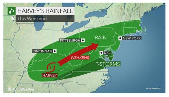
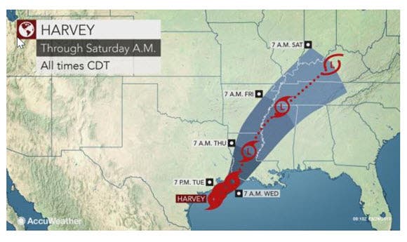
"Harvey will drift inland for the last time on Wednesday, near the Louisiana/Texas border and begin to accelerate northeastward across the interior U.S. late this week," said AccuWeather Hurricane Expert Dan Kottlowski.
Find out what's happening in Toms Riverfor free with the latest updates from Patch.
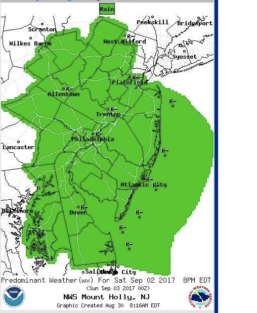
The National Weather Service says New Jersey and Pennsylvania should expect rain to fall after 2 p.m. on Saturday and continue to fall overnight.
Harvey, which is now a tropic storm, made landfall in Louisiana on Wednesday after dumping record amounts of rainfall along the Gulf Coast and in the Houston area. Tens of thousands of people have either evacuated or they've been displaced.
Find out what's happening in Toms Riverfor free with the latest updates from Patch.
Read more: Hurricane Harvey: Rising San Jacinto River Impacting Kingwood, Humble Area Homes
Accuweather says the storm will transition from a tropical storm to a tropical depression then a tropical rainstorm.
"Since Harvey will remain an efficient producer of rain, a general 2-4 inches is likely to fall near and just north of its path," Kottlowski said in the release.
A general 1-2 inches of rain is likely with locally higher amounts in the Northeast. On occasion, old tropical systems can pulse and cause much heavier rain to erupt in a small area well inland from the Gulf of Mexico or the Atlantic Ocean, according to AccuWeather.
In addition to the risk of isolated urban and flash flooding, fans heading to high school and college football games on Friday and Saturday should check their local forecast and dress accordingly. The use of umbrellas may not be allowed in some stadiums, according to AccuWeather.
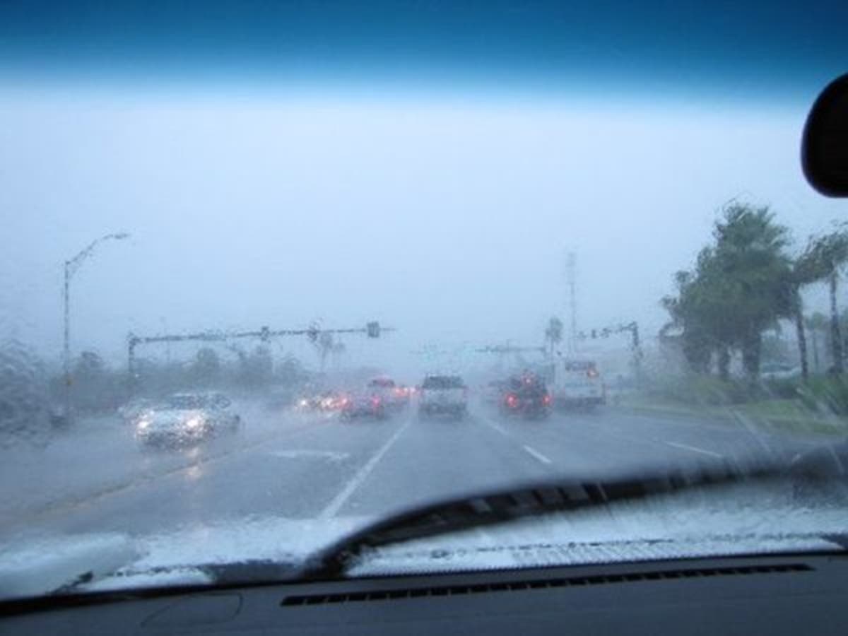
The wet conditions on the road may slow highway travel, especially for those heading out for a getaway during the Labor Day weekend, according to AccuWeather.
Here is the week's forecast:
- Wednesday: Mostly sunny, with a high near 75. North wind 7 to 9 mph.
- Wednesday night: Mostly clear, with a low around 61. Southwest wind 3 to 5 mph.
- Thursday: A chance of showers and thunderstorms after 2pm. Partly sunny, with a high near 82. West wind 7 to 9 mph. Chance of precipitation is 30%. New rainfall amounts of less than a tenth of an inch, except higher amounts possible in thunderstorms.
- Thursday night: A chance of showers and thunderstorms before 8pm. Mostly cloudy, with a low around 54. North wind 7 to 10 mph. Chance of precipitation is 30%. New precipitation amounts of less than a tenth of an inch, except higher amounts possible in thunderstorms.
- Friday: Mostly sunny, with a high near 70. North wind 7 to 10 mph.
- Friday night: Partly cloudy, with a low around 52.
- Saturday: Rain likely, mainly after 2pm. Partly sunny, with a high near 72. Chance of precipitation is 60%.
- Saturday night: Rain likely. Mostly cloudy, with a low around 61. Chance of precipitation is 60%.
- Sunday: Rain likely, mainly before noon. Mostly cloudy, with a high near 79. Chance of precipitation is 60%.
- Sunday night: Mostly cloudy, with a low around 62.
Patch file photo
Get more local news delivered straight to your inbox. Sign up for free Patch newsletters and alerts.


