Weather
Hazardous Weather Expected in New Jersey as Storm Heads For Northeast
Winter weather is expected to hit New Jersey this week as the state could feel the impact of a larger storm coming to the Northeast.


Winter weather is expected to hit New Jersey this week as the state could feel the impact of a larger storm coming to the Northeast.
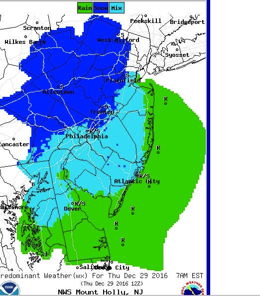
The National Weather Service has issued a hazardous weather outlook for nearly all of New Jersey, saying parts of the state will have periods of snow Thursday that may make travel hazardous at times.
The best chance for accumulation is in northern New Jersey, north of Interstate 78, where 1 to 4 inches of snow may fall before changing to rain, according to the NWS.
Find out what's happening in Toms Riverfor free with the latest updates from Patch.
Snow accumulations and rain, which could make for some slick travel, are expected mostly around 10 a.m. on Thursday.
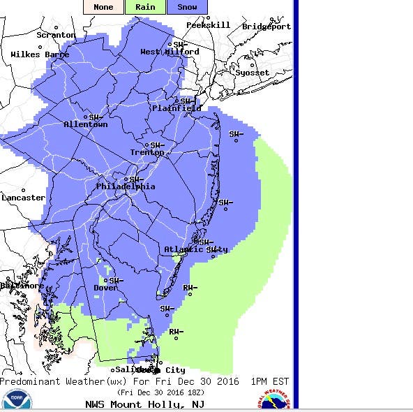
Scattered snow squalls are expected on Friday throughout the state, which could also make for hazardous travel in a few locations.
Find out what's happening in Toms Riverfor free with the latest updates from Patch.
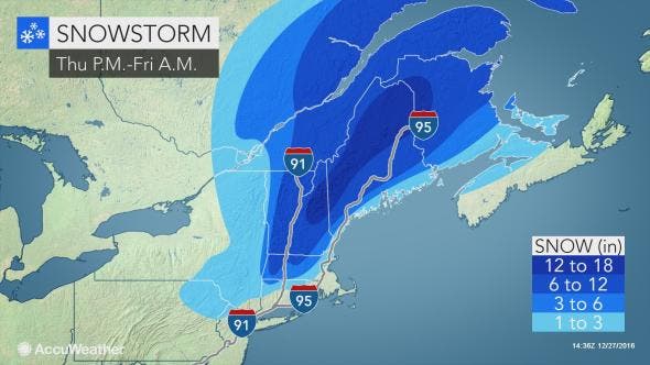
A strengthening storm, meanwhile, will deliver heavy snow and wind to New England before the end of the week. People continuing with their holiday journeys or beginning their end-of-the-year vacation could face some problems in the Northeast due to the storm, according to AccuWeather.
Regardless of the type of precipitation, the storm will cause extensive travel disruptions on Thursday and Friday. Road conditions will range from wet on Cape Cod, Massachusetts, to snow-packed in central New Hampshire and northern Maine, according to AccuWeather.
Here is the weather forecast for New Jersey:
- Tuesday afternoon: A slight chance of showers before 1 p.m. Sunny, with a high near 57. West wind 13 to 15 mph. Chance of precipitation is 20%.
- Tuesday night: Mostly clear, with a low around 33. West wind around 10 mph.
- Wednesday: Partly sunny, with a high near 43. Northwest wind 9 to 13 mph.
- Wednesday Night: Increasing clouds, with a low around 28. West wind around 6 mph becoming calm in the evening.
- Thursday: Rain and/or snow, becoming all rain after noon. High near 41. Southeast wind 5 to 9 mph becoming southwest in the afternoon. Chance of precipitation is 80 percent.
- Thursday night: A slight chance of showers before 8pm. Partly cloudy, with a low around 29. Chance of precipitation is 20 percent.
- Friday: Scattered flurries before 8 a.m., then scattered snow showers, mainly between 8 a.m. and 2 p.m. Mostly sunny, with a high near 39. Chance of precipitation is 30 percent.
Patch file photo
Get more local news delivered straight to your inbox. Sign up for free Patch newsletters and alerts.


