Weather
More Details On Storm, 45-MPH Winds Disrupting NJ Holiday Travel
A flood watch is in effect. The storm could cause power outages and uproot trees. Here's what to expect.

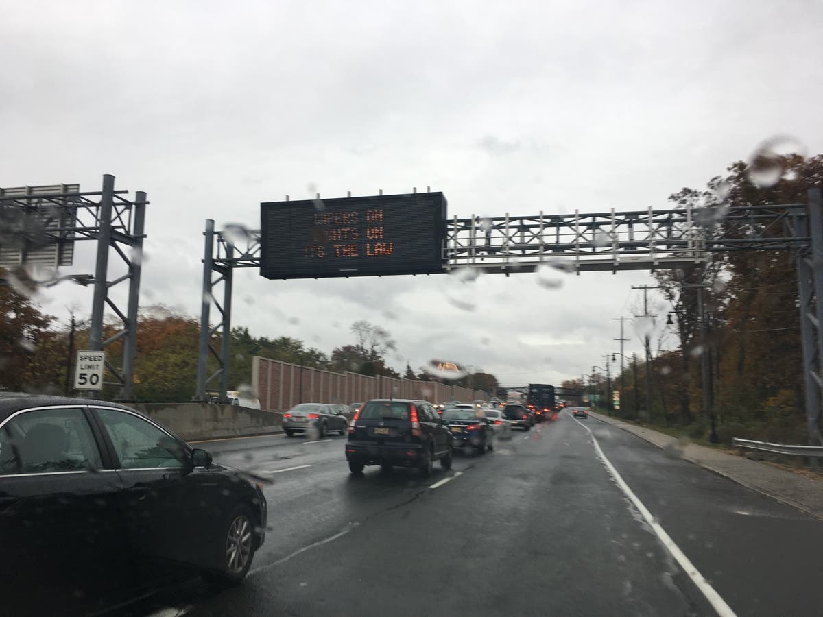


More details were revealed on a strong storm that's expected to disrupt holiday travel this week, bringing with it 1 to 3 inches of rain and packing 45-mph wind gusts.
A hazardous weather outlook and a flood watch has been declared for nearly all New Jersey, saying a strong low pressure system will impact the area Thursday night through Friday and result in widespread rainfall and strong winds.
The storm is supposed to start after 7 p.m. on Thursday. The National Weather Service issued a briefing, providing details on the impacts:
Find out what's happening in Toms Riverfor free with the latest updates from Patch.
Here are more details on the storm:
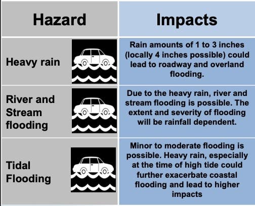
- Given the recent heavy rain and how saturated he ground is, this precipation will result in roadway flooding and areas of poor drainage as well as the potential for significant river flooding, according to the National Weather Service.
- The combination of heavy rain and increased tide levels during the times of high tide will result in coastal flooding along the Atlantic Ocean, Delaware Bay, and tidal Delaware River.
- Jonathan O'Brien, a National Weather Service meteorologist, said the strong winds will peak during the Friday commute with gusts of 40 to 45 mph, especially at the Jersey Shore.
- The wet weather and strong winds could cause power outages and uproot trees, he said. Flight cancellations are also possible, and holiday travel could be severely impacted.
-1545228273-7476.jpg)
Here is the forecast:
Find out what's happening in Toms Riverfor free with the latest updates from Patch.
- Wednesday: Sunny, with a high near 44. West wind 5 to 8 mph.
- Wednesday night: Mostly clear, with a low around 32. Southwest wind 3 to 6 mph.
- Thursday: Rain likely, mainly after 4pm. Increasing clouds, with a high near 54. Calm wind becoming east 5 to 8 mph in the afternoon. Chance of precipitation is 60%. New precipitation amounts of less than a tenth of an inch possible.
- Thursday Night: Rain, with thunderstorms also possible after 1am. Some of the storms could produce heavy rainfall. Low around 49. Breezy, with a southeast wind 11 to 16 mph increasing to 17 to 22 mph after midnight. Winds could gust as high as 33 mph. Chance of precipitation is 100%. New rainfall amounts between 1 and 2 inches possible.
- Friday: Rain and possibly a thunderstorm before 1pm, then showers, mainly between 1pm and 4pm. Some of the storms could produce heavy rainfall. High near 62. Breezy, with a south wind 17 to 21 mph, with gusts as high as 31 mph. Chance of precipitation is 90%. New rainfall amounts between a half and three quarters of an inch possible.
- Friday night: A chance of showers before 1am. Mostly cloudy, with a low around 40. Chance of precipitation is 30%. New precipitation amounts of less than a tenth of an inch possible.
Tom Davis photos
Get more local news delivered straight to your inbox. Sign up for free Patch newsletters and alerts.


